Search
You Searched For
Search Results
- Published / Created:
- Undated
- Call Number:
- 1983 Folio 19
- Collection Title:
- [Atlas factice of 96 maps by Blaeu, Visscher, Jansson, Hondius and others]
- Image Count:
- 2
- Found in:
- Beinecke Rare Book and Manuscript Library > Bohemia
- Published / Created:
- [1930?]
- Call Number:
- 356 1930
- Container / Volume:
- BRBL_00114
- Image Count:
- 1
- Resource Type:
- Maps, Atlases & Globes
- Found in:
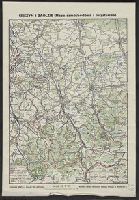
- Beinecke Rare Book and Manuscript Library > Cieszyn i Zaolzie (mapa samochodowa i turystyczna) / rysował i wydał Bronisław Stlasny.
- Creator:
- Pi︠a︡dyshev, Vasiliĭ Petrovich, 1768-1835.
Пядышев, Василий Петрович, 1768-1835.
- Published / Created:
- 1820-1827.
- Call Number:
- EEdb 828P
- Image Count:
- 1
- Resource Type:
- Maps, Atlases & Globes
- Found in:
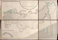
- Beinecke Rare Book and Manuscript Library > Geograficheskīĭ atlas Rossīĭskoĭ Imperīi T︠s︡arstva Polʹskago i Velikago Kni︠a︡zhestva Finli︠a︡ndskago [cartographic material] : raspolozhennyĭ po gubernīi︠a︡m na 80 listakh ... s generalʹnoi︠u︡ kartoi︠u︡ ... / sochinen po novi︠e︡ĭshim i dostovi︠e︡rnym svi︠e︡denīi︠a︡m ... Pi︠a︡dyshevym, nachat 1820-go, okonchen 1827-go goda = Atlas géographique de l'empire de Russie, du royaume de Pologne et du grand duché de Finlande ; divisé en gouvernements ... ; avec une carte générale ... / composé ... par ... Pi︠a︡discheff ...
- Creator:
- Guessefeld, F. L. (Franz Ludwig), 1744-1807
Homann Erben (Firm)
- Published / Created:
- 1775
- Call Number:
- 1983 Folio 23
- Collection Title:
- [Atlas factice of 50 maps, primarily by Johann Baptist Homann and/or issued by the Homann Erben
- Image Count:
- 1
- Found in:
- Beinecke Rare Book and Manuscript Library > Lubomeriae et Galliciae regni tabula geographica / [cartographic material] / F.I.G
- Published / Created:
- [1919?].
- Call Number:
- 11hcf 1919B-1
- Image Count:
- 1
- Resource Type:
- Maps, Atlases & Globes
- Found in:
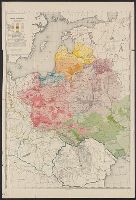
- Beinecke Rare Book and Manuscript Library > Ludność Ziem Polskich / Lit. W. Główczewski.
- Creator:
- Instytut kartograficzny imienia E. Romera
- Published / Created:
- 1931
- Call Number:
- 356cb L98 1931
- Container / Volume:
- BRBL_00115
- Image Count:
- 1
- Resource Type:
- Maps, Atlases & Globes
- Found in:
- Beinecke Rare Book and Manuscript Library > Mapa okolic Lwowa = [Map of the environs of Lwow] / Instytut kartograficzny Prof. E. Romera.
- Published / Created:
- 1936
- Call Number:
- 30gmm 1936
- Container / Volume:
- BRBL_00038
- Image Count:
- 1
- Resource Type:
- Maps, Atlases & Globes
- Found in:
- Beinecke Rare Book and Manuscript Library > Mapa radjokomunikacyjna Europy
- Creator:
- Geographical Publishing Co
- Published / Created:
- c1923.
- Call Number:
- 356 1923
- Container / Volume:
- BRBL_00114
- Image Count:
- 1
- Resource Type:
- Maps, Atlases & Globes
- Found in:
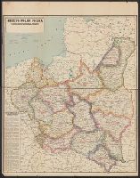
- Beinecke Rare Book and Manuscript Library > Rzeczpospolita Polska : w granicach obecnych z Podziałem na Województwa i z Wyszczególnieniem Wszystkich miast Powiatowych.
- Published / Created:
- [1919?]
- Call Number:
- 11hcf 1919B-23
- Container / Volume:
- BRBL_00010Q
- Image Count:
- 1
- Resource Type:
- Maps, Atlases & Globes
- Found in:
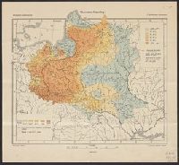
- Beinecke Rare Book and Manuscript Library > Rzymsko-Katolicy = Römisch-Katholische = Catholiques Romains / Opracował E. Romer.
- Creator:
- Instytut Śląski (Katowice, Poland)
Szaflarski, Józef
Wrzosek, Antoni
- Published / Created:
- 1945
- Call Number:
- 3562 1945
- Container / Volume:
- BRBL_00115
- Image Count:
- 1
- Resource Type:
- Maps, Atlases & Globes
- Found in:
- Beinecke Rare Book and Manuscript Library > Śląsk : mapa fizyczna-administracyjna ... / opracowli Józef Szaflarski i Antoni Wrzosek.