Search
You Searched For
Search Results
- Creator:
- De Lacy, W. W. (Walter Washington), 1819-1892
- Call Number:
- WA MSS 443
- Collection Title:
- Isaac Ingalls Stevens papers
- Container / Volume:
- Box 1 | Folder 29
- Image Count:
- 1
- Resource Type:
- Maps, Atlases & Globes
- Found in:
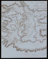
- Beinecke Rare Book and Manuscript Library > Plan of the battle of Grande Ronde fought Jul 17, 1856.
- Creator:
- Cóvens et Mortier
- Published / Created:
- ca. 1730-ca. 1800]
- Call Number:
- 1973 Folio 71
- Image Count:
- 1
- Resource Type:
- Maps, Atlases & Globes
- Found in:
- Beinecke Rare Book and Manuscript Library > [Atlas nouveau contenant toutes les parties du monde ou sont exactement marqués les empires, monarchies, royaumes, états, republiques &c. Le tout recueilli par les meilleurs geógraphes.]
- Published / Created:
- 1831
- Call Number:
- 1988 482
- Image Count:
- 1
- Resource Type:
- Maps, Atlases & Globes
- Found in:
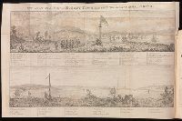
- Beinecke Rare Book and Manuscript Library > Description of a view of Hobart Town, Van Dieman's Land, and the surrounding country : now exhibiting at the Panorama, Strand / painted by the proprietor, Mr. R. Burford.
- Creator:
- Stockdale, John, 1749?-1814
- Published / Created:
- 1800 Nov. 24
- Call Number:
- CF1921 E38 1801
- Collection Title:
- An historical survey of the island of Saint Domingo, together with an account of the Maroon negroes
- Image Count:
- 1
- Resource Type:
- Maps, Atlases & Globes
- Found in:
- Beinecke Rare Book and Manuscript Library > A Map of the Island of St. Domingo
- Creator:
- Bode, Johann Elert, 1747-1826.
- Published / Created:
- 1801
- Call Number:
- QQn32 009
- Image Count:
- 1
- Resource Type:
- Maps, Atlases & Globes
- Found in:
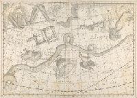
- Beinecke Rare Book and Manuscript Library > Uranographia sive astrorum descriptio viginti tabul oeneis incisa ex recentissimis et absolutissimis Astrononmorum observationibus...
- Creator:
- Pi︠a︡dyshev, Vasiliĭ Petrovich, 1768-1835.
Пядышев, Василий Петрович, 1768-1835.
- Published / Created:
- 1820-1827.
- Call Number:
- EEdb 828P
- Image Count:
- 1
- Resource Type:
- Maps, Atlases & Globes
- Found in:
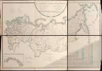
- Beinecke Rare Book and Manuscript Library > Geograficheskīĭ atlas Rossīĭskoĭ Imperīi T︠s︡arstva Polʹskago i Velikago Kni︠a︡zhestva Finli︠a︡ndskago [cartographic material] : raspolozhennyĭ po gubernīi︠a︡m na 80 listakh ... s generalʹnoi︠u︡ kartoi︠u︡ ... / sochinen po novi︠e︡ĭshim i dostovi︠e︡rnym svi︠e︡denīi︠a︡m ... Pi︠a︡dyshevym, nachat 1820-go, okonchen 1827-go goda = Atlas géographique de l'empire de Russie, du royaume de Pologne et du grand duché de Finlande ; divisé en gouvernements ... ; avec une carte générale ... / composé ... par ... Pi︠a︡discheff ...
- Creator:
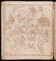
- Burritt, Elijah H. (Elijah Hinsdale), 1794-1838.
- Published / Created:
- c1835.
- Call Number:
- 2000 Folio 110
- Image Count:
- 1
- Resource Type:
- Maps, Atlases & Globes
- Found in:
- Beinecke Rare Book and Manuscript Library > Atlas, designed to illustrate the geography of the heavens ... By Elijah H. Burritt ...
- Creator:
- Tanner, Henry Schenck, 1786-1858
- Published / Created:
- [1839?]
- Call Number:
- G1200 T34 1839 (LC)
- Image Count:
- 4
- Resource Type:
- Maps, Atlases & Globes
- Found in:
- Beinecke Rare Book and Manuscript Library > A new American atlas [cartographic material] : containing maps of the several states of the North American union ... / by Henry S. Tanner.
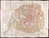
- Creator:
- Montigny, Léon.
- Published / Created:
- [1869]
- Call Number:
- 2015 523
- Image Count:
- 5
- Resource Type:
- Maps, Atlases & Globes
- Found in:
- Beinecke Rare Book and Manuscript Library > Les élections parisiennes de mai et juin 1869 [cartographic material] : application de la géométrie à la statistique / par Léon Montigny.
- Creator:
- Moll, Herman, d. 1732
- Published / Created:
- [178-?]
- Call Number:
- 1973 Folio 113
- Image Count:
- 2
- Resource Type:
- Maps, Atlases & Globes
- Found in:
- Beinecke Rare Book and Manuscript Library > Atlas minor: or A new and curious set of sixty two maps, in which are shewn all the empires, kingdoms, countries, states in all the known parts of the earth ... by Herman Moll ...
- Creator:
- Wytfliet, Corneille.
- Published / Created:
- 1597
- Call Number:
- 1977 +400
- Image Count:
- 2
- Resource Type:
- Maps, Atlases & Globes
- Found in:
- Beinecke Rare Book and Manuscript Library > Descriptionis Ptolemaicae avgmentvm, siue Occidentis notitia breui commentario illustrata, studio et opera Cornely Wytfliet Louaniensis.
- Creator:
- Great Britain. Hydrographic Dept.
- Call Number:
- Conrad +Zz1
- Image Count:
- 2
- Resource Type:
- Maps, Atlases & Globes
- Found in:
- Beinecke Rare Book and Manuscript Library > Original navigation charts used by Joseph Conrad.
- Creator:
- Kitchin, Thomas, d. 1784.
- Published / Created:
- 1773
- Call Number:
- 1979 Folio 59
- Image Count:
- 2
- Resource Type:
- Maps, Atlases & Globes
- Found in:
- Beinecke Rare Book and Manuscript Library > A general atlas, describing the whole universe. Being a compleat and new collection of the most approved maps extant; corrected with the utmost care, and augmented from the latest discoveries: the whole being an improvement of the maps of d'Anville and Robert ... By Thomas Kitchen, senior, and others ...
- Creator:
- Stieler, Adolf, 1775-1836
- Call Number:
- Lxe2 +842s
- Image Count:
- 2
- Resource Type:
- Maps, Atlases & Globes
- Found in:
- Beinecke Rare Book and Manuscript Library > Schul-Atlas über alle Theile der Erde nach dem neuesten Zustande, und über das Weltgebäude : nach Stieler's Hand-Atlas verkleinert.
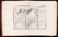
- Creator:
- Beautemps-Beaupré, Charles François, 1766-1854.
- Published / Created:
- 1822-43.
- Call Number:
- 1975 +8
- Image Count:
- 3
- Resource Type:
- Maps, Atlases & Globes
- Found in:
- Beinecke Rare Book and Manuscript Library > Pilote français... rédigé par M. Beautemps-Beaupré, ingénieur hydrographe en chef de la Marine... Publié par ordre du roi...
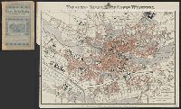
- Published / Created:
- [ca. 1896]
- Call Number:
- 36 N93 1896
- Container / Volume:
- BRBL_00125
- Image Count:
- 1
- Resource Type:
- Maps, Atlases & Globes
- Found in:
- Beinecke Rare Book and Manuscript Library > Neuester Plan der k[öniglichen] bayr[ischen] Stadt Nürnberg.
- Published / Created:
- 1797
- Call Number:
- 3213 1797
- Container / Volume:
- BRBL_00055
- Image Count:
- 1
- Resource Type:
- Maps, Atlases & Globes
- Found in:
- Beinecke Rare Book and Manuscript Library > A map of Kent.
- Creator:
- Des Barres, Joseph F. W. (Joseph Frederick Wallet), 1722-1824
- Published / Created:
- 1775?-1781?]
- Call Number:
- 1983 Folio 25
- Image Count:
- 3
- Resource Type:
- Maps, Atlases & Globes
- Found in:
- Beinecke Rare Book and Manuscript Library > [The Atlantic Neptune : published for the use of the Royal Navy Great Britain / by Joseph F.W. Des Barres, esq.].
- Creator:
- Bowles, Carington, 1724-1793
- Published / Created:
- [1766]
- Call Number:
- ByzL 79t
- Collection Title:
- A new and accurate history and survey of London, Westminster, Southwark, and places adjacent
- Image Count:
- 1
- Resource Type:
- Maps, Atlases & Globes
- Found in:
- Beinecke Rare Book and Manuscript Library > The London guide, or, a pocket plan of the cities of London & Westminster and Borough of Southwark; with the new buildings, &c. to the present year
- Published / Created:
- 1854
- Call Number:
- 1976 Folio 96
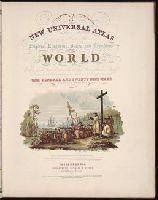
- Collection Title:
- A new universal atlas containing maps of the various empires, kingdoms, states and republics of the
- Image Count:
- 1
- Resource Type:
- Maps, Atlases & Globes
- Found in:
- Beinecke Rare Book and Manuscript Library > A new universal atlas containing maps of the various empires, kingdoms, states and republics of the world ...
- Published / Created:
- 1850
- Call Number:
- 1976 Folio 96
- Collection Title:
- A new universal atlas containing maps of the various empires, kingdoms, states and republics of the
- Image Count:
- 1
- Resource Type:
- Maps, Atlases & Globes
- Found in:
- Beinecke Rare Book and Manuscript Library > 10. Map of Connecticut
- Published / Created:
- 1846
- Call Number:
- 1976 Folio 93
- Collection Title:
- A new universal atlas containing maps of the various empires, kingdoms, states and republics of the
- Image Count:
- 1
- Resource Type:
- Maps, Atlases & Globes
- Found in:
- Beinecke Rare Book and Manuscript Library > 9. Connecticut
- Published / Created:
- [1808]
- Call Number:
- In W890 Zz808
- Collection Title:
- The history of the rise, progress, and accomplishment of the abolition of the African slave-trade
- Image Count:
- 1
- Resource Type:
- Maps, Atlases & Globes
- Found in:
- Beinecke Rare Book and Manuscript Library > [Untitled map of abolition of the slave trade]
- Published / Created:
- 1814
- Call Number:
- Folio Q115 H84 1B
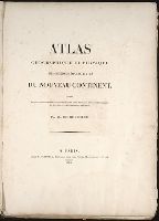
- Collection Title:
- Atlas geographique et physique des regions equinoxiales du nouveau continent, fonde sur des
- Image Count:
- 1
- Resource Type:
- Maps, Atlases & Globes
- Found in:
- Beinecke Rare Book and Manuscript Library > Humanitas. Literae. Fruges
- Published / Created:
- 1814
- Call Number:
- Folio Q115 H84 1B
- Collection Title:
- Atlas geographique et physique des regions equinoxiales du nouveau continent, fonde sur des
- Image Count:
- 1
- Resource Type:
- Maps, Atlases & Globes
- Found in:
- Beinecke Rare Book and Manuscript Library > Atlas geographique et physique des regions equinoxiales du nouveau continent ...
- Creator:
- Friesen, F
- Published / Created:
- 1808
- Call Number:
- Folio Q115 H84 1B
- Collection Title:
- Atlas geographique et physique des regions equinoxiales du nouveau continent, fonde sur des
- Image Count:
- 1
- Resource Type:
- Maps, Atlases & Globes
- Found in:
- Beinecke Rare Book and Manuscript Library > Limite inferieure des Neiges perpetuelles a differentes Latitudes
- Published / Created:
- 1817
- Call Number:
- Folio Q115 H84 1B
- Collection Title:
- Atlas geographique et physique des regions equinoxiales du nouveau continent, fonde sur des
- Image Count:
- 1
- Resource Type:
- Maps, Atlases & Globes
- Found in:
- Beinecke Rare Book and Manuscript Library > Tableau physique des Ils Canaries. Geographie des plantes du Pic de Teneriffe
- Published / Created:
- 1820
- Call Number:
- Folio Q115 H84 1B
- Collection Title:
- Atlas geographique et physique des regions equinoxiales du nouveau continent, fonde sur des
- Image Count:
- 1
- Resource Type:
- Maps, Atlases & Globes
- Found in:
- Beinecke Rare Book and Manuscript Library > Profit du Chemin de Carthagene des Indes au Plateau de Santa Fe de Bogata. pl. 6
- Published / Created:
- 1813
- Call Number:
- Folio Q115 H84 1B
- Collection Title:
- Atlas geographique et physique des regions equinoxiales du nouveau continent, fonde sur des
- Image Count:
- 1
- Resource Type:
- Maps, Atlases & Globes
- Found in:
- Beinecke Rare Book and Manuscript Library > Carte du Cours de Rio Apure et d'une Partie de la Chaine des Montaignes de la Nouvelle Grenade, dressee par Alexandre de Humboldt. pl. 17
- Published / Created:
- undated
- Call Number:
- Folio Q115 H84 1B
- Collection Title:
- Atlas geographique et physique des regions equinoxiales du nouveau continent, fonde sur des
- Image Count:
- 1
- Resource Type:
- Maps, Atlases & Globes
- Found in:
- Beinecke Rare Book and Manuscript Library > Carte du Rio Grande de la Magdalena depuis le 4 [degrees] Latitude jusqu'a son embouchure. No. 24
- Published / Created:
- 1808
- Call Number:
- Folio Q115 H84 3A
- Collection Title:
- Atlas geographique et physique du royaume de la Nouvelle-Espagne, fonde sur des observations
- Image Count:
- 1
- Resource Type:
- Maps, Atlases & Globes
- Found in:
- Beinecke Rare Book and Manuscript Library > Carte de la Vallee de Mexico et des Montagnes Voisines esquissee sur les Lieux en 1804, par Don Louis Martin redigee et corrigee en 1807 d'apres les operations trigonometriques de Don Joaquin Velasquez et d'apres les observations astronomiques et les mesu
- Published / Created:
- 1807-08
- Call Number:
- Folio Q115 H84 3A
- Collection Title:
- Atlas geographique et physique du royaume de la Nouvelle-Espagne, fonde sur des observations
- Image Count:
- 1
- Resource Type:
- Maps, Atlases & Globes
- Found in:
- Beinecke Rare Book and Manuscript Library > Tableau physique de la pente Orientale du Plateau de la Nouvelle Espagne (Chemin de Mexico a Veracruz par Puebla et Xalapa.) Dresse d'apres des mesures barometriques et trigonometriques, prises en 1804 par Mr. de Humboldt. pl. 12
- Published / Created:
- 1805-07
- Call Number:
- Folio Q115 H84 3A
- Collection Title:
- Atlas geographique et physique du royaume de la Nouvelle-Espagne, fonde sur des observations
- Image Count:
- 1
- Resource Type:
- Maps, Atlases & Globes
- Found in:
- Beinecke Rare Book and Manuscript Library > Tableau du Plateau central des Montagnes du Mexique, entre les 19 et 21 [degree] de Latitude boreale, (Chemin de Mexico a Guanaxuato) Dresse d'apres le Nivellement Barometrique de Mr. de Humboldt. pl. 14
- Published / Created:
- 1808
- Call Number:
- Folio Q115 H84 3A
- Collection Title:
- Atlas geographique et physique du royaume de la Nouvelle-Espagne, fonde sur des observations
- Image Count:
- 1
- Resource Type:
- Maps, Atlases & Globes
- Found in:
- Beinecke Rare Book and Manuscript Library > Profit du Canal de Huehuetoca (Desague Real.) Creuse pour preserver la Ville de Mexico du danger des Inondations. pl. 15
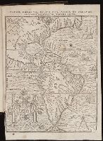
- Published / Created:
- [1567]
- Call Number:
- Peru Cwpr j567
- Collection Title:
- Levini Apollonii, Gandobrvgani, Mittelbvrgensis, de Peruuiae, regionis, inter Noui Orbis prouincias
- Image Count:
- 1
- Resource Type:
- Maps, Atlases & Globes
- Found in:
- Beinecke Rare Book and Manuscript Library > Brevis, exactaq totivs novi orbis et Pervviae regionis descriptio recens edita
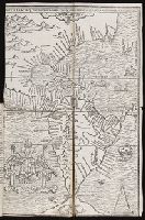
- Published / Created:
- [1560]
- Call Number:
- Peru Cwpr j553ci
- Collection Title:
- La prima parte dell historie del Perv. Dove si tratta lordine delle prouincie, delle citta nuoue in
- Image Count:
- 1
- Resource Type:
- Maps, Atlases & Globes
- Found in:
- Beinecke Rare Book and Manuscript Library > Brevis exactaq totivs novi orbis eivsq; insvlarvm descriptio recens a ioan bellero edita
- Published / Created:
- [1490]
- Call Number:
- 1978 Folio 114
- Collection Title:
- Cosmographia. [Translated into Latin by Jacobus Angelus, and edited by Nicolaus Germanus.]
- Image Count:
- 1
- Resource Type:
- Maps, Atlases & Globes
- Found in:
- Beinecke Rare Book and Manuscript Library > [Map depicting Europe, North Africa, the Middle East and Asia].
- Published / Created:
- [1540]
- Call Number:
- E33 +540P
- Collection Title:
- Geographia vniversalis, vetvs et nova complectens Clavdii Ptolemaei Alexandrini enarrationis libros
- Image Count:
- 1
- Resource Type:
- Maps, Atlases & Globes
- Found in:
- Beinecke Rare Book and Manuscript Library > Tabula Europae IX
- Creator:
- New Haven (Conn.). East Rock Park Commission
- Published / Created:
- 1882 May
- Call Number:
- Za M692 +882
- Collection Title:
- A report to the commissioners on lay-out of East Rock Park / by Donald G. Mitchell, LL.D
- Image Count:
- 1
- Resource Type:
- Maps, Atlases & Globes
- Found in:
- Beinecke Rare Book and Manuscript Library > Hints for the lay-out of East-Rock Park
- Call Number:
- 1989 +19
- Collection Title:
- A collection of voyages and travels, some now first printed from original manuscripts, others now
- Image Count:
- 1
- Resource Type:
- Maps, Atlases & Globes
- Found in:
- Beinecke Rare Book and Manuscript Library > A chart and map of the Gold Coast of Guinea from Rio da Corsa to Ro da Volta. vol. V [5], pl. K
- Published / Created:
- 1722
- Call Number:
- Zc52 +722pe
- Collection Title:
- Derrotero de la expedicion en la provincia de los Texas, nuevo reyno de Philipinas, que de orden
- Image Count:
- 2
- Resource Type:
- Maps, Atlases & Globes
- Found in:
- Beinecke Rare Book and Manuscript Library > Presidio de n.s. de Loreto en la Bahia
- Published / Created:
- 1739
- Call Number:
- WeInd Ehc 739
- Collection Title:
- A description of the Windward Passage, and Gulf of Florida, with the course of the British trading
- Image Count:
- 1
- Resource Type:
- Maps, Atlases & Globes
- Found in:
- Beinecke Rare Book and Manuscript Library > A chart of the Bahamas Islands with a description of the Gulf of Florida and Windward passage &c. referr'd from the figures here set down, to the general index annexed ... by J.C
- Published / Created:
- [ca. 1675]
- Call Number:
- GEN MSS VOL 4
- Collection Title:
- Atlas of the world
- Image Count:
- 1
- Resource Type:
- Maps, Atlases & Globes
- Found in:
- Beinecke Rare Book and Manuscript Library > Die gantse welt
- Call Number:
- Zc52 843Leb
- Collection Title:
- The legion of liberty
- Image Count:
- 1
- Resource Type:
- Maps, Atlases & Globes
- Found in:
- Beinecke Rare Book and Manuscript Library > Moral map of U.S., Jan. 1837
- Creator:
- Bry, Theodor de, 1528-1598
- Call Number:
- 1976 Folio 110
- Collection Title:
- The mariners mirrovr wherin may playnly be seen the courses, heights, distances, depths, sounding
- Image Count:
- 1
- Resource Type:
- Maps, Atlases & Globes
- Found in:
- Beinecke Rare Book and Manuscript Library > The sea coastes of the landes of Poyctou and Bordeaux ...as they shew and appeare, when you sayle there alongst betweene Picquelier and the River of Bordeaux called the Garonne
- Creator:
- Clark, William, 1770-1838
Lewis, Samuel, 1753 or 4-1822
- Published / Created:
- [ca. 1814]
- Call Number:
- Zc10 814Le
- Collection Title:
- History of the expedition under the command of Captains Lewis and Clark, to the sources of the
- Image Count:
- 2
- Resource Type:
- Maps, Atlases & Globes
- Found in:
- Beinecke Rare Book and Manuscript Library > A map of Lewis and Clark's track, across the western portion of North America fom the Mississippi to the Pacific Ocean; by order of the Executive of the United States . In 1804, 5 & 6
- Creator:
- Clark, William, 1770-1838
- Published / Created:
- [ca. 1814]
- Call Number:
- Zc10 814Le
- Collection Title:
- History of the expedition under the command of Captains Lewis and Clark, to the sources of the
- Image Count:
- 1
- Resource Type:
- Maps, Atlases & Globes
- Found in:
- Beinecke Rare Book and Manuscript Library > Fortification
- Call Number:
- 1983 Folio 50
- Collection Title:
- Atlas novus sive Tabulae geographicae totius orbis faciem : partes, imperia, regna et provincias
- Image Count:
- 2
- Resource Type:
- Maps, Atlases & Globes
- Found in:
- Beinecke Rare Book and Manuscript Library > Historia Imperii Romano-Germanici, nec non finitimarum Regionum In Mappa exhibita, ac aeri incisa a Mattheo Seutter ...
- Creator:
- Cook, James, 1728-1779
Gulielmus Whitchurch
- Published / Created:
- 1776
- Call Number:
- 1977 +300
- Collection Title:
- A voyage towards the South pole, and round the world. Performed in His Majesty’s ships the
- Image Count:
- 1
- Resource Type:
- Maps, Atlases & Globes
- Found in:
- Beinecke Rare Book and Manuscript Library > A chart of the southern hemisphere; shewing the tracks of some of the most distinguished navigators
- Published / Created:
- 1719
- Call Number:
- Defoe 50 719db 1
- Collection Title:
- The life and strange surprizing adventures of Robinson Crusoe, of York, mariner : who lived eight
- Image Count:
- 1
- Resource Type:
- Maps, Atlases & Globes
- Found in:
- Beinecke Rare Book and Manuscript Library > A Map of the world, on wch is delineated the voyages of Robinson Cruso