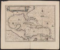
Insulae Americanae in Oceano Septentrionali cum terris adjacentibus and Insvlae Americanae in Oceano Septentrionali cum terris adiacentibus
Description:
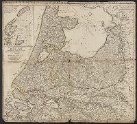
Appears in various Dutch eds. of Jansson's Nieuwen atlas., Includes scales in milliaria germanica and mill, and Shows southeast coast of North America from Virginia to north coast of South America to east of Trinidad, west coast of Central America, West Indies.
Publisher:
Apud Ioannem Ianssonium,
Subject (Geographic):
Caribbean Area--Maps--Early works to 1800, Mexico, Gulf of--Maps--Early works to 1800, and West Indies--Maps--Early works to 1800
Subject (Name):
Jansson, Jan, 1588-1664. Atlas novus. Dutch
Subject (Topic):
Coasts--North America--Maps--Early works to 1800 and Coasts--South America--Maps--Early works to 1800
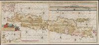
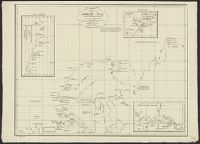
Also shows p, Includes text, col. view of Jakarta, inset of Jakarta, and some cities are marked with gilt., Library copy joined to form 1 sheet., Pars occidentalis --, Prime meridian: Ferro., and Title and notes in Latin. Place-names and scale statements in Dutch.
Publisher:
by Gerard van Keulen aan de Nieuwe brug met previlegie,
Subject (Geographic):
Jakarta (Indonesia)--Maps--Early works to 1800 and Java (Indonesia)--Maps--Early works to 1800
East West Greenland, Scoresby 1822, 1:2,800,000., Insets: Straat of Waaigat 1:100,000., Mauritius of Jan Mayen Eil. 1611, 1:533,000., and Siberia to Cape Chelyuskin.
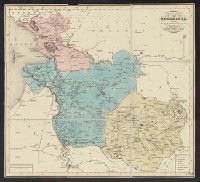
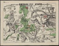
Caricature map., Ill. of people and animals represent international relations., In top margin: Voorwaarts., and Includes text.
Publisher:
W.L. Stoeller,
Subject (Geographic):
Europe--Maps
Subject (Topic):
Franco-Prussian War, 1870-1871--Caricatures and cartoons, Franco-Prussian War, 1870-1871--Maps, and International relations--History--19th century--Maps