Kitchin, Thomas, d. 1784, creator Sayer, Robert, 1725-1794
Published / Created:
1787 January 1
Call Number:
1982 Folio 10
Image Count:
2
Description:
Also appeared in Kitchin's General atlas, describing the whole universe. London : Printed and sold for R. Sayer and J. Bennet, 1780., By Thos. Kitchin, hydrographer to the king ; with many additions and improvements from the latest surveys and observations., No. 4 of 43 maps bound together in composite atlas., Pictorial relief., Scale [ca. 1:4,800,000]., and Western part of the northern states including the British Islands, Norway, Denmark and part of Sweden -- Eastern part of the northern states, including the eastern part of Sweden; European Russia, &c. -- Western part of the Mediterranean Sea with the coasts of Spain, France, Italy, Barbary -- Eastern part of the Mediterranean Sea with the coasts of Turky [sic], Anatolia, Syria, Egypt and Barbary.
Publisher:
Robert Sayer
Subject (Geographic):
Africa, North --Maps --Early works to 1800, Europe --Maps --Early works to 1800, and Middle east --Maps --Early works to 1800
Europe divided into its principall parts viz. the Brittish [sic] Islands, Scandinavia, Moscovia, France, Germany, Poland, Spain, Italy, Turky [sic] in Europe ... described by Sanson, corrected and amended by William Berry
Description:
Dedicated To the most serene and most sacred majesty of Charles II ... by William Berry., Includes coat of arms and decorative cartouche containing dedication., No. 2 of 69 maps bound together in composite atlas., Prime meridian: Ferro., Relief shown pictorially., and Scale [ca. 1:75 000 000].
Publisher:
Sold by William Berry at ye sign of the globe between Charing-Cross and White-Hall
Subject (Geographic):
Europe --Maps --Early works to 1800, Russia --Maps --Early works to 1800, and Turkey --Maps --Early works to 1800
Langren, Henricus F. ab (Henricus Florentius), ca. 1574-1648
Published / Created:
1595
Call Number:
Z3 017
Collection Title:
John Huighen van Linschoten, his Discours of Voyages into ye Easte & West Indies
Image Count:
1
Description:
[Scale ca. 1:13,500,000]., Bound in following p. 32., Map has some small tears along fold lines., and Map properly belongs to the Dutch edition of 1596.
Subject (Geographic):
Borneo --Maps --Early works to 1800, China --Maps --1368-1644, Japan --Maps --Early works to 1800, Java (Indonesia) --Maps --Early works to 1800, and Sumatra (Indonesia) --Maps
Subject (Topic):
Voyages and travels --Early works to 1800
Collection Created:
[London] : Printed at London by [John Windet for] Iohn Wolfe, printer to ye Honorable Cittie of London, [1598]
Navigatio ac itinerarivm Iohannis Hvgonis Linscotani in Orientalem sive Lvsitanorvm Indiam
Image Count:
1
Description:
[Scale ca. 1:13,500,000]., Bound in following page 22., Map has several areas of small brown and yellow stains on the recto as well as two areas of linear white chalky lines on the verso; one forms a cross., and Map has significant tear along bottom center fold.
Subject (Geographic):
Borneo --Maps, China --Maps --Early works to 1800, Indonesia --Maps, Japan --Maps --Early works to 1800, Java (Indonesia) --Maps --Early works to 1800, and Philippines --Maps
Subject (Name):
Claesz, Cornelis, ca. 1546-1609, publisher, Elzevier, Gillis, bookseller, Hendricksz, Aelbrecht, fl. 1573-1605, printer, and Langren, Arnold Florent van, 1580-1644
Subject (Topic):
Voyages and travels --Early works to 1800
Collection Created:
Hagae-Comitis : Ex officina Alberti Henrici, impensis authoris & Cornelii Nicolai, prostantque apud Aegidium Elseuirum, anno 1599
Nauigatio ac itinerarium Iohannis Hugonis Linscotani in Orientalem siue Lusitanorum Indiam
Image Count:
1
Description:
[Scale ca. 1:13,500,000]., Bound in following page 22., In pencil on middle left panel of left verso: 23., In pencil on middle right panel of left verso: 22-1., and Map has several areas of staining most noticeably along the top verso.
Subject (Geographic):
Borneo --Maps, China --Maps --Early works to 1800, Indonesia --Maps, Japan --Maps --Early works to 1800, Java (Indonesia) --Maps --Early works to 1800, and Philippines --Maps
Subject (Name):
Claesz, Cornelis, ca. 1546-1609, publisher, Elzevier, Gillis, bookseller, and Hendricksz, Aelbrecht, fl. 1573-1605, printer
Subject (Topic):
Voyages and travels --Early works to 1800
Collection Created:
Hagae-Comitis : Ex officina Alberti Henrici, impensis authoris & Cornelii Nicolai, prostantque apud Aegidium Elseuirum, anno 1599
John Huighen van Linschoten, his Discours of Voyages into ye Easte & West Indies
Image Count:
1
Description:
[Scale ca. 1:13,500,000]., Bound in following p. 32., and Map has several small brown marks on the left portion that can also be seen on the verso.
Subject (Geographic):
Borneo --Maps --Early works to 1800, China --Maps --1368-1644, Japan --Maps --Early works to 1800, Java (Indonesia) --Maps --Early works to 1800, and Sumatra (Indonesia) --Maps
Subject (Name):
Wolfe, John, d. 1601, printer
Subject (Topic):
Voyages and travels --Early works to 1800
Collection Created:
[London] : Printed at London by [John Windet for] Iohn Wolfe, printer to ye Honorable Cittie of London, [1598]
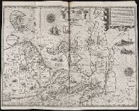
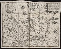
Bat. cum Privil. Ordin. Gener, Belgii Faederati--Title cartouche., Features include ornate title cartouche (top left) with cherubs, male and female figures and royal coat-of-arms supported by lion and unicorn, arms of Scotland supported by cherubs (above scale cartouche at top right), compass indicator and coasts shaded outwards., In Latin with some place names in English; explanations and title for index to places in Dutch and English., No. 7 of 69 maps bound together in composite atlas., Relief shown pictorially., Scale [ca. 1:960 000]., Scale statement reads: Milliaria Germanica Communia 15 in uno Gradu, with scale bar graded [0]-10; Milliaria Scotica Communia quorum 50 in uno Gradu, with scale bar graded [0]-34; Milliaria Gallica quae et Horae Itineris 20 in uno Gradu, with scale bar graded [0]-14., Shows grid, rivers and tributaries, lochs (shaded), trees, place and county names, settlements (symbols classified by importance in legend), territorial boundaries., Shows Scotland including the Hebrides and Orkney Islands., and The four cardinal points are written in the borders.