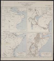
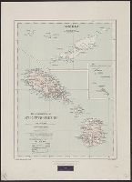
Maps of Eastern Equatorial Africa showing the progress of exploration
Description:
"Eastern Equatorial Africa, Garstin. The Geographical Journal, 1909"--in upper right hand corner. and Eastern Equatorial Africa according to Ptolemy, A.D. 150 -- Eastern Equatorial Africa immediately before Speke's first journey ... 1856 -- Map showing the results of Burton, Speke, and Grant's explorations ... 1863 -- Eastern Equatorial Africa, 1909.
Publisher:
Royal Geographical Society,
Subject (Geographic):
Africa, East--Discovery and exploration--Maps
Subject (Name):
Royal Geographical Society (Great Britain) and Speke, John Hanning,--1827-1864--Travel--Maps
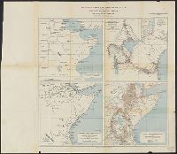
Maps of Eastern Equatorial Africa showing the progress of exploration
Description:
"Eastern Equatorial Africa, Garstin. The Geographical Journal, 1909"--in upper right hand corner. and Eastern Equatorial Africa according to Ptolemy, A.D. 150 -- Eastern Equatorial Africa immediately before Speke's first journey ... 1856 -- Map showing the re
Publisher:
Royal Geographical Society,
Subject (Geographic):
Africa, East--Discovery and exploration--Maps
Subject (Name):
Royal Geographical Society (Great Britain) and Speke, John Hanning,--1827-1864--Travel--Maps
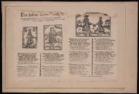
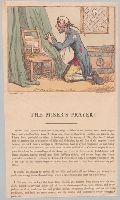
A thin man in shabby clothes, kneels in prayer before a candle on a chair, bedcurtains on either side of the chair; his toes through his worn shoes. The window panes in his room are broken.
Description:
Not in the Catalogue of prints and drawings in the British Museum. Division I, political and personal satires., Three paragraphs of letterpress below title: Plutus thou God of wealth and riches, deign to listen to thy humble votary..., and Title printed in letterpress below image.
Publisher:
Pubd. Feby. 10, 1801, by R. Ackermann, No. 101 Strand,
Subject (Name):
Ackermann, Rudolph, 1764-1834, publisher., Auchincloss, Hugh Dudley--Ownership., Harvey, Francis--Ownership., and Woodward, G. M. (George Moutard), approximately 1760-1809, artist.
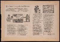
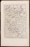
From Thomas Stackhouse's New history of the Holy Bible (London, 1752)., In lower left corner, "Pl. 3"; in lower right corner, "page 24.", Prime meridian: Ferro., Relief shown pictorially., and Watermark.
Publisher:
[Printed for John Hinton],
Subject (Geographic):
Middle East--Historical geography--Maps--Early works to 1800. and Middle East--Maps--Early works to 1800.
Subject (Name):
Hinton, John, -1781 and Stackhouse, Thomas, approximately 1680-1752. New history of the Holy Bible.