Browne, Christopher, fl. 1684-1712 Fer, Nicolas de, 1646-1720, creator
Published / Created:
[1704?]
Call Number:
1973 Folio 10
Image Count:
1
Resource Type:
Maps, Atlases & Globes
Alternative Title:
New map of the theatre of the war in Flanders and on the Rhine and Theatre of the warr in Flanders
Description:
Bar scales given in English miles., Dedicated to Q. Anne by C. Browne., Ferro meridian., Includes inset map the Rhine River Valley., No. 46 of 69 maps bound together in composite atlas., Relief shown pictorially., and Scale [ca. 1:600 000].
Publisher:
Made english and sold by C. Browne at the Globe at the west end of St. Pauls Church
Africa distinguished into its principall parts viz. Barbary, Biledulgerid, Egypt, Zaara or the Desart, the Country of the Negroes, Guinea, Nubia, Abissinea, Zanguebar, Congo, Monomotapa, Caffrares, the Islands of the Canaries, Cape Verd, St. Thomas, Madagascar or St. Lawrence in which are observed the empires, monarchies, kingdomes, states and peoples, which at present inhabite Africa
Description:
Ferro meridian., No. 56 of 69 maps bound together in composite atlas., Relief shown pictorially., Scale [ca 1:34 000 000]., and To the most serene and most sacred majesty of Charles II, by the grace of God, king of Great Brittain, France, and Ireland, this map of Africa is humbly dedicated and presented by your majesties loyal subject and servant, William Berry.
Publisher:
Sold by William Berry at the sign of the globe between Charing Cross and White-Hall
Also appeared in Kitchin's General atlas describing the whole universe. London : Printed for Robert Sayer, [1780]., By S. Boulton ; and also a summary description relative to the trade and natural produce, manners and customs of the African continent and islands., Insets: A particular chart of the Gold Cost. -- Azores or Western Islands., No. 35 of 43 maps bound together in composite atlas., Scale [ca. 1:8,500,000]., Sheets pasted together to create 1 map on 2 sheets., and With descriptive text.
Publisher:
Printed for Robert Sayer
Subject (Geographic):
Africa --Maps --Early works to 1800 and Ghana --Maps --Early works to 1800
An historical, geographical, commercial, and philosophical view of the American United States, and
Image Count:
1
Description:
Engraved by J. Russell, Constitution Row Grays Inn Lane. and Facing p. 177.
Publisher:
Publish'd as the Act directs, by H.D. Symonds, No. 20 Pater Noster Row
Subject (Geographic):
America --Description and travel, America --History --To 1810, Great Britain. Treaties, etc. United States, 1783 Sept. 3, United States --Description and travel, and United States --History --Revolution, 1775-1783 --Maps --Early works to 1800
Collection Created:
London, Printed for the editor; J. Ridgway [etc.] 1795
Anville, Jean Baptiste Bourguignon d', 1697-1782 Cook, James, 1728-1779 Kitchin, Thomas, d. 1784, creator Sayer, Robert, 1725-1794
Published / Created:
1787 January 6
Call Number:
1982 Folio 10
Image Count:
2
Description:
Also appeared in Kitchin's General atlas describing the whole universe. London : Printed for Robert Sayer, [1780]., No. 29 of 43 maps bound together in composite atlas., Relief shown pictorially., Scale [ca. 1:11,100,000]., Sheets mounted together to form 2 sheets., Shows boundaries, rivers, settlements, islands; includes descriptive notes., and Title cartouche depicts local produce, a palm tree and a camel.
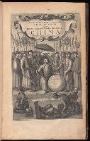
At head of map: Asia distinguished into its principall parts viz. Turky in Asia, Arabia, Persia, India, China, Tartaria, the islands of Japan, of the Philippines, of the Moluckes, of the Sundaes, of Ceylan, and of the Maldivies, where are set down the empires, monarchies, kingdoms, and states which are found there at present., Dedication in cartouche: To the most serene and most sacred majesty of Charles II by the grace of God, King of Great Brittain, France and Ireland. This map of Asia is humbly dedicated, and presented by your majesties loyal subject, and servant William Berry., Map of Asia from Saudi Arabia, Russia, India, China, Japan to Southeast Asia. Relief shown pictorially., No. 49 of 69 maps bound together in composite atlas., and Scale [ca. 1:12 165 120].
Publisher:
Sold by William Berry at the signe of the Globe between Charing-Cross and White-Hall
Subject (Geographic):
Asia --Maps --Early works to 1800, Asia, Central --Maps --Early works to 1800, South Asia --Maps --Early works to 1800, and Southeast Asia --Maps --Early works to 1800
Chart of the northwest coast of America and the northeast coast of Asia, explored in the years 1778 and 1779
Description:
Includes notes., No. 34 of 43 maps bound together in composite atlas., Prepared by Lieut. Heny. Roberts, under the immediate inspection of Capt. Cook ; engraved by W. Palmer., Relief shown pictorially. Depths shown by soundings., and Scale [ca. 1:13,500,000].
Publisher:
Wm. Faden, geographer to the King, Charing Cross
Subject (Geographic):
Bering Strait Region --Discovery and exploration --Maps --Early works to 1800, North America --Discovery and exploration --Maps --Early works to 1800, Pacific Coast (North America) --Discovery and exploration --Maps --Early works to 1800, and Russian Far east (Russia) --Discovery and exploration --Maps --Early works to 1800
Subject (Name):
Cook, James, 1728-1779
Subject (Topic):
Discoveries in geography --Maps --Early works to 1800