Search
You Searched For
Search Results
- Creator:
- Lodge, John, -1796
- Published / Created:
- [1778?]
- Call Number:
- BrSides 2017 62
- Image Count:
- 1
- Resource Type:
- Maps, Atlases & Globes
- Found in:
- Beinecke Rare Book and Manuscript Library > A general map of North America ; from the latest observations / engrav'd by Jno. Lodge from the late Mr. Jefferys, geographer to the King.
- Creator:
- Rocque, John, -1762.
- Published / Created:
- [between 1762 and 1773]
- Call Number:
- 327 1785
- Image Count:
- 2
- Resource Type:
- Maps, Atlases & Globes
- Found in:
- Beinecke Rare Book and Manuscript Library > A map of the kingdom of Ireland : divided into provinces, counties and baronies, shewing the archbishopricks, bishopricks, cities, boroughs, market towns, villages, barracks, mountains, lakes, bogs, rivers, bridges, ferries, passes : also, the great, the branch and the by post roads, together with the inland navigation, &c. / by John Rocque ...
- Creator:
- Bowen, Emanuel, 1693 or 1694-1767, cartographer.
- Published / Created:
- [1747]
- Call Number:
- 655 1747
- Container / Volume:
- BRBL_00345
- Image Count:
- 1
- Resource Type:
- Maps, Atlases & Globes
- Found in:
- Beinecke Rare Book and Manuscript Library > A new & accurate map of Negroland and the adjacent countries : also Upper Guinea, shewing the principal European settlements, & distinguishing w[hi]ch belong to England, Denmark, Holland &c., the sea coast & some of the rivers being drawn from surveys & t
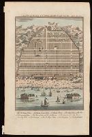
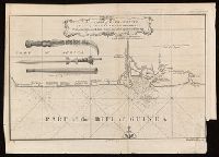
- Creator:
- Harris, John, 1667?-1719.
- Published / Created:
- [1744]
- Call Number:
- BrSides Folio 2017 33
- Image Count:
- 1
- Resource Type:
- Maps, Atlases & Globes
- Found in:
- Beinecke Rare Book and Manuscript Library > A plan of the city of Canton on the river Ta ho [cartographic material].
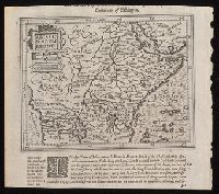
- Creator:
- Hondius, Jodocus, 1563-1612, cartographer.
- Published / Created:
- [1625]
- Call Number:
- BrSides Box 2019 15
- Image Count:
- 2
- Resource Type:
- Maps, Atlases & Globes
- Found in:
- Beinecke Rare Book and Manuscript Library > Abissinorum Regnu[m].
- Creator:
- Jefferys, Thomas, -1771.
- Published / Created:
- [1748]
- Call Number:
- BrSides Folio 2017 11
- Image Count:
- 1
- Resource Type:
- Maps, Atlases & Globes
- Found in:
- Beinecke Rare Book and Manuscript Library > Africa [cartographic material] / drawn from the best maps by T. Jefferys, Geographer to his Royal Highness the Prince of Wales.
- Creator:
- Speed, John, 1552?-1629.
- Published / Created:
- [1676?]
- Call Number:
- 70 1676
- Container / Volume:
- BRBL_00354
- Image Count:
- 2
- Resource Type:
- Maps, Atlases & Globes
- Found in:
- Beinecke Rare Book and Manuscript Library > America with those known parts in that unknowne worlde both people and manner of buildings / Discribed and inlarged by I.S. Ano 1626 ; Abraham Goos ... sculpsit.
- Published / Created:
- [between 1743-1747?]
- Call Number:
- BrSides Folio 2017 20
- Image Count:
- 1
- Resource Type:
- Maps, Atlases & Globes
- Found in:
- Beinecke Rare Book and Manuscript Library > An accurate map of Kalbar River (commonly called Kalabar or Rio Real) and adjacent coast drawn on ye spot by several pilots, 1699 / G. Child, sculpt.
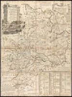
- Creator:
- Bowen, Emanuel, 1693 or 1694-1767, creator.
- Published / Created:
- [1749]
- Call Number:
- 2016 1346
- Image Count:
- 1
- Resource Type:
- Maps, Atlases & Globes
- Found in:
- Beinecke Rare Book and Manuscript Library > An accurate map of the county of Huntingdon divided into its hundreds : drawn from surveys and illustrated with various additional improvements ; also historical extracts relating to its trade, manufactures, natural history &c. not extant in any other map