Search
You Searched For
Search Results
- Creator:
- Sanborn Map Company
- Published / Created:
- June, 1919.
- Call Number:
- 776 D75 1919
- Container / Volume:
- BRBL_00502
- Image Count:
- 15
- Resource Type:
- Maps, Atlases & Globes
- Found in:
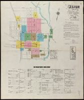
- Beinecke Rare Book and Manuscript Library > Dover, Kent County, Delaware.
- Creator:
- Sanborn Map Company
- Published / Created:
- Nov. 1919.
- Call Number:
- 776 M59 1919
- Container / Volume:
- BRBL_00502
- Image Count:
- 15
- Resource Type:
- Maps, Atlases & Globes
- Found in:
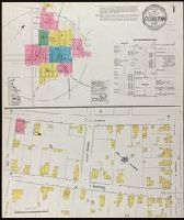
- Beinecke Rare Book and Manuscript Library > Milford, Kent and Sussex Co., Delaware.
- Creator:
- Pissina, Giuseppe Antonio
- Published / Created:
- [1786]
- Call Number:
- BrSides Double Folio 2018 103
- Image Count:
- 11
- Resource Type:
- Maps, Atlases & Globes
- Found in:
- Beinecke Rare Book and Manuscript Library > Tipo dimostrativo delle acque, cavi, edificij, e fondi cadenti rapporto alle loro colature sotto il contratto di transazione sequito fra l'illmo. Sig. Marchese Cusani Livellario delle acque di Lunico, ed uniti della misericordia unitamente a ssri. Carpane
- Creator:
- Sanborn Map Company
- Published / Created:
- August, 1915.
- Call Number:
- 766 Sm95 1915
- Container / Volume:
- BRBL_00502
- Image Count:
- 7
- Resource Type:
- Maps, Atlases & Globes
- Found in:
- Beinecke Rare Book and Manuscript Library > Smyrna, Kent County, Delaware.
- Creator:
- Sanborn Map Company
- Published / Created:
- October, 1919.
- Call Number:
- 776 G295 1919
- Container / Volume:
- BRBL_00502
- Image Count:
- 7
- Resource Type:
- Maps, Atlases & Globes
- Found in:
- Beinecke Rare Book and Manuscript Library > Georgetown, Sussex County, Delaware.
- Creator:
- Sanborn Map Company, issuing body
- Published / Created:
- 1926
- Call Number:
- 766 M31 1926
- Image Count:
- 36
- Resource Type:
- Maps, Atlases & Globes
- Found in:
- Beinecke Rare Book and Manuscript Library > Insurance maps of Manchester, including part of Highland Park and Manchester Green, Hartford Co., Connecticut.
- Creator:
- Sanborn Map Company
- Published / Created:
- 1920
- Call Number:
- 783 P83 1920
- Container / Volume:
- BRBL_00510
- Image Count:
- 30
- Resource Type:
- Maps, Atlases & Globes
- Found in:
- Beinecke Rare Book and Manuscript Library > Insurance maps of Portsmouth, Virginia.
- Creator:
- Sanborn Map Company, issuing body
- Published / Created:
- 1925
- Call Number:
- 766 M59 1925
- Image Count:
- 31
- Resource Type:
- Maps, Atlases & Globes
- Found in:
- Beinecke Rare Book and Manuscript Library > Insurance maps of Milford, New Haven County, Connecticut, including Woodmont, Merwin's Point, Bay View, Fort Trumbull Beach, Silver Sands, Seaside, Myrtle Beach, Meadows End, Walnut Beach, Wildmere Beach, Laurel Beach, Cedar Beach, Devon and Rivercliff.
- Published / Created:
- 1860
- Call Number:
- 806gme C43 1860
- Container / Volume:
- BRBL_00549
- Image Count:
- 1
- Resource Type:
- Maps, Atlases & Globes
- Found in:
- Beinecke Rare Book and Manuscript Library > Plat exhibiting the location of the Southern Michigan and Rock Island R.R. depots and adjacent grounds. / lithographed by Ed Mendel.
- Creator:
- Howard, Joseph
- Published / Created:
- 1824
- Call Number:
- 804 D376 1824
- Image Count:
- 1
- Resource Type:
- Maps, Atlases & Globes
- Found in:
- Beinecke Rare Book and Manuscript Library > A map of the district of Delaware in Ohio / by Joseph Howard ; H. Platt sc.
- Creator:
- Savigny, Hugh P
- Published / Created:
- [1870]
- Call Number:
- BrSides Double Folio 2018 101
- Image Count:
- 1
- Resource Type:
- Maps, Atlases & Globes
- Found in:
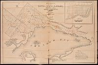
- Beinecke Rare Book and Manuscript Library > Plan of survey of the silver mining district, Thunder Bay, Lake Superior, Canada / compiled by Hugh P. Savigny, P.L.S.
- Creator:
- Johnson, Thomas H., Cartographer
- Published / Created:
- 2nd Feby. 1877.
- Call Number:
- BrSides Double Folio 2018 97
- Image Count:
- 1
- Resource Type:
- Maps, Atlases & Globes
- Found in:
- Beinecke Rare Book and Manuscript Library > McIntyre / Thos. H. Johnson, Assistant Commissioner.
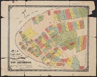
- Creator:
- Tyler, Henry Dunreath
- Published / Created:
- [approximately 1897?]
- Call Number:
- 771 1897A
- Container / Volume:
- BRBL_00479
- Image Count:
- 1
- Resource Type:
- Maps, Atlases & Globes
- Found in:
- Beinecke Rare Book and Manuscript Library > Map of the original grants of village lots from the Dutch West India Company to the inhabitants of New-Amsterdam (now New-York) lying below the present line of Wall Street : grants commencing A.D. 1642 / [by Henry Dunreath Tyler].
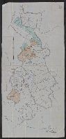
- Creator:
- De Witt, Simeon, 1756-1834
- Published / Created:
- [1793?]
- Call Number:
- 771 1793
- Container / Volume:
- BRBL_00477
- Image Count:
- 1
- Resource Type:
- Maps, Atlases & Globes
- Found in:
- Beinecke Rare Book and Manuscript Library > 1st sheet of De Witt's state-map of New-York / C. Tiebout sculp. NYork.
- Published / Created:
- 1890
- Call Number:
- 804fa P984 1890
- Container / Volume:
- BRBL_00545
- Image Count:
- 1
- Resource Type:
- Maps, Atlases & Globes
- Found in:
- Beinecke Rare Book and Manuscript Library > [East Part of Putnam County, Ohio].
- Published / Created:
- 1890
- Call Number:
- 805fa Ad18 1890
- Container / Volume:
- BRBL_00546
- Image Count:
- 1
- Resource Type:
- Maps, Atlases & Globes
- Found in:
- Beinecke Rare Book and Manuscript Library > [Map of Adams County, Indiana].
- Published / Created:
- 1936
- Call Number:
- 796 T247 1936
- Container / Volume:
- BRBL_00528
- Image Count:
- 1
- Resource Type:
- Maps, Atlases & Globes
- Found in:
- Beinecke Rare Book and Manuscript Library > Map of the city of Temple, Texas.
- Creator:
- Texas & Pacific Railway. Land Dept
- Published / Created:
- [1900?]
- Call Number:
- 796 C13 1900
- Container / Volume:
- BRBL_00527
- Image Count:
- 1
- Resource Type:
- Maps, Atlases & Globes
- Found in:
- Beinecke Rare Book and Manuscript Library > Callahan County, Texas / Office, Land Dept., Texas & Pacific Railway Co.
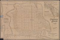
- Creator:
- Rand McNally and Company
- Published / Created:
- [1886?]
- Call Number:
- 844 C77 1886
- Container / Volume:
- BRBL_00604
- Image Count:
- 1
- Resource Type:
- Maps, Atlases & Globes
- Found in:
- Beinecke Rare Book and Manuscript Library > Map of Coronado Beach, San Diego, California / Rand McNally & Co., engravers, Chicago.
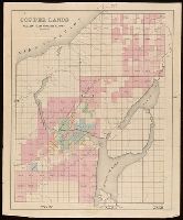
- Creator:
- Heyrick, J. C., creator
- Published / Created:
- 1912
- Call Number:
- 802gbc P429 1912
- Container / Volume:
- BRBL_00717
- Image Count:
- 1
- Resource Type:
- Maps, Atlases & Globes
- Found in:
- Beinecke Rare Book and Manuscript Library > Map of Riverside Coal & Timber Co. : lands on Little Leatherwood C'r, Perry Co., Kentucky / J.C. Heydrick.
- Published / Created:
- [approximately 1900?]
- Call Number:
- BrSides Double Folio 2018 102
- Image Count:
- 1
- Resource Type:
- Maps, Atlases & Globes
- Found in:
- Beinecke Rare Book and Manuscript Library > [Partial cadastral map of the Province of Ontario in Canada].
- Published / Created:
- [1859?]
- Call Number:
- BrSides Folio 2018 134
- Image Count:
- 1
- Resource Type:
- Maps, Atlases & Globes
- Found in:
- Beinecke Rare Book and Manuscript Library > Copper lands of St. Mary's Canal Mineral Land Co. shaded red.
- Published / Created:
- [1859?]
- Call Number:
- BrSides Folio 2018 136
- Image Count:
- 1
- Resource Type:
- Maps, Atlases & Globes
- Found in:
- Beinecke Rare Book and Manuscript Library > Copper lands of St. Mary's Canal Mineral Land Co. shaded red.
- Published / Created:
- [1859?]
- Call Number:
- BrSides Folio 2018 135
- Image Count:
- 1
- Resource Type:
- Maps, Atlases & Globes
- Found in:
- Beinecke Rare Book and Manuscript Library > Lands of the St. Mary's Canal Mineral Land Co. shaded red.
- Published / Created:
- [1859?] and [between 1880 and 1889?]
- Call Number:
- BrSides Folio 2018 138
- Image Count:
- 1
- Resource Type:
- Maps, Atlases & Globes
- Found in:
- Beinecke Rare Book and Manuscript Library > Map of a portion of Point Keweenaw, L.S. : showing the lands &c. of the Pennsylvania & Delaware Mining Co's.
- Published / Created:
- [1872?]
- Call Number:
- BrSides Folio 2018 139
- Image Count:
- 1
- Resource Type:
- Maps, Atlases & Globes
- Found in:
- Beinecke Rare Book and Manuscript Library > [Map of Thunder Bay District, Canada, showing silver lands owned by Peter Mitchell & others, Sept. 7th, 1872].
- Creator:
- Denton, D. S., Jr., cartographer.
- Published / Created:
- [1907]
- Call Number:
- BrSides Double Folio 2018 88
- Image Count:
- 1
- Resource Type:
- Maps, Atlases & Globes
- Found in:
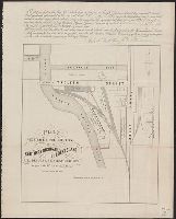
- Beinecke Rare Book and Manuscript Library > Map of Meadow Land at Ocean side in the town of Hempstead Nassau County, N.Y. belonging to the estate of Lewis Davison Dec'd and the estate of Tredwell Davison dec'd / surveyed in March 1907, by DS Denton, Jr.
- Published / Created:
- 1852
- Call Number:
- 804 C991 1852
- Container / Volume:
- BRBL_00544
- Image Count:
- 1
- Resource Type:
- Maps, Atlases & Globes
- Found in:
- Beinecke Rare Book and Manuscript Library > Map of the town of Cuyahoga Falls Ohio.
- Published / Created:
- 1890
- Call Number:
- 804fa Au421 1890
- Container / Volume:
- BRBL_00545
- Image Count:
- 1
- Resource Type:
- Maps, Atlases & Globes
- Found in:
- Beinecke Rare Book and Manuscript Library > [Map of Auglaize County, Ohio].
- Creator:
- Ireland, J. B. (Jerome Bonaparte), 1879-
- Published / Created:
- [1950?]
- Call Number:
- 836 Sa37 1858
- Container / Volume:
- BRBL_00592
- Image Count:
- 1
- Resource Type:
- Maps, Atlases & Globes
- Found in:
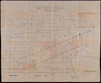
- Beinecke Rare Book and Manuscript Library > Pioneer map showing lot locations of first pioneer owners in the five-acre plat "A" portion of the Big Field Survey, Great Salt Lake City / drawn by J. B. Ireland.