The generall historie of Virginia, New-England, and the Summer Isles : with the names of the
Image Count:
1
Abstract:
With inset map of "Ould Virginia" [with linen backing].
Description:
Engraved by Robert Vaughan, Ink washes on various vignettes., and Tipped-in facing title page.
Publisher:
Printed by I.D. and I.H. for Michael Sparkes
Subject (Name):
Smith, John, 1580-1631
Subject (Topic):
Indians of North America--Virginia., New England --History --Colonial period, ca. 1600-1775., Virginia --History --Colonial period, ca. 1600-1775, and Voyages and travels.
Collection Created:
London : Printed by I.[ohn] D.[awson] and I.[ohn] H.[aviland] for Michael Sparkes, 1624
The generall historie of Virginia, New-England, and the Summer Iles ...
Image Count:
1
Abstract:
Inset map of Virginia
Description:
Engraved by Robert Vaughan, Facing p. 41, and Printed by James Reeve
Publisher:
Printed by I.D. and I.H. for Michael Sparkes
Subject (Name):
Smith, John, 1580-1631
Subject (Topic):
Indians of North America--Virginia., New England --History --Colonial period, ca. 1600-1775., Virginia --History --Colonial period, ca. 1600-1775, and Voyages and travels.
Collection Created:
London : Printed by I.D. and I.H. for Michael Sparkes, 1624
Atlas minor: or a set of sixty-two new and correct maps, of all parts of the world. All composed
Image Count:
1
Description:
Autograph of Gravely. Autograph of Baldock. Autograph of Aston. Autograph of W. Alington. and Teaching resource: Professor John Mack Faragher, History 141: The American West.
Subject (Geographic):
America--Maps--Early works to 1800 and Fundy, Bay of--Maps
A collection of voyages and travels, some now first printed from original manuscripts, others now
Image Count:
4
Description:
In: Churchill, Awnsham, d. 1728. Collection of voyages and travels. London : Printed by assignment from Messrs. Churchill, for H. Lintot [etc.], 1746 vol. 5.
Publisher:
Printed by assignment from Messrs. Churchill, for H. Lintot [etc.],
Subject (Geographic):
America--Discovery and exploration, Angola--Description and travel--Early works to 1800, Guinea--Description and travel--Early works to 1800, Guyana--Description and travel--Early works to 1800, and West Indies--Description and travel--Early works to 1800
Bowen, Emanuel, d. 1767 Cook, James, fl. 1766, creator
Published / Created:
Decr. 1766
Call Number:
2003 Folio 85
Image Count:
1
Description:
BEIN 2003 Folio 85: No. 24 of 45 maps bound together with binder's spine title: Atlas of America; ms. table of contents. Bookplate: Robinson. Bookplate of Paul Mellon., by their humble servt. James Cook ; approv'd of by Mr. Joiner 20 years a pilot of that place., Depths shown by soundings., Emanl. Bowen sculpt., Hand colored., and Scale [1:65,000].
Publisher:
By the author
Subject (Geographic):
Port Royal (S.C.) -- Maps -- Early works to 1800
Subject (Topic):
Nautical charts -- Port Royal (S.C.) -- Early works to 1800
Bowen, Emanuel, d. 1767 Cook, James, 1728-1779, creator
Published / Created:
Decem'r. 1766
Call Number:
2003 Folio 85
Image Count:
1
Description:
BEIN 2003 Folio 85: No. 15 of 45 maps bound together with binder's spine title: Atlas of America; ms. table of contents. Bookplate: Robinson. Bookplate of Paul Mellon., by James Cook, when surveyor of His Majesty's Ship the Mars., Depths shown by soundings., Eman'l. Bowen sculp't., Hand colored., and Scale [ca. 1:64,000].
Publisher:
Published by the author according to Act of Parliament
Subject (Geographic):
Halifax (N.S.) -- Maps -- Early works to 1800
Subject (Topic):
Coasts -- Nova Scotia -- Maps -- Early works to 1800 and Nautical charts -- Nova Scotia -- Early works to 1800
BEIN 2003 Folio 85: No. 26 of 45 maps bound together with binder's spine title: Atlas of America; ms. table of contents. Bookplate: Robinson. Bookplate of Paul Mellon., Cartouche with dedication to John Ellis, Esq., King's agent for the province of west Florida, by James Cook., Depths shown by soundings., Hand colored., Inserts are A plan of Pensacola Harbour with the marks for going in (scale 1:95,000) and A draught of Spirito Sancto and coast adjacent (scale ca. 1:140,000)., and Scale [ca. 1:550,000].
Publisher:
Published by the author according to Act of Parliament
Subject (Geographic):
Florida -- Maps -- Early works to 1800
Subject (Topic):
Coasts -- Florida -- Maps -- Early works to 1800 and Nautical charts -- Florida -- Early works to 1800
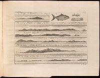
BEIN 1986 +48: With: A new booke of mapps exactly describing Europe. [London] : Tho Jenner excu., [1645?] (1986 +48) and Plates, with English t.p. and captions in French, Dutch, or Latin, from De vyerighe colom / by Jacob Aertsz Colom, first published in 1635. Cf. Koeman, C. Atlantes Neerlandici, II, p. 40.
Publisher:
By Iames Colom,
Subject (Geographic):
Benelux countries--Kings and rulers--Portraits and Benelux countries--Maps--Early works to 1800
Subject (Name):
Luttrell, Narcissus,--1657-1732--Inscription.--696 % pro
Atlas minor: or a set of sixty-two new and correct maps, of all parts of the world. All composed
Image Count:
1
Resource Type:
Maps, Atlases & Globes
Description:
Autograph of Gravely. Autograph of Baldock. Autograph of Aston. Autograph of W. Alington. and Teaching resource: Professor John Mack Faragher, History 141: The American West.
Subject (Geographic):
America--Maps, Europe, Northern--Maps--Early works to 1800, Great Britain--Maps--Early works to 1800, and Ireland--Maps--Early works to 1800