Skip to search
Skip to main content
Skip to first result
Search
You Searched For
Date
1600 - 1799
Resource Type
Maps, Atlases & Globes
Date Created
1600 to 1799
New Search
Search Results
Creator:
Published / Created:
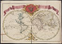
1652?]
Call Number:
19 1657
Container / Volume:
BRBL_00682
Image Count:
1
Resource Type:
Maps, Atlases & Globes
Description:
Cross Collection no. 60., From Janssonius's Niewen atlas ... Amstelodami : Apud Ioannem Ianssonium, 1652., Hand col. Mounted on linen., Includes marginal ill., Relief shown pictorially., Title supplied by cataloger., and Variant of Hondius' Polus Antarcticus, 1638.
Publisher:
J. Jansson,
Subject (Geographic):
Antarctica--Maps--Early works to 1800 and Southern Hemisphere--Maps--Early works to 1800
Subject (Name):
Jansson, Jan, 1588-1664. Atlas novus. Dutch
Found in:
Beinecke Rare Book and Manuscript Library > [Polus Antarcticus].
Published / Created:
1643
Call Number:
11 1643
Container / Volume:
BRBL_00700
Image Count:
1
Resource Type:
Maps, Atlases & Globes
Description:
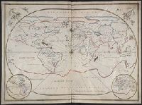
[Joannes Oliva, Leghorn, 1643]., Giovane Oliva de Messina fatta in liorno año 1643., and Manuscript on vellum.
Subject (Geographic):
World--Maps, Manuscript--Early works to 1800
Found in:
Beinecke Rare Book and Manuscript Library > [Portolan chart of the World].
Creator:
Published / Created:
between 1783 and 1799?]
Call Number:
71 1785C
Container / Volume:
BRBL_00366
Image Count:
2
Resource Type:
Maps, Atlases & Globes
Alternative Title:
Map of North America and the West Indies
Description:
An issue of the Pownall map of North America and the West Indies; appears similar to the 1783 and 1794 editions., Insets: A particular map of Baffin and Hudson's Bay -- The passage by land to California., Prime meridians: London and Ferro., and Relief shown pict
Publisher:
s.n.,
Subject (Geographic):
North America--Maps--Early works to 1800
Subject (Topic):
British--America--Maps--Early works to 1800
Found in:
Beinecke Rare Book and Manuscript Library > [Pownall's map of North America and the West Indies].
Published / Created:
1780?]
Call Number:
786 C38 1780
Container / Volume:
BRBL_00516
Image Count:
1
Resource Type:
Maps, Atlases & Globes
Publisher:
[W. Faden?,
Subject (Geographic):
Charleston (S.C.)--Maps--Early works to 1800
Found in:
Beinecke Rare Book and Manuscript Library > [Proof copy of a map of Charleston, South Carolina].
Published / Created:
1754
Call Number:
88 P96 1754
Container / Volume:
BRBL_00647
Image Count:
1
Resource Type:
Maps, Atlases & Globes
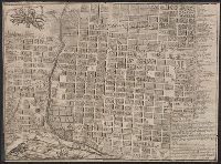
Description:
For more information see the back of the catalogue card.
Subject (Geographic):
Mexico--Maps--Early works to 1800
Found in:
Beinecke Rare Book and Manuscript Library > [Puebla de los Angeles: Engraved plan of the town by] Jph. ortiz Carnero sculpe Altixco [after] Bs Joseph Marianus a Medina.
Published / Created:
[1720]
Call Number:
11 1720A
Container / Volume:
BRBL_00004
Image Count:
1
Resource Type:
Maps, Atlases & Globes
Description:
American N.W. Coast is not continued (except in a dotted line) North of California, and no mention is made of Bering's discoveries. and Preliminary record.
Subject (Geographic):
World--Maps--Early works to 1800
Found in:
Beinecke Rare Book and Manuscript Library > [Russian World Map, identical to the maps of Guillaume de L'Isle].
Published / Created:
[1745?]
Call Number:
38 SA22 1745
Container / Volume:
BRBL_00165
Image Count:
1
Resource Type:
Maps, Atlases & Globes
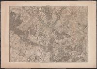
Subject (Geographic):
Saint-Cloud (France)--Maps--Early works to 1800
Found in:
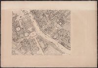
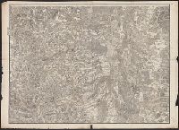
Beinecke Rare Book and Manuscript Library > [Section West of St. Cloud.]
Published / Created:
[1755?]
Call Number:
38 P21 1755
Container / Volume:
BRBL_00160
Image Count:
1
Resource Type:
Maps, Atlases & Globes
Subject (Geographic):
Paris (France)--Maps--Early works to 1800
Found in:
Beinecke Rare Book and Manuscript Library > [Sections of Paris].
Published / Created:
[1780?]
Call Number:
38 ST81 1780
Container / Volume:
BRBL_00165
Image Count:
1
Resource Type:
Maps, Atlases & Globes
Subject (Geographic):
Strasbourg (France)--Maps--Early works to 1800
Found in:
Beinecke Rare Book and Manuscript Library > [Strasbourg and Environs].
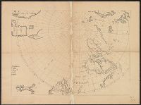
Published / Created:
[1650?]
Call Number:
18 1650
Container / Volume:
BRBL_00012
Image Count:
1
Resource Type:
Maps, Atlases & Globes
Subject (Geographic):
Arctic Regions--Maps--Early works to 1800
Found in:
Beinecke Rare Book and Manuscript Library > [The Arctic Regions].
Branch:v1.61.8 ,Deployed:2024-06-20T11:14:55-04:00