"Humbly dedicated to Elihu Yale, esq., of Place Grove in Denbyshire by his obliged humble servants, Cha. Price, Ion. Senex, Ion. Maxwell, Geographers to the Queen.", Backed with linen., and Relief shown pictorially.
Publisher:
J. Senex?],
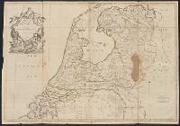
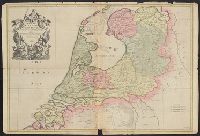
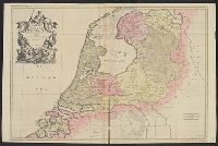
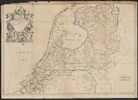
Subject (Geographic):
Netherlands--Maps--Early works to 1800.
Subject (Name):
Maxwell, John, active 1708-1712, dedicator., Price, Charles, active 1700-1707, dedicator., and Yale, Elihu, 1649-1721, dedicatee.
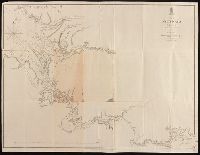
At head of title: Australia N.W. Coast., Coordinates not present on map and are approximated., Imperfect: mutilated and repaired, with no loss of text., In lower right corner: 1705., and Relief shown by hachures; soundings in fathoms.
Publisher:
Hydrographic Office of the Admiralty,
Subject (Geographic):
Victoria River (N.T.)--Maps. and Victoria River (N.T.)--Navigation--Maps.
Subject (Name):
Bate, R. B. (Robert Brettell), bookseller., Great Britain. Hydrographic Office, publisher., and J. & C. Walker (Firm), engraver.
Engravers: Emanuel Bowen, C. Moore, and G. Child., From Jean-Baptiste Du Halde's Description géographique, historique, chronologique, politique, et physique de l'empire de la Chine (English edition, 1738)., From maps originally drawn in 1709-1710 by Jean Baptiste, Pierre Jartoux, Xavier Ehrenbert Fridelli, and Guillaume Bonjour., Prime meridians: Paris and Peking [Beijing]., Relief shown pictorially., and Watermarks.
Publisher:
[T. Gardner for Edward Cave],
Subject (Geographic):
Asia, Central--Maps--Early works to 1800.
Subject (Name):
Bonjour, Guillaume, 1670-1714, cartographer., Bowen, Emanuel, 1693 or 1694-1767, engraver., Child, G., engraver., and Du Halde, J.-B. (Jean-Baptiste), 1674-1743. Description géographique, historique, chronologique, politique,
From Thomas Jeffery's American atlas. 1778., Imperfect: southern portion of text torn along fold and separated. Sheets pasted together to form one map. No. "17" stamped on verso, upper right corner., Insets: A chart of the mouth of Hudson's River, from Sandy Hook to New York.--A plan of the city of New York.--Plan of Amboy, with its environs, from an actual survey., Prime meridian: London., Relief shown pictorially., Shows administrative divisions., and Watermarks.
Publisher:
Printed for Robt. Sayer & John Bennett ...,
Subject (Geographic):
New Jersey--Administrative and political divisions--Maps--Early works to 1800., New Jersey--Maps--Early works to 1800., New York (N.Y.)--Maps--Early works to 1800, New York (State)--Administrative and political divisions--Maps--Early works to 1800., Northeastern States, Northeastern States--Maps--Early works to 1800., Perth Amboy (N.J.)--Maps--Early works to 1800., and Québec (Province)--Maps--Early works to 1800
Subject (Name):
Holland, Samuel, 1728-1801 and Robert Sayer and John Bennett (Firm)
2nd edition, 1st state, with entirely new plate from 1st edition that now shows all of Florida peninsula with title in cartouche., Below map is letterpress entitled: A compendious account of the British colonies in North America., Lower right corner of map includes Evan's polymetric table of America, with distances, and Thomas Templeman's survey of the size and area of the individual colonies., and Watermark.
Subject (Geographic):
North America--Maps--Early works to 1800 and United States--History--Revolution, 1775-1783--Maps
Subject (Name):
Jefferys, Thomas, -1771. and Robert Sayer and John Bennett (Firm)