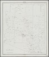
Insets: Aleutian Islands, Sitka, Juneau, Nome., Relief shown by shading and spot heights., and Shows forest reserves, Indian reservations, reindeer station reserves, military installations, etc.
Publisher:
General Land Office,
Subject (Geographic):
Alaska--Maps
Subject (Name):
Andrew B. Graham Co, Bond, Frank, 1856-1940, Hendges, M, and United States. General Land Office
"No. 20"--Upper right margin., "The Yukon River, ranges of mountains, shores of Norton Sound and many features of the interior from a reconnaissance by W.H. Dall, Director of the Scientific Corps, of the W.U. Tel. Expedition, 1865-1868.", and Inset: Aleutian Islands.
Publisher:
U.S. Coast Survey,
Subject (Geographic):
Alaska--Maps and Yukon Territory--Maps
Subject (Name):
Dall, William Healey, 1845-1927 and Lindenkohl, H. (Henry)
Copper River and adjacent territory, Geological Survey (U.S.). Report, Public resolution ; no. 25, 55th Congress, 3d session., and Its Report, Public resolution ; no. 25, 55th Congress, 3d session
Description:
Contour interval approximately 250 feet., Imperfect: Upper portion of map wanting. Dimensions 35 x 50 cm., and Relief shown by form lines, hachures, and spot heights.
Publisher:
The Survey,
Subject (Geographic):
Alaska--Maps, Chugach Mountains (Alaska)--Maps, and Copper River Region (Alaska)--Maps
Subject (Name):
Abercrombie, W. R.--(William Ralph),--b. 1857, Lowe, P. G, Mahlo, Emil, and Schrader, Frank C. (Frank Charles), 1860-1944
"Henry Gannet, Chief Geographer, H.M. Wilson, Geographer in charge; Topography by Frank Sutton and J.H. Jennings; surveyed in 1891-1892.", "Reprinted Nov. 1906.", "Surveyed in cooperation with the State of New York.", Contour interval 20 feet., and Relief shown by contours.