Great Britain. War Office. General Staff. Geographical Section
Published / Created:
1919?]
Call Number:
434fd 1919
Container / Volume:
BRBL_00251
Image Count:
1
Resource Type:
Maps, Atlases & Globes
Alternative Title:
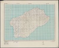
Czecho-Slovakia
Description:
"G.S.G.S. No. 2758.", "S.G.A. 2.4.19.", Also shows portions of Germany, Poland, Austria, Hungary, and Romania., In French and English., Relief shown by contours and spot heights., and Shows proposed boundaries and roads.
Publisher:
G.S.G.S.,
Subject (Geographic):
Czechoslovakia--Boundaries--Maps and Czechoslovakia--Maps
Great Britain. War Office. General Staff. Geographical Section
Published / Created:
1940
Call Number:
342 1944
Container / Volume:
BRBL_00092
Image Count:
2
Resource Type:
Maps, Atlases & Globes
Alternative Title:
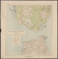
G.S.G.S. ; 4139 and GSGS (Series) ; 4139.
Description:
Contents: North sheet -- South sheet., Contours at 50 meters interval., Copied from a Danish map of 1932., Four classes of roads are shown., and Military grid.
Great Britain. War Office. General Staff. Geographical Section
Published / Created:
1927
Call Number:
BrSides Folio 2018 131
Image Count:
1
Resource Type:
Maps, Atlases & Globes
Alternative Title:
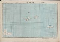
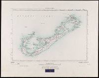
GSGS (Series) ; 3857
Description:
"250/27.", "Surveyed in 1898-99.", Bookseller's label at bottom of sheet: International Map Company, Inc. ... New York. N.Y., Relief shown by spot heights (in feet)., and Shows roads (2 categories) and parish boundaries.
Publisher:
Ordnance Survey Office,
Subject (Geographic):
Bermuda Islands--Maps.
Subject (Name):
Great Britain. Ordnance Survey and International Map Company
Great Britain. War Office. General Staff. Geographical Section
Published / Created:
1943
Call Number:
408 Ag84 1943
Container / Volume:
BRBL_00239
Image Count:
1
Resource Type:
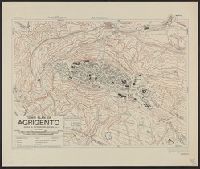
Maps, Atlases & Globes
Alternative Title:
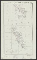
Geographical Section, General Staff ; no. 4379, GSGS (Series) ; 4379., and Italy 1:5,000
Description:
"5-43.", "Enlarged, "Published by the War Office, 1942, 2nd edition, 1943.", A few important streets are named., Also shows power lines, railways, and aquaducts., Includes index to buildings., Military grid., and Relief shown by contours, hachures, and spot heights.