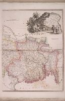
The American military pocket atlas : being an approved collection of correct maps, both general and
Image Count:
1
Alternative Title:
The Seat of war, in the northern colonies, containing the province of Quebec, Newfoundland, Nova-Scotia, New-England, New-York, New-Jersey, Pennsylvania, &ca
Description:
14th August 1776. and Teaching resource: Professor John Mack Faragher, History 141: The American West.
Publisher:
Printed for Robt. Sayer & Jno. Bennett, Map and Sea Chartsellers, No. 53, Fleet Street, as the Act directs
Subject (Geographic):
New England --Maps --Early works to 1800, North America --Maps --Early works to 1800, and United States --History --Revolution, 1775-1783 --Maps
Collection Created:
London : Printed for R. Sayer and J. Bennet, [1776]
The American military pocket atlas : being an approved collection of correct maps, both general and
Image Count:
1
Alternative Title:
The Seat of war, in the southern British colonies, comprehending North and South Carolina, Georgia, east and west Florida, &ca
Description:
15th Oct. 1776., Inset: Plan of Charlestown and plan of St. Augustine., and Teaching resource: Professor John Mack Faragher, History 141: The American West.
Publisher:
Printed for R. Sayer & J. Bennett, Map, Chart and Printsellers, No. 53 Fleet Street, as the Act directs
Subject (Geographic):
North America --Maps --Early works to 1800, Southern States --Maps --Early works to 1800, and United States --History --Revolution, 1775-1783 --Maps
Collection Created:
London : Printed for R. Sayer and J. Bennet, [1776]
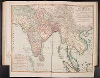
A general atlas of modern geography, consisting of a complete collection of the most approved maps ...
Image Count:
1
Publisher:
James Wyld
Collection Created:
London, Published by James Wyld, no.5, Charing Cross, (Successor to Mr. Faden) geographer to His Majesty, and to His Royal Highness the Duke of York, 1824 [i.e. 1825?]
The American military pocket atlas : being an approved collection of correct maps, both general and
Image Count:
1
Description:
Augst. 5th. 1776., Inset: A particular plan of Lake George. surveyed in 1756. By Capt. Jackson., and Teaching resource: Professor John Mack Faragher, History 141: The American West.
Publisher:
Printed for Robt. Sayer & Jno. Bennett, Map & Sea Chartsellers No. 53 Fleet Street, as the Act directs
Subject (Geographic):
North America --Maps --Early works to 1800 and United States --History --Revolution, 1775-1783 --Maps
Collection Created:
London : Printed for R. Sayer and J. Bennet, [1776]
BEIN 2003 Folio 85: Without book of directions mentioned after publisher statement. No. 10 of 45 maps bound together with binder's spine title: Atlas of America; ms. table of contents. Bookplate: Robinson. Bookplate of Paul Mellon., by James Cook, surveyor., Depths shown by soundings., Hand colored., Insets of enlarged harbors: Great Jervis Harbour, Harbours of St. Laurence, Harbour Briton [scale ca. 1:32,000]., Larken sc., and Scale [ca. 1:230,000].
Publisher:
Published ... by James Cook, and sold by I. Mount and T. Page ... Tho's. Jeffrey ... and And'w. Dury ... London
Subject (Topic):
Coasts -- Newfoundland and Labrador -- Maps -- Early works to 1800 and Nautical charts -- Newfoundland and Labrador -- Early works to 1800
Also appeared in Faden's [General atlas. London : William Faden, 1811?]., Includes relief profiles and inset map of "Positions ascertained by courses and distances given; on a scale reduced to the third.", No. 42 of 43 maps bound together in composite atlas., Relief shown pictorially; depths by soundings., and Scale [ca. 1:2,700,000].
Publisher:
Wm. Faden
Subject (Geographic):
Antilles, Lesser --Maps --Early works to 1800
Subject (Topic):
Nautical charts --Antilles, Lesser --Early works to 1800
Delarochette, L. (Louis), 1731-1802 Dicquemare, (Jacques-Francois), M. l'abbe, 1733-1789, creator Faden, William, 1749-1836
Published / Created:
1780 June 17
Call Number:
1982 Folio 10
Image Count:
1
Description:
By Monsr. L Abbe Diquemare ; with several emendations, and many useful additions &c. by L.S. De La Rochette., Depths shown by soundings., No. 8 of 43 maps bound together in composite atlas., and Scale [ca. 1:3,100,000].
Publisher:
Engraved & published by W. Faden
Subject (Geographic):
Biscay, Bay of (France and Spain) --Navigation --Maps --Early works to 1800, English Channel --Navigation --Maps --Early works to 1800, and North Sea --Navigation --Maps --Early works to 1800
Subject (Topic):
Coasts --England --Maps --Early works to 1800, Coasts --France --Maps --Early works to 1800, Nautical charts --English Channel --Early works to 1800, and Nautical charts --North Sea --Early works to 1800
... sold with a book of directions by I. Mount & T. Page on Tower Hill, London., BEIN 2003 Folio 85: No. 9 of 45 maps bound together with binder's spine title: Atlas of America; ms. table of contents. Bookplate of Paul Mellon., by James Cook, surveyor., Hand-colored., Includes References and 5 insets., Larken, sculpt., Relief shown by hachures. Depths shown by soundings., and Scale ca. 1:220,000.
Subject (Geographic):
Belle Isle, Strait of (N.L.) -- Maps -- Early works to 1800
Subject (Topic):
Nautical charts -- Newfoundland and Labrador -- Belle Isle, Strait of -- Early works to 1800