Skip to search
Skip to main content
Skip to first result
Search
You Searched For
Resource Type
Maps, Atlases & Globes
Publication Place
Boston :
New Search
Search Results
Creator:
Published / Created:
[1908]
Call Number:
762gmb 1908
Container / Volume:
BRBL_00451
Image Count:
1
Resource Type:
Maps, Atlases & Globes
Alternative Title:
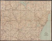
Automobile map of New Hampshire, central and Automobile map of New Hampshire, south
Description:
Automobile map of New Hampshire, south, No. 13 -- Automobile map of New Hampshire central, No. 14., Maps mounted on cloth backing., Relief shown by hachures., Shows southeastern New Hampshire and some of Maine and Massachusetts, from Saco, Me. in the northeast to Newbury, Mass. in the southeast and Orange, N.H. in the northwest to Rindge, N.H. in the southwest., and Title from panel.
Publisher:
Walker Lith. & Pub. Co.,
Subject (Geographic):
New Hampshire--Maps.
Subject (Name):
Walker Lith. & Pub. Co.
Subject (Topic):
Roads--New Hampshire--Maps.
Found in:
Beinecke Rare Book and Manuscript Library > Automobile map of New Hampshire / Automobile Club of America.
Creator:
Published / Created:
c1905.
Call Number:
764am B65 1905
Container / Volume:
BRBL_00460
Image Count:
1
Resource Type:
Maps, Atlases & Globes
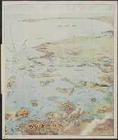
Description:
Copyright: 1905 by the Federal Engraving and Publishing Co., Boston, Mass., Index to points of interest on cover., Oriented with north to the left., and Title from cover.
Publisher:
Published by John F. Murphy,
Subject (Geographic):
Boston Harbor (Mass.)--Maps, Boston Harbor Islands (Mass.)--Maps, Boston Harbor Region (Mass.)--Maps, and South Shore Region (Mass. : Coast)--Maps
Subject (Name):
Murphy, John F
Found in:
Beinecke Rare Book and Manuscript Library > Bird's eye view of Boston Harbor and South Shore to Provincetown : showing steamboat routes.
Creator:
Published / Created:
1902]
Call Number:
762am W588 1902
Container / Volume:
BRBL_00451
Image Count:
2
Resource Type:
Maps, Atlases & Globes
Alternative Title:
Bird's eye map of the White Mountains, reached by Boston & Maine
Description:
"Tourist Season 1902, in effect June 23"., Relief shown pictorially and by spot heights., and Verso: Railroad schedules.
Publisher:
[R.A. Supply Co.,
Subject (Geographic):
White Mountains (N.H. and Me.)--Maps
Subject (Topic):
Railroads--White Mountains (N.H. and Me.)--Maps
Found in:
Beinecke Rare Book and Manuscript Library > Bird's-eye map of the White Mountains, reached by Boston & Maine RR / R.A. Supply Co., eng'rs and printers.
Published / Created:
c1902.
Call Number:
762am M86 1902
Container / Volume:
BRBL_00451
Image Count:
1
Resource Type:
Maps, Atlases & Globes
Alternative Title:
Bird's eye view from Mt. Washington, New Hampshire
Description:
"Issued by Passenger Department of Boston & Maine R.R.", Includes key to 189 places., and Panel title: Bird's eye view from Mt. Washington, New Hampshire.
Publisher:
Geo. H. Walker & Co.,
Subject (Geographic):
Washington, Mount (N.H.)--Maps and White Mountains (N.H. and Me.)--Maps
Subject (Name):
Boston and Maine Railroad and Geo. H. Walker & Co
Found in:
Beinecke Rare Book and Manuscript Library > Birds-eye view from summit of Mt. Washington, White Mountains, New Hampshire.
Creator:
Published / Created:
[1911?]
Call Number:
76gme 1910
Container / Volume:
BRBL_00446A
Image Count:
1
Resource Type:
Maps, Atlases & Globes
Alternative Title:
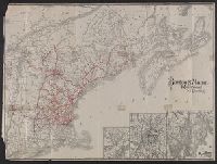
Boston and Maine Railroad and connections
Description:
St. Andrews N.B. and about there -- White Mountain region -- Mount Desert Island and vicinity.
Publisher:
The Company,
Subject (Geographic):
New England--Maps
Subject (Name):
Boston and Maine Railroad
Subject (Topic):
Railroads--New England--Maps
Found in:
Beinecke Rare Book and Manuscript Library > Boston & Maine Railroad and connections / Rand Avery Supply Co.
Creator:
Published / Created:
[1890?]
Call Number:
764am B65 1890A
Container / Volume:
BRBL_00460
Image Count:
1
Resource Type:
Maps, Atlases & Globes
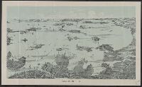
Description:
Shows deatails of islands, bays, and buildings.
Publisher:
Walker Lith. & Pub. Co.,
Subject (Geographic):
Boston (Mass.)--Maps
Subject (Topic):
Harbors--Massachusetts--Boston--Aerial views
Found in:
Beinecke Rare Book and Manuscript Library > Boston Harbor.
Published / Created:
1918
Call Number:
764gme B65 1918
Container / Volume:
BRBL_00462
Image Count:
1
Resource Type:
Maps, Atlases & Globes
Description:
Includes relevant legal acts printed between sections of title.
Publisher:
Boston Transit Commission,
Subject (Geographic):
Boston (Mass.)--Maps
Found in:
Beinecke Rare Book and Manuscript Library > Boston Subway, East Boston Tunnel, Washington St. Tunnel, tunnel for Cambridge connection, Dorchester Tunnel, Boylston St. Subway & East Boston Tunnel Connection.
Published / Created:
1897
Call Number:
764 M64 1897
Container / Volume:
BRBL_00458
Image Count:
1
Resource Type:
Maps, Atlases & Globes
Publisher:
Heliotype Printing Co.,
Subject (Geographic):
Milton (Mass.)--Maps
Found in:
Beinecke Rare Book and Manuscript Library > Breck's map of Milton : showing area taken for the Blue Hills Reservation of the Metropolitan Park System, also location of fire alarm boxes and police signal stations / Chas. C.E. Breck, Civil Engr.
Published / Created:
1875
Call Number:
764hc B65 1775
Container / Volume:
BRBL_00462
Image Count:
2
Resource Type:
Maps, Atlases & Globes
Description:
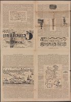
A newspaper with maps, drawings and description of the battle of Bunker Hill, June 17, 1775.
Publisher:
Rand, Avery, & Co.,
Subject (Geographic):
Boston (Mass.)--Maps
Found in:
Beinecke Rare Book and Manuscript Library > Bunker Hill Centennial.
Creator:
Published / Created:
1865
Call Number:
764 B65 1865
Container / Volume:
BRBL_00455
Image Count:
1
Resource Type:
Maps, Atlases & Globes
Description:
In center lower margin: Entered according to Act of Congress in the year 1861 by E.P. Dutton & Co. in the Clerks Office of the District Court in the District of Massachusetts., Relief shown by hachures., Sho, and Shows location of buoys, lighthouses, rocks, etc.
Publisher:
E.P. Dutton & Co.,
Subject (Geographic):
Boston Harbor (Mass.)--Maps and Massachusetts--Maps
Subject (Name):
Boston Map Store
Found in:
Beinecke Rare Book and Manuscript Library > Chart of Boston Harbor and Massachusetts Bay : with map of the adjacent country / published at the Boston Map Store.
Branch:v1.61.8 ,Deployed:2024-06-20T11:14:55-04:00