Search
You Searched For
Search Results
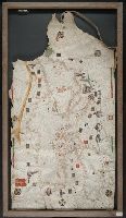
- Creator:
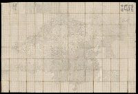
- Dong, Fangli, active 19th century, cartographer
董方立, active 19th century, cartographer
- Published / Created:
- Daoguang 12 [1842]
- Call Number:
- Covers 56 +1842
- Image Count:
- 1
- Resource Type:
- cartographic image
- Found in:
- Beinecke Rare Book and Manuscript Library > Huang chao yi tong yu di quan tu, 皇朝壹統輿地全圖
- Published / Created:
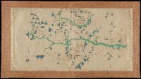
- [not after 1624]
- Call Number:
- Lanman 5626 1624
- Image Count:
- 1
- Resource Type:
- cartographic image
- Found in:
- Beinecke Rare Book and Manuscript Library > [Jiangxi Yuanzhou Fu tu]., [江西袁州府圖].
- Published / Created:
- [not after 1841]
- Call Number:
- Covers 56cea +1840
- Image Count:
- 136
- Resource Type:
- cartographic image
- Found in:
- Beinecke Rare Book and Manuscript Library > [Zhongguo gu hang hai tu]., [中國古航海圖].
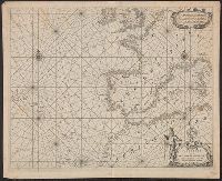
- Creator:
- Volčić, Vicko Dimitrije, 1563-1607, cartographer
- Published / Created:
- [1601]
- Call Number:
- Manuscript 49cea 1601
- Image Count:
- 2
- Resource Type:
- cartographic image
- Found in:
- Beinecke Rare Book and Manuscript Library > [Portolan chart of the Mediterranean Sea].
- Published / Created:
- [approximately 1960]
- Call Number:
- Art Storage 1019
- Image Count:
- 2
- Resource Type:
- cartographic image
- Found in:
- Beinecke Rare Book and Manuscript Library > [Portolan chart of the Mediterranean Sea, the North Atlantic Ocean, the Black Sea, and the northwestern African coast].
- Creator:
- Koyano, Ishun, creator
- Published / Created:
- Bunka 6, 6th month :
- Call Number:
- 2018 +512
- Image Count:
- 154
- Resource Type:
- cartographic image
- Found in:
- Beinecke Rare Book and Manuscript Library > Visualized map of all the countries
- Published / Created:
- MDXCVIII [1598]
- Call Number:
- 2016 +333
- Image Count:
- 13
- Resource Type:
- cartographic image
- Found in:
- Beinecke Rare Book and Manuscript Library > Tabula itineraria ex illustri Peutingerorum Bibliotheca quae Augustae Vindel est beneficio Marci Velseri Septemuiri Augustani in lucem edita. Nobilissimo viro Marco Velsero r.p. Augustanae Septemuiro Ioannes Moretus typographus Antverp s.p.d. ... [cartographic material].
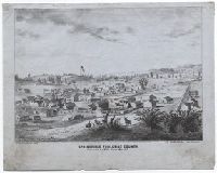
- Creator:
- Goddard, George H. (George Henry), 1817-1906, artist
- Published / Created:
- May 1853.
- Call Number:
- WA Prints 432
- Image Count:
- 1
- Resource Type:
- cartographic image
- Found in:
- Beinecke Rare Book and Manuscript Library > Springfield, Tuolumne County
- Creator:
- Goddard, George H. (George Henry), 1817-1906, artist
- Published / Created:
- May 1853.
- Call Number:
- WA Prints 432
- Image Count:
- 1
- Resource Type:
- cartographic image
- Found in:
- Beinecke Rare Book and Manuscript Library > Springfield, Tuolumne County
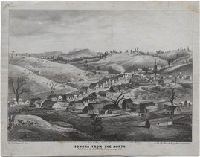
- Creator:
- Goddard, George H. (George Henry), 1817-1906, artist
- Published / Created:
- May 1853.
- Call Number:
- WA Prints 391
- Image Count:
- 1
- Resource Type:
- cartographic image
- Found in:
- Beinecke Rare Book and Manuscript Library > Sonora from the north
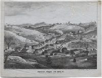
- Creator:
- Goddard, George H. (George Henry), 1817-1906, artist
- Published / Created:
- May 1853.
- Call Number:
- WA Prints 391
- Image Count:
- 1
- Resource Type:
- cartographic image
- Found in:
- Beinecke Rare Book and Manuscript Library > Sonora from the north
- Creator:
- United States. General Land Office
- Published / Created:
- [1908]
- Call Number:
- BrSides Zc35 908un
- Image Count:
- 2
- Resource Type:
- cartographic image
- Found in:
- Beinecke Rare Book and Manuscript Library > Sectionized map of Cheyenne River and Standing Rock Indian Reservation opened by act of May 29, 1908 [cartographic material]
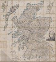
- Creator:
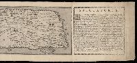
- Ainslie, John (Surveyor)
- Published / Created:
- [1800]
- Call Number:
- Folio 15 800Ai
- Image Count:
- 1
- Resource Type:
- cartographic image
- Found in:
- Lewis Walpole Library > Scotland : drawn and engrav'd from a series of angles and astronomical observations
- Creator:
- Sanborn Map Company, issuing body
- Published / Created:
- 1973.
- Call Number:
- Folio G1244 N48 S26 1973 (LC)
- Image Count:
- 445
- Resource Type:
- cartographic image
- Found in:
- Beinecke Rare Book and Manuscript Library > Sanborn maps of New Haven
- Published / Created:
- [between 1800 and 1899?]
- Call Number:
- GEN MSS FILE 601 (Oversize)
- Image Count:
- 2
- Resource Type:
- cartographic image
- Found in:
- Beinecke Rare Book and Manuscript Library > Portolan chart of western Europe and the Mediterranean Sea
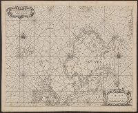
- Creator:
- Roselli, Petrus, active 1446-1468, cartographer
- Published / Created:
- [approximately 1450-1475]
- Call Number:
- Art Storage 49cea 1425
- Image Count:
- 2
- Resource Type:
- cartographic image
- Found in:
- Beinecke Rare Book and Manuscript Library > Portolan chart of the Mediterranean Sea and the Black Sea
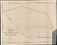
- Creator:
- Searl, S. W., cartographer
- Published / Created:
- [1863]
- Call Number:
- BrSides Folio 2014 10
- Image Count:
- 2
- Resource Type:
- cartographic image
- Found in:
- Beinecke Rare Book and Manuscript Library > Plan of the New Haven City burial ground
- Creator:
- Blaeu, Joan, 1596-1673, cartographer
- Published / Created:
- [1655]
- Call Number:
- 21 1670B
- Image Count:
- 1
- Resource Type:
- cartographic image
- Found in:
- Beinecke Rare Book and Manuscript Library > Paskaerte van de Westersche Schipvaert van Nederland af tot de Canarise en Vlaemse Eylanden
- Creator:
- Blaeu, Joan, 1596-1673, cartographer
- Published / Created:
- [1655]
- Call Number:
- 21 1670A
- Image Count:
- 1
- Resource Type:
- cartographic image
- Found in:
- Beinecke Rare Book and Manuscript Library > Paskaerte van de Oosterse en Noordse Schipvaert van Nederlandt tot Nova Zembla
- Creator:
- Hollar, Wenceslaus, 1607-1677, cartographer
- Published / Created:
- [between 1850 and 1900?]
- Call Number:
- 32 Ox1 1643
- Image Count:
- 1
- Resource Type:
- cartographic image
- Found in:
- Beinecke Rare Book and Manuscript Library > Oxforde