Search
You Searched For
Search Results
- Published / Created:
- 1878
- Call Number:
- 32 L84 1741A
- Container / Volume:
- BRBL_00048
- Image Count:
- 16
- Resource Type:
- Maps, Atlases & Globes
- Found in:
- Beinecke Rare Book and Manuscript Library > Environs of London By John Rocque 1741-1745. London, 1746-63.
- Creator:
- Kip, Johannes, 1653-1722
- Published / Created:
- 1903
- Call Number:
- 32 L84 1720/1903
- Container / Volume:
- BRBL_00736
- Image Count:
- 12
- Resource Type:
- Maps, Atlases & Globes
- Found in:
- Beinecke Rare Book and Manuscript Library > A prospect of the city of London, Westminster and St. James Park = veue et perspective de la ville de Londre, Westminster et Parc St. Jacques / John Kip delineavit et sculpsit.
- Published / Created:
- 1769
- Call Number:
- 32 1769
- Container / Volume:
- BRBL_00043
- Image Count:
- 11
- Resource Type:
- Maps, Atlases & Globes
- Found in:
- Beinecke Rare Book and Manuscript Library > England and Wales ... Engraved by Thos. Kitchin.
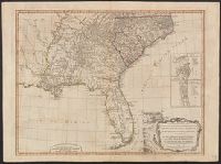
- Published / Created:
- 1808
- Call Number:
- 89cea 1808
- Container / Volume:
- BRBL_00658
- Image Count:
- 4
- Resource Type:
- Maps, Atlases & Globes
- Found in:
- Beinecke Rare Book and Manuscript Library > A General Chart of the West Indies and Gulf of Mexico, describing the Gulf and Winward Passages, Coasts of Florida, Louisiana and Mexico, Bay of Honduras and Musquito Shore ... Drawn from the surveys taken by Mr. Geo Gaulo ... by Foss Dessiou.
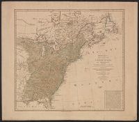
- Creator:
- Pownall, Thomas, 1722-1805
- Published / Created:
- March 25th, 1776.
- Call Number:
- 71 1776N
- Container / Volume:
- BRBL_00726
- Image Count:
- 4
- Resource Type:
- Maps, Atlases & Globes
- Found in:
- Beinecke Rare Book and Manuscript Library > A map of the middle British colonies in North America [cartographic material] : First published by Lewis Evans, of Philadelphia, in 1755 ; and since corrected and improved, as also extended, with the addition of New England, and bordering parts of Canada
- Published / Created:
- 1811
- Call Number:
- 90 1819
- Container / Volume:
- BRBL_00662
- Image Count:
- 6
- Resource Type:
- Maps, Atlases & Globes
- Found in:
- Beinecke Rare Book and Manuscript Library > Outlines of the Physical and Political Divisions of South America: delineated by A. Arrowsmith partly from scarse and Original Documents, published before the year 1806 corrected from accurate Astronomical observations to 1810.
- Published / Created:
- [19--?]
- Call Number:
- 32 L84 1900
- Container / Volume:
- BRBL_00051
- Image Count:
- 5
- Resource Type:
- Maps, Atlases & Globes
- Found in:
- Beinecke Rare Book and Manuscript Library > [Map of London and Environs].
- Creator:
- Wyld, James, 1812-1887
- Published / Created:
- [1828]
- Call Number:
- 71 1828
- Container / Volume:
- BRBL_00369
- Image Count:
- 7
- Resource Type:
- Maps, Atlases & Globes
- Found in:
- Beinecke Rare Book and Manuscript Library > Map of North America : exhibiting the recent discoveries, geographical and nautical; drawn chiefly from the authorities of M. de Humbolt, Lieutt. Pike, Messrs. Lewis and Clarke, Sir Alexr. Mackenzie, Mr. Hearne, Coll. Bouchette, Captns. Vancouver, Ross, P
- Creator:
- Agas, Ralph, 1545-1621
- Published / Created:
- 1905
- Call Number:
- 32 L84 1570/1905
- Container / Volume:
- BRBL_00737
- Image Count:
- 8
- Resource Type:
- Maps, Atlases & Globes
- Found in:
- Beinecke Rare Book and Manuscript Library > Civitas Londinum.
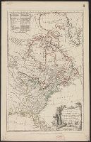
- Creator:
- Mitchell, John, 1711-1768
- Published / Created:
- [1775?]
- Call Number:
- 71 1755A
- Container / Volume:
- BRBL_00363
- Image Count:
- 8
- Resource Type:
- Maps, Atlases & Globes
- Found in:
- Beinecke Rare Book and Manuscript Library > A map of the British colonies in North America : with the roads, distances, limits, and extent of the settlements, humbly inscribed to the Right Honourable the Earl of Halifax, and the other Right Honourable the Lords Commissioners for Trade & Plantations
- Published / Created:
- [1796?]
- Call Number:
- 755 1800A
- Container / Volume:
- BRBL_00437
- Image Count:
- 1
- Resource Type:
- Maps, Atlases & Globes
- Found in:
- Beinecke Rare Book and Manuscript Library > Bowles's New one-sheet map of the United States of America; with the territories belonging to Great Britain and Spain.
- Published / Created:
- 1805
- Call Number:
- 755 1805B
- Container / Volume:
- BRBL_00437
- Image Count:
- 1
- Resource Type:
- Maps, Atlases & Globes
- Found in:
- Beinecke Rare Book and Manuscript Library > A new map of the United States of North America ... with Upper and Lower Canada &c ... by John Cary, Engraver.
- Published / Created:
- [1800?]
- Call Number:
- 755 1800E
- Container / Volume:
- BRBL_00437
- Image Count:
- 1
- Resource Type:
- Maps, Atlases & Globes
- Found in:
- Beinecke Rare Book and Manuscript Library > Bowles's new one-sheet map of the independent States of Virginia, ... Rhode Island, &c ... Habitations and hunting countries of the Confederate Indians; by Lewis Evans.
- Published / Created:
- 1805
- Call Number:
- 755 1805B
- Container / Volume:
- BRBL_00437
- Image Count:
- 1
- Resource Type:
- Maps, Atlases & Globes
- Found in:
- Beinecke Rare Book and Manuscript Library > A new map of the United States of North America ... with Upper and Lower Canada &c ... by John Cary, Engraver.
- Published / Created:
- 1806
- Call Number:
- 755 1806A
- Container / Volume:
- BRBL_00438
- Image Count:
- 1
- Resource Type:
- Maps, Atlases & Globes
- Found in:
- Beinecke Rare Book and Manuscript Library > A new map of part of the United States of North America ... by John Cary, Engraver.
- Published / Created:
- 1823
- Call Number:
- 755 1823A
- Container / Volume:
- BRBL_00439
- Image Count:
- 1
- Resource Type:
- Maps, Atlases & Globes
- Found in:
- Beinecke Rare Book and Manuscript Library > United States of America. Neele & Son Sculpt.
- Published / Created:
- 1819
- Call Number:
- 755 1819
- Container / Volume:
- BRBL_00439
- Image Count:
- 1
- Resource Type:
- Maps, Atlases & Globes
- Found in:
- Beinecke Rare Book and Manuscript Library > A new map of part of the United States, exhibiting the North West, Michigan, Indiana, and Illinois territory the States of Kentucky, Ohio, Virginia, Maryland and Pennsylvania ... John Cary, Engraver.
- Published / Created:
- 1832
- Call Number:
- 755 1832
- Container / Volume:
- BRBL_00440
- Image Count:
- 1
- Resource Type:
- Maps, Atlases & Globes
- Found in:
- Beinecke Rare Book and Manuscript Library > The United States of North America with the British Territories.
- Published / Created:
- [1780?]
- Call Number:
- 755 1780D
- Container / Volume:
- BRBL_00433
- Image Count:
- 1
- Resource Type:
- Maps, Atlases & Globes
- Found in:
- Beinecke Rare Book and Manuscript Library > Bowles's new pocket map of the middle British Colonies in America, ... habitations and hunting countries of the confederate Indians: by Lewis Evans.
- Published / Created:
- 1786
- Call Number:
- 755 1786
- Container / Volume:
- BRBL_00435
- Image Count:
- 1
- Resource Type:
- Maps, Atlases & Globes
- Found in:
- Beinecke Rare Book and Manuscript Library > A new map of Nova Scotia and Cape Breton Island with the adjacent parts of New England and Canada ...
- Creator:
- Pownall, Thomas, 1722-1805
- Published / Created:
- March 25th, 1776.
- Call Number:
- 755 1776P
- Container / Volume:
- BRBL_00430
- Image Count:
- 1
- Resource Type:
- Maps, Atlases & Globes
- Found in:
- Beinecke Rare Book and Manuscript Library > A map of the middle British colonies in North America [cartographic material] : First published by Lewis Evans, of Philadelphia, in 1755 ; and since corrected and improved, as also extended, with the addition of New England, and bordering parts of Canada
- Published / Created:
- 1776
- Call Number:
- 755 1776L
- Container / Volume:
- BRBL_00430
- Image Count:
- 1
- Resource Type:
- Maps, Atlases & Globes
- Found in:
- Beinecke Rare Book and Manuscript Library > A map of the British Empire, in North America. By Samuel Dunn, Mathematician, improved from the surveys of Capt. Carver.
- Published / Created:
- 1776
- Call Number:
- 764 B65 1776A
- Container / Volume:
- BRBL_00455
- Image Count:
- 1
- Resource Type:
- Maps, Atlases & Globes
- Found in:
- Beinecke Rare Book and Manuscript Library > A plan of Boston and its environs showing the true situation of His Majesty's Army. Also those of the Rebels ... 1775. Engraved by Jono. Lodge.
- Published / Created:
- 1794
- Call Number:
- 3897 1794
- Container / Volume:
- BRBL_00183
- Image Count:
- 1
- Resource Type:
- Maps, Atlases & Globes
- Found in:
- Beinecke Rare Book and Manuscript Library > A new map of the Island and Kingdom of Corsica by Thomas Jefferys, Geographer to the King with additions and improvements.
- Published / Created:
- 1784
- Call Number:
- 773hc EL48 1780
- Container / Volume:
- BRBL_00497
- Image Count:
- 1
- Resource Type:
- Maps, Atlases & Globes
- Found in:
- Beinecke Rare Book and Manuscript Library > Sketch of the position of the British forces at Elizabeth Town point after their return from Connecticut farm, in the province of East Jersey: under the command of his excelly. Leiutt. Genl. Knyphausen, on the 8th June 1780 / by John Hills ...
- Published / Created:
- 1776
- Call Number:
- 771hc C358 1776
- Container / Volume:
- BRBL_00495
- Image Count:
- 1
- Resource Type:
- Maps, Atlases & Globes
- Found in:
- Beinecke Rare Book and Manuscript Library > The attack and defeat of the American Fleet under Benedict Arnold by the King's Fleet Champlain by Captn. Thos. Pringle upon Lake Champlain the 11th. of Oct. 1776. From a sketch taken by an officer on the spot.
- Published / Created:
- 1776
- Call Number:
- 771hc 1776B
- Container / Volume:
- BRBL_00495
- Image Count:
- 1
- Resource Type:
- Maps, Atlases & Globes
- Found in:
- Beinecke Rare Book and Manuscript Library > The Seat of Action between the British and American Forces ... the Western part of Long Island ... Staten Island ... Amboy and New York ... Hudson's river from Courtland to Sandy Hook .... Surveys of Major Holland.
- Published / Created:
- 1784
- Call Number:
- 771hc H864 1777A
- Container / Volume:
- BRBL_00495
- Image Count:
- 1
- Resource Type:
- Maps, Atlases & Globes
- Found in:
- Beinecke Rare Book and Manuscript Library > Plan of the attack of the forts Clinton & Montgomery, upon Hudson's river, which were stormed by his majesty's forces, under the command of Sir Henry Clinton, K.B., on the 6th of Octr., 1777. Drawn from the surveys of Verplank, Holland & Metcalfe. By John
- Published / Created:
- 1776
- Call Number:
- 792cea Am32 1776
- Container / Volume:
- BRBL_00519
- Image Count:
- 1
- Resource Type:
- Maps, Atlases & Globes
- Found in:
- Beinecke Rare Book and Manuscript Library > A Plan of Amelia Harbour and Barr in east Florida ...
- Creator:
- Jefferys, Thomas, d. 1771
- Published / Created:
- 1794
- Call Number:
- 795cea 1794
- Container / Volume:
- BRBL_00523
- Image Count:
- 1
- Resource Type:
- Maps, Atlases & Globes
- Found in:
- Beinecke Rare Book and Manuscript Library > The western coast of Louisiana and the coast of New Leon / by Thos. Jefferys, geographer to His Majesty.
- Creator:
- Jefferys, Thomas, -1771
- Published / Created:
- 20 Feby., 1775.
- Call Number:
- 792cea 1775C
- Container / Volume:
- BRBL_00519
- Image Count:
- 1
- Resource Type:
- Maps, Atlases & Globes
- Found in:
- Beinecke Rare Book and Manuscript Library > The island of Cuba with part of the Bahama banks & the Martyrs / by Thos. Jefferys.
- Creator:
- Lewis, Samuel, 1753 or 1754-1822
- Published / Created:
- 1814
- Call Number:
- 80 1814
- Container / Volume:
- BRBL_00532
- Image Count:
- 1
- Resource Type:
- Maps, Atlases & Globes
- Found in:
- Beinecke Rare Book and Manuscript Library > A map of Lewis and Clark's track across the western portion of North America, from the Mississippi to the Pacific Ocean : by order of the executive of the United States in 1804, 5 & 6 / copied by Samuel Lewis from the original drawing of Wm. Clark ; Neele
- Creator:
- Ross, Lieut
- Published / Created:
- 1 June 1775.
- Call Number:
- 807 1775
- Container / Volume:
- BRBL_00550
- Image Count:
- 1
- Resource Type:
- Maps, Atlases & Globes
- Found in:
- Beinecke Rare Book and Manuscript Library > Course of the river Mississippi from the Balise to Fort Chartres : taken on an expedition to the Illinois, in the latter end of the year 1765 / by Lieut. Ross of the 34th Regiment ; improved from the surveys of the river made by the French.
- Creator:
- Ross, Lieut
- Published / Created:
- 1 June 1775.
- Call Number:
- 807 1775A
- Container / Volume:
- BRBL_00550
- Image Count:
- 1
- Resource Type:
- Maps, Atlases & Globes
- Found in:
- Beinecke Rare Book and Manuscript Library > Course of the river Mississippi from the Balise to Fort Chartres : taken on an expedition to the Illinois, in the latter end of the year 1765 / by Lieut. Ross of the 34th Regiment ; improved from the surveys of the river made by the French.
- Published / Created:
- 1775
- Call Number:
- 966 1775
- Container / Volume:
- BRBL_00676
- Image Count:
- 1
- Resource Type:
- Maps, Atlases & Globes
- Found in:
- Beinecke Rare Book and Manuscript Library > A chart of the Straits of Magellan. Inlarged from a chart published at Madrid in 1769, by Don Juan de la Cruz Cano y Olmedilla ... and improved from the observations and surveys of Captns. Byron, Wallis and Carteret ...
- Creator:
- Edward Stanford Ltd
- Published / Created:
- [1912?]
- Call Number:
- 96 1912
- Container / Volume:
- BRBL_00676
- Image Count:
- 1
- Resource Type:
- Maps, Atlases & Globes
- Found in:
- Beinecke Rare Book and Manuscript Library > Chile.
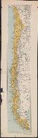
- Published / Created:
- [1920?].
- Call Number:
- 911 1920
- Container / Volume:
- BRBL_00669
- Image Count:
- 1
- Resource Type:
- Maps, Atlases & Globes
- Found in:
- Beinecke Rare Book and Manuscript Library > Official map of Brazil / by Joao Chrockatt de Sa, John Pereira de Castro and Eduardo A.G. Thompson.
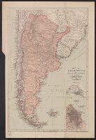
- Published / Created:
- 1900
- Call Number:
- 935 1900
- Container / Volume:
- BRBL_00674
- Image Count:
- 1
- Resource Type:
- Maps, Atlases & Globes
- Found in:
- Beinecke Rare Book and Manuscript Library > Map of Argentina and adjoining states : to illustrate "Argentina" by W.A. Hirst.
- Published / Created:
- 1755
- Call Number:
- 97 L62 1755
- Container / Volume:
- BRBL_00678
- Image Count:
- 1
- Resource Type:
- Maps, Atlases & Globes
- Found in:
- Beinecke Rare Book and Manuscript Library > A Scenographic Plan of the City of the Kings, otherwise called Lima, the capital of the Kingdonm of Peru ... as it was before the late earthquakes.
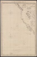
- Published / Created:
- 1849
- Call Number:
- 844cea 1849
- Container / Volume:
- BRBL_00613
- Image Count:
- 1
- Resource Type:
- Maps, Atlases & Globes
- Found in:
- Beinecke Rare Book and Manuscript Library > The coasts of California, Oregon, &c.
- Published / Created:
- 1787
- Call Number:
- 21 1787
- Container / Volume:
- BRBL_00724
- Image Count:
- 1
- Resource Type:
- Maps, Atlases & Globes
- Found in:
- Beinecke Rare Book and Manuscript Library > The Atlantic Ocean / by Governor Pownall F.R.S.
- Published / Created:
- 1797
- Call Number:
- 70 1797
- Container / Volume:
- BRBL_00725
- Image Count:
- 1
- Resource Type:
- Maps, Atlases & Globes
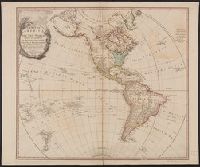
- Found in:
- Beinecke Rare Book and Manuscript Library > A map of America, or the new world, wherein are introduced all the known parts of the western hemisphere, from the map of d'Anville ...
- Published / Created:
- 1774
- Call Number:
- 71 1774
- Container / Volume:
- BRBL_00726
- Image Count:
- 1
- Resource Type:
- Maps, Atlases & Globes
- Found in:
- Beinecke Rare Book and Manuscript Library > A map of the British empire in North America / by Samuel Dunn, mathematician.
- Published / Created:
- 1776
- Call Number:
- 71 1776M
- Container / Volume:
- BRBL_00726
- Image Count:
- 1
- Resource Type:
- Maps, Atlases & Globes
- Found in:
- Beinecke Rare Book and Manuscript Library > A map of the British empire in North America / by Samuel Dunn, mathematician ; improved from the surveys of Capt. Carver.
- Creator:
- Pownall, Thomas, 1722-1805
- Published / Created:
- March 25th, 1776.
- Call Number:
- 71 1776N
- Container / Volume:
- BRBL_00726
- Image Count:
- 1
- Resource Type:
- Maps, Atlases & Globes
- Found in:
- Beinecke Rare Book and Manuscript Library > A map of the middle British colonies in North America [cartographic material] : First published by Lewis Evans, of Philadelphia, in 1755 ; and since corrected and improved, as also extended, with the addition of New England, and bordering parts of Canada
- Creator:
- Wyld, James, 1812-1887
- Published / Created:
- 1861
- Call Number:
- 754hc 1861E
- Container / Volume:
- BRBL_00420
- Image Count:
- 1
- Resource Type:
- Maps, Atlases & Globes
- Found in:
- Beinecke Rare Book and Manuscript Library > Wyld's military map of the United States, the northern states, and the southern confederate states: with the forts, harbours, arsenals, and military positions.
- Published / Created:
- 1783
- Call Number:
- 755 1783E
- Container / Volume:
- BRBL_00434
- Image Count:
- 1
- Resource Type:
- Maps, Atlases & Globes
- Found in:
- Beinecke Rare Book and Manuscript Library > Bowles's New Pocket map of the United States of America with the British possessions ... French and Spanish ... Louisiana and Florida according to Versailles ... 1783.
- Published / Created:
- 1783
- Call Number:
- 755 1783C
- Container / Volume:
- BRBL_00434
- Image Count:
- 1
- Resource Type:
- Maps, Atlases & Globes
- Found in:
- Beinecke Rare Book and Manuscript Library > A new map of the United States of North America with the British Dominions on the Continent &c. By Samuel Dunn, Mathematician; improved from the Surveys of Capt. Carver.
- Published / Created:
- 1794
- Call Number:
- 755 1794D
- Container / Volume:
- BRBL_00436
- Image Count:
- 1
- Resource Type:
- Maps, Atlases & Globes
- Found in:
- Beinecke Rare Book and Manuscript Library > A new and general map of the Southern dominions belonging to the United States of America, ... Indian countries, and the Spanish Possessions of Louisiana and Florida.