Skip to search
Skip to main content
Skip to first result
Search
You Searched For
Extent of Digitization
Unspecified
Resource Type
Maps, Atlases & Globes
New Search
Search Results
Creator:
Published / Created:
1932
Image Count:
1
Resource Type:
Maps, Atlases & Globes
Found in:
Medical Historical Library, Cushing/Whitney Medical Library > "A View of Human Welfare Group"
Published / Created:
undated
Call Number:
WA MSS S-2962
Collection Title:
Northern Pacific Railway Company maps and drawings
Container / Volume:
Box 1 | Map 11
Image Count:
1
Resource Type:
Maps, Atlases & Globes
Found in:
Beinecke Rare Book and Manuscript Library > (IDAHO & WASHINGTON) [Anon.] [Untitled map of northwestern Idaho and northeastern Washington].
Creator:
Published / Created:
1890
Call Number:
WA MSS S-2962
Collection Title:
Northern Pacific Railway Company maps and drawings
Container / Volume:
Box 1 | Map 10
Image Count:
2
Resource Type:
Maps, Atlases & Globes
Found in:
Beinecke Rare Book and Manuscript Library > (IDAHO) Kendrick, J. W., Surveyor. Map Showing Definite Location of the Spokane & Palouse Ry. (Lewiston Extension). From Julietta to Lewiston Idaho Territory. Distance 24-1/lO Miles. Drawn by J. M. Gibboney. Assistant Engineer's Office, Tacoma, Washington. Scale 1 in.=2000 ft.
Published / Created:
undated
Call Number:
WA MSS S-2962
Collection Title:
Northern Pacific Railway Company maps and drawings
Container / Volume:
3 (Roll) | Map 24
Image Count:
1
Resource Type:
Maps, Atlases & Globes
Found in:
Beinecke Rare Book and Manuscript Library > (MONTANA & IDAHO) [Anon.] [Untitled map of far northwestern Montana and a part of the Idaho panhandle.]
Creator:
Published / Created:
1891 April 6
Call Number:
WA MSS S-2962
Collection Title:
Northern Pacific Railway Company maps and drawings
Container / Volume:
Box 1 | Map 34
Image Count:
1
Resource Type:
Maps, Atlases & Globes
Found in:
Beinecke Rare Book and Manuscript Library > (MONTANA) Bischoff, A. Map of North- West part of Montana...Great Northern Line St. Paul, Minneapolis & Manitoba Ry. Pacific Extension. Elbridge H. Beckler, Chief Engineer. Helena, Mont. Scale 1 in.= 2 miles.
Creator:
Published / Created:
1887 August
Call Number:
WA MSS S-2962
Collection Title:
Northern Pacific Railway Company maps and drawings
Container / Volume:
Box 1 | Map 33
Image Count:
2
Resource Type:
Maps, Atlases & Globes
Found in:
Beinecke Rare Book and Manuscript Library > (MONTANA) Roberts, E. J. Montana Extension. The Saint Paul, Minneapolis and Manitoba Ry. Co. Scale 12 miles to 1 inch.
Published / Created:
1886
Call Number:
WA MSS S-2962
Collection Title:
Northern Pacific Railway Company maps and drawings
Container / Volume:
Box 1 | Map 31
Image Count:
1
Resource Type:
Maps, Atlases & Globes
Found in:
Beinecke Rare Book and Manuscript Library > (MONTANA) [Anon.] Map of a Portion of Montana Territory.
Published / Created:
undated
Call Number:
WA MSS S-2962
Collection Title:
Northern Pacific Railway Company maps and drawings
Container / Volume:
Box 1 | Map 36
Image Count:
1
Resource Type:
Maps, Atlases & Globes
Found in:
Beinecke Rare Book and Manuscript Library > (MONTANA) [Anon.] [Untitled map of a part of north central Montana.]
Published / Created:
1891 September 10
Call Number:
WA MSS S-2962
Collection Title:
Northern Pacific Railway Company maps and drawings
Container / Volume:
Box 1 | Map 40
Image Count:
1
Resource Type:
Maps, Atlases & Globes
Found in:
Beinecke Rare Book and Manuscript Library > (WASHINGTON) [Anon.] Sketch of Country North of Spokane Wash. Helena Mont.
Creator:
Published / Created:
1785
Call Number:
1977 Folio 177
Image Count:
2
Resource Type:
Maps, Atlases & Globes
Found in:
Beinecke Rare Book and Manuscript Library > A general chart exhibiting the discoveries made by Captn. James Cook in this and his two preceeding voyages with the tracks of the ships under his command / by Lieutt. Roberts of His Majesty's Royal Navy ; Jn. Lodge sc.
Creator:
Published / Created:
1755
Call Number:
391 +1755h
Collection Title:
Geographical, historical, political, philosophical and mechanical essays : the first, containing an
Image Count:
1
Resource Type:
Maps, Atlases & Globes
Found in:
Beinecke Rare Book and Manuscript Library > A general map of the middle British colonies in America
Creator:
Published / Created:
Jany. 1st, 1795.
Call Number:
1977 Folio 177
Image Count:
2
Resource Type:
Maps, Atlases & Globes
Found in:
Beinecke Rare Book and Manuscript Library > A map of China : with the surrounding states, correctly copied from Monsr. d'Anville : engraved for Monsr. de Paun's Philosophical dissertations on the Egyptians & Chinese.
Creator:
Published / Created:
[1759]
Call Number:
1977 Folio 177
Image Count:
2
Resource Type:
Maps, Atlases & Globes
Found in:
Beinecke Rare Book and Manuscript Library > A map of the King of Great Britain's Dominions in Germany, or, The Electorate of Brunswick-Lunenburg with its dependencies [cartographic material] : containing the Dutchies of Lunenburg, Calenberg, Grunbenhagen, Lauenburg, Bremen & Verden, and the countie
Creator:
Published / Created:
175-?]
Call Number:
1977 Folio 177
Image Count:
2
Resource Type:
Maps, Atlases & Globes
Found in:
Beinecke Rare Book and Manuscript Library > A map of the circle of Westphalia comprehending the bishopricks of Liege, Munster, Paderborn & Osnabrug, the dutchies of Westphalia, Cleves, Juliers, Berg & Verden with the principalities of Minden & East Friesland and the counties of Mark, Ravensberg, Ol
Creator:
Published / Created:
1787
Call Number:
1977 Folio 177
Image Count:
2
Resource Type:
Maps, Atlases & Globes
Found in:
Beinecke Rare Book and Manuscript Library > A map of the country between Albemarle Sound, and Lake Erie [cartographic material] : comprehending the whole of Virginia, Maryland, Delaware and Pensylvania, with parts of several other of the United States of America / engraved by S.J. Neele.
Creator:
Published / Created:
1795
Call Number:
1977 Folio 177
Image Count:
2
Resource Type:
Maps, Atlases & Globes
Found in:
Beinecke Rare Book and Manuscript Library > A map of the district of Maine : drawn from the latest surveys and other best authorities / by Osgood Carleton ; Doolittle, sc., Newhaven.
Creator:
Published / Created:
Jany. 1st , 1793.
Call Number:
1977 Folio 177
Image Count:
2
Resource Type:
Maps, Atlases & Globes
Found in:
Beinecke Rare Book and Manuscript Library > A new map of France divided into eighty three departments according to the decree of the National Assembly in 1790.
Creator:
Published / Created:
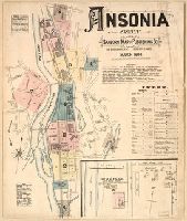
1884
Call Number:
766 An81 1884
Image Count:
8
Resource Type:
Maps, Atlases & Globes
Found in:
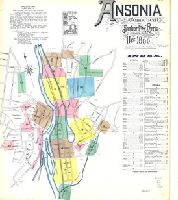
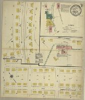
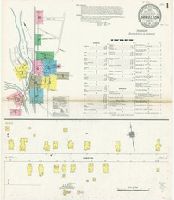
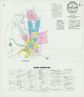
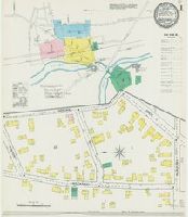
Beinecke Rare Book and Manuscript Library > Ansonia, Conn.
Creator:
Published / Created:
1890
Call Number:
766 An81 1890
Image Count:
13
Resource Type:
Maps, Atlases & Globes
Found in:
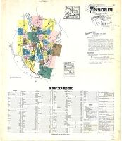
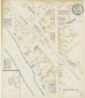
Beinecke Rare Book and Manuscript Library > Ansonia, New Haven Co., Connecticut.
Creator:
Published / Created:
1924
Call Number:
766 An81 1924
Image Count:
39
Resource Type:
Maps, Atlases & Globes
Found in:
Beinecke Rare Book and Manuscript Library > Ansonia, New Haven Co., Connecticut.
Published / Created:
1918
Call Number:
RG 14
Collection Title:
Archives of the Trustees of Lingnan University
Container / Volume:
Box 51 | Folder 573
Image Count:
1
Resource Type:
Maps, Atlases & Globes
Found in:
Yale Divinity Library > Architect's Map of Campus
Published / Created:
March 1, 1809
Call Number:
1978 226
Collection Title:
A new royal atlas, illustrative of the various divisions which comprise the surface of the globe...
Image Count:
1
Resource Type:
Maps, Atlases & Globes
Found in:
Beinecke Rare Book and Manuscript Library > Asia. Engraved for Evans's Geographical Grammar
Creator:
Published / Created:
1911
Call Number:
766 B217 1911
Image Count:
3
Resource Type:
Maps, Atlases & Globes
Found in:
Beinecke Rare Book and Manuscript Library > Baltic, New London County, Connecticut.
Creator:
Published / Created:
1932
Call Number:
766 B217 1932
Image Count:
5
Resource Type:
Maps, Atlases & Globes
Found in:
Beinecke Rare Book and Manuscript Library > Baltic, New London County, Connecticut.
Creator:
Published / Created:
1887
Call Number:
766 B45 1887
Image Count:
2
Resource Type:
Maps, Atlases & Globes
Found in:
Beinecke Rare Book and Manuscript Library > Berlin, Conn.
Creator:
Published / Created:
1895
Call Number:
766 B45 1895
Image Count:
3
Resource Type:
Maps, Atlases & Globes
Found in:
Beinecke Rare Book and Manuscript Library > Berlin, Hartford Co., Conn.
Creator:
Published / Created:
1901
Call Number:
766 B45 1901
Image Count:
4
Resource Type:
Maps, Atlases & Globes
Found in:
Beinecke Rare Book and Manuscript Library > Berlin, Hartford Co., Conn.
Creator:
Published / Created:
1908
Call Number:
766 B45 1908
Image Count:
8
Resource Type:
Maps, Atlases & Globes
Found in:
Beinecke Rare Book and Manuscript Library > Berlin, Hartford County, Connecticut.
Creator:
Published / Created:
1914
Call Number:
766 B45 1914
Image Count:
9
Resource Type:
Maps, Atlases & Globes
Found in:
Beinecke Rare Book and Manuscript Library > Berlin, Hartford County, Connecticut.
Creator:
Published / Created:
1927
Call Number:
766 B45 1927
Image Count:
8
Resource Type:
Maps, Atlases & Globes
Found in:
Beinecke Rare Book and Manuscript Library > Berlin, Hartford County, Connecticut.
Creator:
Published / Created:
1884
Call Number:
766 B467 1884
Image Count:
2
Resource Type:
Maps, Atlases & Globes
Found in:
Beinecke Rare Book and Manuscript Library > Bethel, Conn.
Creator:
Published / Created:
1889
Call Number:
766 B467 1889
Image Count:
3
Resource Type:
Maps, Atlases & Globes
Found in:
Beinecke Rare Book and Manuscript Library > Bethel, Conn.
Creator:
Published / Created:
1895
Call Number:
766 B467 1895
Image Count:
4
Resource Type:
Maps, Atlases & Globes
Found in:
Beinecke Rare Book and Manuscript Library > Bethel, Conn., Fairfield Co.
Creator:
Published / Created:
1901
Call Number:
766 B467 1901
Image Count:
5
Resource Type:
Maps, Atlases & Globes
Found in:
Beinecke Rare Book and Manuscript Library > Bethel, Fairfield Co., Conn.
Creator:
Published / Created:
1906
Call Number:
766 B467 1906
Image Count:
5
Resource Type:
Maps, Atlases & Globes
Found in:
Beinecke Rare Book and Manuscript Library > Bethel, Fairfield Co., Conn.
Creator:
Published / Created:
1912
Call Number:
766 B467 1912
Image Count:
7
Resource Type:
Maps, Atlases & Globes
Found in:
Beinecke Rare Book and Manuscript Library > Bethel, Fairfield County, Connecticut.
Creator:
Published / Created:
1927
Call Number:
766 B467 1927
Image Count:
10
Resource Type:
Maps, Atlases & Globes
Found in:
Beinecke Rare Book and Manuscript Library > Bethel, Fairfield County, Connecticut.
Creator:
Published / Created:
1886
Call Number:
766 B53 1886
Image Count:
11
Resource Type:
Maps, Atlases & Globes
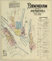
Found in:
Beinecke Rare Book and Manuscript Library > Birmingham, Connecticut.
Creator:
Published / Created:
1892
Call Number:
766 B53 1892
Image Count:
14
Resource Type:
Maps, Atlases & Globes
Found in:
Beinecke Rare Book and Manuscript Library > Birmingham, including Shelton and Derby Narrows, Connecticut.
Creator:
Published / Created:
1932
Call Number:
766 B62 1932
Image Count:
3
Resource Type:
Maps, Atlases & Globes
Found in:
Beinecke Rare Book and Manuscript Library > Bloomfield, Hartford County, Connecticut.
Creator:
Published / Created:
1924
Call Number:
766 B72 1924
Image Count:
24
Resource Type:
Maps, Atlases & Globes
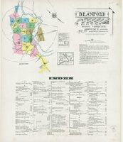
Found in:
Beinecke Rare Book and Manuscript Library > Branford : including Short Beach, Indian Neck, Pine Orchard, Stony Creek and Pine Orchard West, New Haven Co., Connecticut.
Creator:
Published / Created:
1884
Call Number:
766 B72 1884
Image Count:
2
Resource Type:
Maps, Atlases & Globes
Found in:
Beinecke Rare Book and Manuscript Library > Branford, Conn.
Creator:
Published / Created:
1889
Call Number:
766 B72 1889A
Image Count:
6
Resource Type:
Maps, Atlases & Globes
Found in:
Beinecke Rare Book and Manuscript Library > Branford, New Haven Co., Conn.
Creator:
Published / Created:
1895
Call Number:
766 B72 1895A
Image Count:
4
Resource Type:
Maps, Atlases & Globes
Found in:
Beinecke Rare Book and Manuscript Library > Branford, New Haven Co., Conn.
Creator:
Published / Created:
1901
Call Number:
766 B72 1901
Image Count:
8
Resource Type:
Maps, Atlases & Globes
Found in:
Beinecke Rare Book and Manuscript Library > Branford, New Haven Co., Conn.
Creator:
Published / Created:
1914
Call Number:
766 B72 1914
Image Count:
14
Resource Type:
Maps, Atlases & Globes
Found in:
Beinecke Rare Book and Manuscript Library > Branford, New Haven County, Connecticut.
Creator:
Published / Created:
1908
Call Number:
766 B72 1908
Image Count:
12
Resource Type:
Maps, Atlases & Globes
Found in:
Beinecke Rare Book and Manuscript Library > Branford, New Haven, Connecticut.
Creator:
Published / Created:
1884
Call Number:
766 B76 1884
Image Count:
20
Resource Type:
Maps, Atlases & Globes
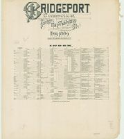
Found in:
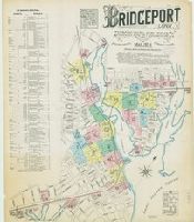
Beinecke Rare Book and Manuscript Library > Bridgeport, Conn.
Creator:
Published / Created:
1889
Call Number:
766 B76 1889
Image Count:
37
Resource Type:
Maps, Atlases & Globes
Found in:
Beinecke Rare Book and Manuscript Library > Bridgeport, Connecticut.
Creator:
Published / Created:
1890
Call Number:
766 B77 1890
Image Count:
9
Resource Type:
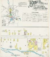
Maps, Atlases & Globes
Found in:
Beinecke Rare Book and Manuscript Library > Bristol and Forestville, Hartford Co., Connecticut.
Creator:
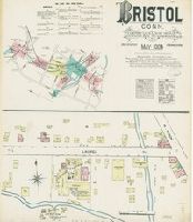
Published / Created:
1884
Call Number:
766 B77 1884
Image Count:
5
Resource Type:
Maps, Atlases & Globes
Found in:
Beinecke Rare Book and Manuscript Library > Bristol, Conn.
Creator:
Published / Created:
1896
Call Number:
766 C16 1896
Image Count:
1
Resource Type:
Maps, Atlases & Globes
Found in:
Beinecke Rare Book and Manuscript Library > Canaan, Litchfield Co., Conn.
Creator:
Published / Created:
1901
Call Number:
766 C16 1901
Image Count:
2
Resource Type:
Maps, Atlases & Globes
Found in:
Beinecke Rare Book and Manuscript Library > Canaan, Litchfield Co., Conn.
Creator:
Published / Created:
1909
Call Number:
766 C16 1909
Image Count:
3
Resource Type:
Maps, Atlases & Globes
Found in:
Beinecke Rare Book and Manuscript Library > Canaan, Litchfield County, Connecticut.
Creator:
Published / Created:
1923
Call Number:
766 C16 1923
Image Count:
7
Resource Type:
Maps, Atlases & Globes
Found in:
Beinecke Rare Book and Manuscript Library > Canaan, Litchfield County, Connecticut.
Creator:
Published / Created:
[1743]
Call Number:
1977 Folio 177
Image Count:
2
Resource Type:
Maps, Atlases & Globes
Found in:
Beinecke Rare Book and Manuscript Library > Carte des environs de Dunkerque, Bergue, Gravelines, St. Omer, Aire, Lille, Menin, Ypres, Dixmude, &c. en 1743 / [cartographic material] / dressee sur les memoires de Eugene Henri Friex.
Creator:
Published / Created:
1743
Call Number:
1977 Folio 177
Image Count:
2
Resource Type:
Maps, Atlases & Globes
Found in:
Beinecke Rare Book and Manuscript Library > Carte des environs de Valencienne, Maubeuge, Cambray, Le Quenoi Landrecy, Bouchain, Condeí, Avesne, Mons &c. / [cartographic material] / dresseí sur les memoires de Eugene Henry Friex.
Creator:
Published / Created:
[1744]
Call Number:
1977 Folio 177
Image Count:
2
Resource Type:
Maps, Atlases & Globes
Found in:
Beinecke Rare Book and Manuscript Library > Carte particuliere des environs d'Abbeville, Montreuil [cartographic material] : avec les embouchures des rivierres de Somme, d'Autie, et de la Canche en 1744 / dresseí sur les memoires de Eugene Henri Friex.
Creator:
Published / Created:
1903
Call Number:
766 C33 1903
Image Count:
1
Resource Type:
Maps, Atlases & Globes
Found in:
Beinecke Rare Book and Manuscript Library > Central Village, Windham County, Connecticut.
Creator:
Published / Created:
1927
Call Number:
766 C33 1927
Image Count:
2
Resource Type:
Maps, Atlases & Globes
Found in:
Beinecke Rare Book and Manuscript Library > Central Village, Windham County, Connecticut.
Creator:
Published / Created:
1925
Call Number:
766 C422 1925
Image Count:
6
Resource Type:
Maps, Atlases & Globes
Found in:
Beinecke Rare Book and Manuscript Library > Cheshire, New Haven County, Connecticut.
Creator:
Published / Created:
1908
Call Number:
766 C426 1908
Image Count:
4
Resource Type:
Maps, Atlases & Globes
Found in:
Beinecke Rare Book and Manuscript Library > Chester, Middlesex Co., Connecticut, issuing body.
Creator:
Published / Created:
1897
Call Number:
766 C426 1897
Image Count:
1
Resource Type:
Maps, Atlases & Globes
Found in:
Beinecke Rare Book and Manuscript Library > Chester, Middlesex County, Conn.
Creator:
Published / Created:
1914
Call Number:
766 C426 1914
Image Count:
4
Resource Type:
Maps, Atlases & Globes
Found in:
Beinecke Rare Book and Manuscript Library > Chester, Middlesex County, Connecticut, issuing body.
Creator:
Published / Created:
1925
Call Number:
766 C426 1925
Image Count:
4
Resource Type:
Maps, Atlases & Globes
Found in:
Beinecke Rare Book and Manuscript Library > Chester, Middlesex County, Connecticut, issuing body.
Creator:
Published / Created:
1903
Call Number:
766 C426 1903
Image Count:
3
Resource Type:
Maps, Atlases & Globes
Found in:
Beinecke Rare Book and Manuscript Library > Chester, Middlesex-County, Connecticut, issuing body.
Creator:
Published / Created:
1757
Call Number:
1977 Folio 177
Image Count:
3
Resource Type:
Maps, Atlases & Globes
Found in:
Beinecke Rare Book and Manuscript Library > Circuli supe. Saxoniae pars meridionalis sive Ducatus, Electoratus et Principatus Ducum Saxoniae / ex Zolmannianis et Zuíörnerianis subsidijs designata et edita per Homannianos Heredes.
Creator:
Published / Created:
1884
Call Number:
766 C61 1884
Image Count:
1
Resource Type:
Maps, Atlases & Globes
Found in:
Beinecke Rare Book and Manuscript Library > Clinton, Conn.
Creator:
Published / Created:
1889
Call Number:
766 C61 1889
Image Count:
2
Resource Type:
Maps, Atlases & Globes
Found in:
Beinecke Rare Book and Manuscript Library > Clinton, Middlesex Co., Conn.
Creator:
Published / Created:
1895
Call Number:
766 C61 1895
Image Count:
2
Resource Type:
Maps, Atlases & Globes
Found in:
Beinecke Rare Book and Manuscript Library > Clinton, Middlesex Co., Conn.
Creator:
Published / Created:
1901
Call Number:
766 C61 1901
Image Count:
3
Resource Type:
Maps, Atlases & Globes
Found in:
Beinecke Rare Book and Manuscript Library > Clinton, Middlesex Co., Conn.
Creator:
Published / Created:
1908
Call Number:
766 C61 1908
Image Count:
4
Resource Type:
Maps, Atlases & Globes
Found in:
Beinecke Rare Book and Manuscript Library > Clinton, Middlesex Co., Conn.
Creator:
Published / Created:
1924
Call Number:
766 C61 1924
Image Count:
6
Resource Type:
Maps, Atlases & Globes
Found in:
Beinecke Rare Book and Manuscript Library > Clinton, Middlesex County, Connecticut.
Creator:
Published / Created:
1884
Call Number:
766 C67 1884
Image Count:
2
Resource Type:
Maps, Atlases & Globes
Found in:
Beinecke Rare Book and Manuscript Library > Colchester, Conn.
Creator:
Published / Created:
1892
Call Number:
766 C67 1892
Image Count:
3
Resource Type:
Maps, Atlases & Globes
Found in:
Beinecke Rare Book and Manuscript Library > Colchester, New London Co., Conn.
Creator:
Published / Created:
1897
Call Number:
766 C67 1897
Image Count:
3
Resource Type:
Maps, Atlases & Globes
Found in:
Beinecke Rare Book and Manuscript Library > Colchester, New London Co., Conn.
Creator:
Published / Created:
1903
Call Number:
766 C67 1903
Image Count:
3
Resource Type:
Maps, Atlases & Globes
Found in:
Beinecke Rare Book and Manuscript Library > Colchester, New London Co., Connecticut.
Creator:
Published / Created:
1908
Call Number:
766 C67 1908
Image Count:
3
Resource Type:
Maps, Atlases & Globes
Found in:
Beinecke Rare Book and Manuscript Library > Colchester, New London County, Connecticut.
Creator:
Published / Created:
1927
Call Number:
766 C67 1927
Image Count:
3
Resource Type:
Maps, Atlases & Globes
Found in:
Beinecke Rare Book and Manuscript Library > Colchester, New London County, Connecticut.
Creator:
Published / Created:
1884
Call Number:
766 C69 1884
Image Count:
3
Resource Type:
Maps, Atlases & Globes
Found in:
Beinecke Rare Book and Manuscript Library > Collinsville, Conn.
Creator:
Published / Created:
1892
Call Number:
766 C69 1892
Image Count:
4
Resource Type:
Maps, Atlases & Globes
Found in:
Beinecke Rare Book and Manuscript Library > Collinsville, Hartford Co., Conn.
Creator:
Published / Created:
1903
Call Number:
766 C69 1903
Image Count:
4
Resource Type:
Maps, Atlases & Globes
Found in:
Beinecke Rare Book and Manuscript Library > Collinsville, Hartford Co., Connecticut.
Creator:
Published / Created:
1909
Call Number:
766 C69 1909
Image Count:
6
Resource Type:
Maps, Atlases & Globes
Found in:
Beinecke Rare Book and Manuscript Library > Collinsville, Hartford County, Connecticut.
Creator:
Published / Created:
1921
Call Number:
766 C69 1921
Image Count:
9
Resource Type:
Maps, Atlases & Globes
Found in:
Beinecke Rare Book and Manuscript Library > Collinsville, Hartford County, Connecticut.
Creator:
Published / Created:
1796
Call Number:
1977 Folio 177
Image Count:
2
Resource Type:
Maps, Atlases & Globes
Found in:
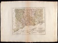
Beinecke Rare Book and Manuscript Library > Connecticut / entworfen von D.F. Sotzmann ; P. Schmidt, sculp.
Creator:
Published / Created:
1925
Call Number:
766 C88 1925
Image Count:
4
Resource Type:
Maps, Atlases & Globes
Found in:
Beinecke Rare Book and Manuscript Library > Cromwell, Middlesex County, Connecticut.
Published / Created:
approximately 1935
Image Count:
1
Resource Type:
Maps, Atlases & Globes
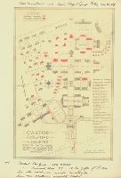
Found in:
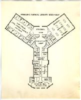
Medical Historical Library, Cushing/Whitney Medical Library > Cushing/Whitney Medical Library sketch
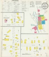
Creator:
Published / Created:
1884
Call Number:
766 D19 1884
Image Count:
10
Resource Type:
Maps, Atlases & Globes
Found in:
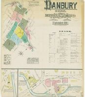
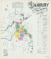
Beinecke Rare Book and Manuscript Library > Danbury, Conn.
Creator:
Published / Created:
1889
Call Number:
766 D19 1889
Image Count:
12
Resource Type:
Maps, Atlases & Globes
Found in:
Beinecke Rare Book and Manuscript Library > Danbury, Connecticut.
Creator:
Published / Created:
1897
Call Number:
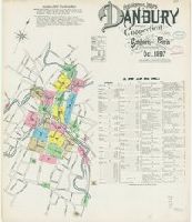
766 D19 1897
Image Count:
14
Resource Type:
Maps, Atlases & Globes
Found in:
Beinecke Rare Book and Manuscript Library > Danbury, Fairfield Co., Connecticut.
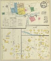
Creator:
Published / Created:
1892
Call Number:
766 D19 1892
Image Count:
13
Resource Type:
Maps, Atlases & Globes
Found in:
Beinecke Rare Book and Manuscript Library > Danbury, Fairfield County, Connecticut.
Creator:
Published / Created:
1897
Call Number:
766 D228 1897
Image Count:
5
Resource Type:
Maps, Atlases & Globes
Found in:
Beinecke Rare Book and Manuscript Library > Danielson, Windham Co., Conn.
Creator:
Published / Created:
1903
Call Number:
766 D228 1903
Image Count:
8
Resource Type:
Maps, Atlases & Globes
Found in:
Beinecke Rare Book and Manuscript Library > Danielson, Windham County, Connecticut.
Creator:
Published / Created:
1911
Call Number:
766 D228 1911
Image Count:
10
Resource Type:
Maps, Atlases & Globes
Found in:
Beinecke Rare Book and Manuscript Library > Danielson, Windham County, Connecticut.
Creator:
Published / Created:
1927
Call Number:
766 D228 1927
Image Count:
14
Resource Type:
Maps, Atlases & Globes
Found in:
Beinecke Rare Book and Manuscript Library > Danielson, Windham County, Connecticut.
Creator:
Published / Created:
1884
Call Number:
776 D228 1884
Image Count:
2
Resource Type:
Maps, Atlases & Globes
Found in:
Beinecke Rare Book and Manuscript Library > Danielsonville, CT.
Creator:
Published / Created:
1892
Call Number:
776 D228 1892
Image Count:
4
Resource Type:
Maps, Atlases & Globes
Found in:
Beinecke Rare Book and Manuscript Library > Danielsonville, Windham County, CT.
Creator:
Published / Created:
1887
Call Number:
766 D24 1887
Image Count:
1
Resource Type:
Maps, Atlases & Globes
Found in:
Beinecke Rare Book and Manuscript Library > Darien, Conn.
Creator:
Published / Created:
1895
Call Number:
766 D24 1895
Image Count:
1
Resource Type:
Maps, Atlases & Globes
Found in:
Beinecke Rare Book and Manuscript Library > Darien, Fairfield County, Conn.
Creator:
Published / Created:
1906
Call Number:
766 D24 1906
Image Count:
2
Resource Type:
Maps, Atlases & Globes
Found in:
Beinecke Rare Book and Manuscript Library > Darien, Fairfield County, Connecticut.
Branch:v1.60.98 ,Deployed:2024-05-15T10:28:41-04:00