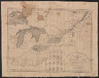
Insets: Plan of the entrance to Port Manoukao -- Plan of Victoria Bay of Islands New Zealand -- Port Nicholson -- Plan of Dusky Bay -- Plan of Southern Port, Stewarts Island -- -Oyerri or Pelorus River -- Plan of the bar and part of the Hokianga River . and Plan of Port Nicholson and Oyerri by permission of the New Zealand Land Company.
Publisher:
James Wyld, geographer to the Queen, Charing Cross East,
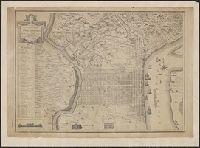
Map of the improved part of the province of Pennsylvania
Description:
2nd state of 2 known states. Distinguishing features of 2nd state: "Four [sic] long lines of text have been added at right of the Narrows of the Susquehannah at Nelson's Ferry. A road now leads east from Carlisle direct to Pine Ford" (Wheat and Brun 89).
Publisher:
sold by the author Nicholas Scull,
Subject (Geographic):
Pennsylvania--Administrative and political divisions--Maps--Early works to 1800 and Pennsylvania--Maps--Early works to 1800
Subject (Name):
Davis, John, fl. 1756-1759, Penn, Richard, 1706-1771. dedication, Penn, Thomas, 1702-1775. dedication, and Turner, James, d. 1759. engraver
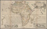
"According to the newest and most exact observations.", Includes views of "Cape Coast Castle on ye gold coast of Guinea," "James Fort on the island of St. Helena," and "A prospect of the Cape of Good Hope," and a plan of, and Prime meridians: London and Ferro.
Publisher:
Printed for H. Moll over against Devereux Court without Temple Bar, D. Midwinter at the 3 Crowns in St. Pauls church yard and Tho. Bowles print and mapseller next to the chapter house in St. Pauls church yard by Philip Overton, map and printseller near St
Subject (Geographic):
Africa--Maps--Early works to 1800
Subject (Name):
Bowles, Thomas, -1767, Midwinter, Daniel, active 1698-1725, and Overton, Philip, -1751
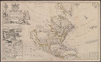
North America, according to ye newest and most exact observations
Description:
Appears in the author's The world described, or a new and correct sett of maps., Has watermark., Includes text, 10 insets of North American ports, decorative cartouche with coat of arms and figures, and "view of a stage & also, and Shows California as an island.
Publisher:
Printed for H. Moll, D. Midwinter at ye 3 Crowns in St. Pauls Church yard, T. Bowles ... next to the chapter house in St. Pauls Church yard, and over against Devereux Court, without Temple Bar, and by P. Overton ... near St. Dunstans Church Fleetstreet,
Subject (Geographic):
North America--Maps--Early works to 1800
Subject (Name):
Lens, Bernard, 1659-1725, Moll, Herman, d. 1732. World described, and Vertue, George, 1684-1756