Skip to search
Skip to main content
Skip to first result
Search
You Searched For
Genre
Maps
Language
English
Publication Place
Boston :
New Search
Search Results
Published / Created:
[1833?]
Call Number:
764 AM47 1833
Container / Volume:
BRBL_00453
Image Count:
1
Resource Type:
Maps, Atlases & Globes
Publisher:
Pendleton Lith.,
Found in:
Beinecke Rare Book and Manuscript Library > A Map of Amherst with a view of the College ... by Alonzo Gray & Charles B. Adams ... 1833.
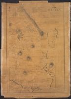
Published / Created:
1831
Call Number:
764 M52 1831
Container / Volume:
BRBL_00458
Image Count:
1
Resource Type:
Maps, Atlases & Globes
Publisher:
Pendleton's Lithog.,
Subject (Geographic):
Mendon (Mass.)--Maps
Found in:
Beinecke Rare Book and Manuscript Library > A Map of Mendon, Worcester County, Mass. By John Geo. Metcalf, M.D. Newell nelson, Surveyor.
Published / Created:
[1831?]
Call Number:
764 B63 1831
Container / Volume:
BRBL_00454
Image Count:
1
Resource Type:
Maps, Atlases & Globes
Publisher:
Pendleton Lithography,
Subject (Geographic):
Bolton (Mass. : Town)--Maps
Found in:
Beinecke Rare Book and Manuscript Library > A Map of the Town of Bolton in the County of Worcester and the Commonwealth of Massachusetts. Surveyed by Silas Holman in the Year 1831.
Published / Created:
1791
Call Number:
7645cea 1791
Container / Volume:
BRBL_00463
Image Count:
1
Resource Type:
Maps, Atlases & Globes
Description:
Negative Photo-stat.
Publisher:
John Norman,
Subject (Geographic):
Nantucket (Mass.)--Maps--Early works to 1800
Found in:
Beinecke Rare Book and Manuscript Library > A chart of Nantucket Shoals by Capt. Paul Pinkham.
Published / Created:
[1840.]
Call Number:
765CA 1840
Container / Volume:
BRBL_00464
Image Count:
1
Resource Type:
Maps, Atlases & Globes
Description:
Upper left-hand corner torn away. from R.I. Geological & agricultural survey. A report ... by Charles T. Jacson ... 1840.
Publisher:
C. Cook,
Subject (Geographic):
Rhode Island--Maps
Found in:
Beinecke Rare Book and Manuscript Library > A geological map of Rhode-Island. By Charles T. Jackson. 1840.
Creator:
Published / Created:
c1907.
Call Number:
762 W73 1907
Container / Volume:
BRBL_00451
Image Count:
1
Resource Type:
Maps, Atlases & Globes
Description:
"Caution" text gives meaning of buoy colors and general rules for small craft navigation., "This map (outline) is copied from an old tracing in the possession of Mr. Wm. Puffer of Boston, Mass. It has been carefully tested by taking many cross sights ...", Bathymetry shown by spot heights., Includes area and distance statistics of lake and islands., Insets: Little Bear Isl'd thorofare -- Entrance to Lees Mills thorofare -- Entrance to Green's Basin -- Three Mile Island thorofare., Oriented with north toward the upper left., and Shows buoys, fixed lights, steamer routes, railroads and stations, post offices, sunken rocks and shoals.
Publisher:
E.N. Burwell,
Subject (Geographic):
Winnipesaukee, Lake (N.H.)--Maps and Winnipesaukee, Lake (N.H.)--Navigation--Maps
Subject (Topic):
Lakes--New Hampshire--Maps
Found in:
Beinecke Rare Book and Manuscript Library > A map of Lake Winnipesaukee, New Hampshire / author, Elliot Noël Burwell.
Published / Created:
[1794?]
Call Number:
764 1794
Container / Volume:
BRBL_00452
Image Count:
1
Resource Type:
Maps, Atlases & Globes
Description:
note: Watermark, A. Blackwell 1794? and Preliminary record.
Publisher:
J. Norman,
Found in:
Beinecke Rare Book and Manuscript Library > A new map of Massachusetts State including Rhode Island and Connecticut .. revised by Osgood Carelton ... Boston.
Published / Created:
[1800?]
Call Number:
764 1800
Container / Volume:
BRBL_00452
Image Count:
1
Resource Type:
Maps, Atlases & Globes
Description:
Mounted.
Publisher:
I. Norman,
Found in:
Beinecke Rare Book and Manuscript Library > A new map of the state of Massachusetts from the original map compiled by Osgood Carleton esqr. from the actual surveys that were made agreable to an act of the General court.
Published / Created:
1800
Call Number:
764 B65 1800
Container / Volume:
BRBL_00455
Image Count:
1
Resource Type:
Maps, Atlases & Globes
Description:
L.C. 153-9.
Publisher:
W. Norman,
Subject (Geographic):
Boston (Mass.)--Maps--Early works to 1800
Found in:
Beinecke Rare Book and Manuscript Library > A new plan of Boston from Actual surveys by Osgood Carleton. With corrections, additions, & improvements.
Branch:v1.61.8 ,Deployed:2024-06-20T11:15:04-04:00