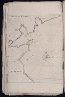
The English pilot: describing the sea-coasts, capes, head-lands, rivers, bays, roads, havens
Image Count:
1
Description:
Most maps numbered in pencil on verso, some on recto.
Subject (Geographic):
Atlantic Ocean --Maps --Early works to 1800 and Newfoundland and Labrador --Maps --Early works to 1800
Subject (Topic):
Navigation --Early works to 1800, Pilot guides --Atlantic Coast (U.S.) --Early works to 1800, and Pilot guides --Caribbean Area --Early works to 1800
Collection Created:
London : Printed for John Thornton, at the sign of the England, Scotland, and Ireland, in the Minories, and Richard Mount, at the Postern on Tower-Hill, 1698London : Printed for John Thornton, at the sign of the England, Scotland, and Ireland, in the Minories, and Richard Mount, at the Postern on Tower-Hill, 1698
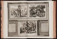
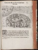
La galerie agreable du monde, où l'on voit en un grand nombre de cartes tres-exactes et de belles
Image Count:
1
Resource Type:
Maps, Atlases & Globes
Alternative Title:
Magnificence du gouverneur a Suratte, pl. 32., Melik Ambar, un miserable esclave, protecteur du Royaume de Decan, pl. 32., and Mine de Diamans, aux Indes Orientales
Subject (Topic):
Atlases--Early works to 1800 and Geography--Pictorial works
Collection Created:
Le tout mis en ordre & executé à Leide, par Pierre vander Aa [1729?]
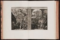
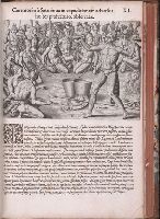
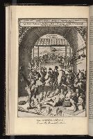
The generall historie of Virginia, New-England, and the Summer Isles : with the names of the
Image Count:
1
Description:
Added plate from French ed. with legend in French and Dutch bound in facing p. 49. and MS note at bottom: "An additional print from the French edition.
Subject (Geographic):
Virginia --History --Colonial period, ca. 1600-1775
Subject (Topic):
First contact of aboriginal peoples with Westerners and Indians of North America--Virginia.
Collection Created:
London : Printed by I.[ohn] D.[awson] and I.[ohn] H.[aviland] for Edward Blackmore, anno 1632
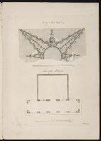
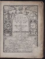
Certaine errors in nauigation / detected and corrected by Edw. Wright ; with many additions that
Image Count:
1
Abstract:
Engraved title page depicts world map at bottom with various navigation intsruments along sides and top, as well as a day and night themed sky at top left and top right, respectively.
Description:
In ink at bottom: B1., Printer’s error: lower right corner of title page offset; title page repeated on verso of *2., and With an additional engraved title page.
Subject (Topic):
Cosmography--Early works to 1800, Nautical astronomy --Early works to 1800, and Navigation --Early works to 1800
Collection Created:
[London] : Printed by Felix Kingsto[n] at London, 1610
Certaine errors in nauigation / detected and corrected by Edw. Wright ; with many additions that
Image Count:
1
Abstract:
Engraved title page depicts world map at bottom with various navigation intsruments along sides and top, as well as a day and night themed sky at top left and top right, respectively.
Description:
In ink at top right corner: 5 [underlined]., Printer’s error: lower right corner of title page offset; title page repeated on verso of *2., and With an additional engraved title page.
Subject (Topic):
Cosmography--Early works to 1800, Nautical astronomy --Early works to 1800, and Navigation --Early works to 1800
Collection Created:
[London] : Printed by Felix Kingsto[n] at London, 1610