Search
You Searched For
Search Results
- Creator:
- Ordnance Survey of Great Britain and Ireland
Royal Geographical Society (Great Britain). Geographical Section
- Published / Created:
- 1918
- Call Number:
- 11hcf 1919E-20
- Container / Volume:
- BRBL_00010ZA
- Image Count:
- 1
- Resource Type:
- Maps, Atlases & Globes
- Found in:
- Beinecke Rare Book and Manuscript Library > Buda Pest : North L 34. / compiled at the Royal Geographical Society under the direction of the Geographical Section; drawn and printed by Ordnance Survey.
- Creator:
- Ordnance Survey of Great Britain and Ireland
Royal Geographical Society (Great Britain). Geographical Section
- Published / Created:
- 1915
- Call Number:
- 11hcf 1919E-19
- Container / Volume:
- BRBL_00010Z
- Image Count:
- 1
- Resource Type:
- Maps, Atlases & Globes
- Found in:
- Beinecke Rare Book and Manuscript Library > Buda Pest : North L 34. / compiled at the Royal Geographical Society under the direction of the Geographical Section; drawn and printed by Ordnance Survey.
- Creator:
- Ordnance Survey of Great Britain and Ireland
Royal Geographical Society (Great Britain). Geographical Section
- Published / Created:
- 1915
- Call Number:
- 11hcf 1919E-19
- Image Count:
- 1
- Resource Type:
- Maps, Atlases & Globes
- Found in:
- Beinecke Rare Book and Manuscript Library > Buda Pest : North L 34. / compiled at the Royal Geographical Society under the direction of the Geographical Section; drawn and printed by Ordnance Survey.
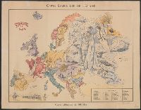
- Creator:
- Crétée, B
- Published / Created:
- [1914]
- Call Number:
- 30 1914C
- Container / Volume:
- BRBL_00032A
- Image Count:
- 1
- Resource Type:
- Maps, Atlases & Globes
- Found in:
- Beinecke Rare Book and Manuscript Library > Carte symbolique de l'Europe : guerre libératrice de 1914-1915 / B. Crétée.
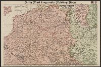
- Creator:
- Philip, George, 1870-1937
- Published / Created:
- [1914.]
- Call Number:
- 11hc 1915B
- Image Count:
- 2
- Resource Type:
- Maps, Atlases & Globes
- Found in:
- Beinecke Rare Book and Manuscript Library > Daily Mail large-scale Military maps No. 3. : The Franco-Belgian Theatre of War / edited by George Philip, F.R.G.S., in conjunction with Military experts.
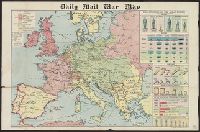
- Creator:
- George Philip & Son
London Geographical Institute
- Published / Created:
- [1918?]
- Call Number:
- 11hc 1914P
- Image Count:
- 1
- Resource Type:
- Maps, Atlases & Globes
- Found in:
- Beinecke Rare Book and Manuscript Library > Daily mail war map [cartographic material].
- Published / Created:
- 1916
- Call Number:
- 11hc 1916HA
- Container / Volume:
- BRBL_00010C
- Image Count:
- 1
- Resource Type:
- Maps, Atlases & Globes
- Found in:
- Beinecke Rare Book and Manuscript Library > De L'Yser a L'Aisne / dressé et dessiné́ par G. Peltier.
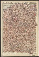
- Published / Created:
- 1915
- Call Number:
- 11hc 1915D
- Image Count:
- 1
- Resource Type:
- Maps, Atlases & Globes
- Found in:
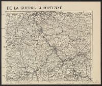
- Beinecke Rare Book and Manuscript Library > De la guerre européenne : feuille nord-est.
- Published / Created:
- 1916.]
- Call Number:
- 11hc 1916D
- Container / Volume:
- BRBL_00010C
- Image Count:
- 2
- Resource Type:
- Maps, Atlases & Globes
- Found in:
- Beinecke Rare Book and Manuscript Library > Die militärischen ereignisse vom 23, bis 30. October 1916 : Wochentliche Kriegsschauplatzkarte.