"3-43.", "Copied from I.S.I.S. report 1:5,000, San Sebastian, CB 1811, no. 4, 1942.", "First edition 1943.", Relief shown by contours and rock drawings., and Some streets and buildings are named.
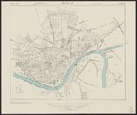
"3-43.", "Copied from I.S.I.S. report, 1:7,900, Seville, CB 1811, no. 7, 1941.", "First edition 1943.", Oriented with north towards the lower left., Relief shown by hachures., and Some buildings are named.
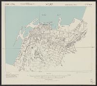
"3-43.", "Copied from Spanish map, 1:7,750, Patronato Nacional del Turismo, Vigo.", "First edition 1943.", Relief shown by hachures., and Some streets and buildings are named.
"3-43.", "Copied from Spanish map, 1:8,000, Oviedo.", "First edition 1943.", Most streets and some buildings are named., and North oriented toward upper left.
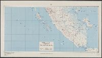
Elevations shown by hachures and spot heights in meters., Four classes of roads or trails, and narrow and normal gauge railroads are shown., and Inset: Strategic area.
"4-43.", "Copied from CB 1804, map 27.", "French Lambert zone II grid.", Major street names and place names in French., Relief shown by rock drawings., and Some streets and buildings are named.
A.M.S. ; 6201 and Series (Standard map series designation system) ; 6201.
Description:
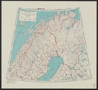
Elevations are shown by hachures and spot heights in meters., Inset with detailed transportation information., and Two classes of roads and eight classes of railroads are shown.
Publisher:
The Service,
Subject (Topic):
Transportation--Finland--Maps and Transportation--Sweden--Maps