Search
You Searched For
Search Results
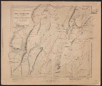
- Published / Created:
- 1861
- Call Number:
- 771fab 1861
- Container / Volume:
- BRBL_00493
- Image Count:
- 6
- Resource Type:
- Maps, Atlases & Globes
- Found in:
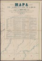
- Beinecke Rare Book and Manuscript Library > Map of the boundary line between the states of New York and Connecticut, to accompany the report of the New York Commissioners/ H.S. Dewy, Engineer, John Evans, Assistant.
- Creator:
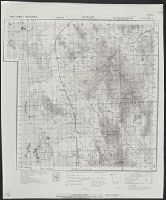
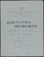
- United States. Department of Agriculture. Production and Marketing Administration
- Published / Created:
- [1951?]
- Call Number:
- 824bc K772 1951
- Container / Volume:
- BRBL_00571
- Image Count:
- 6
- Resource Type:
- Maps, Atlases & Globes
- Found in:
- Beinecke Rare Book and Manuscript Library > Knox County, Nebraska / U.S. Department of Agriculture, Production and Marketing Administration.
- Creator:
- Hoempler, Carlos E. C
- Published / Created:
- 1906
- Call Number:
- 9739 1906
- Container / Volume:
- BRBL_00678
- Image Count:
- 6
- Resource Type:
- Maps, Atlases & Globes
- Found in:
- Beinecke Rare Book and Manuscript Library > Mapa del departamento de Loreto [cartographic material] / correjido y aumentado con los estudios los Srs. Espinar, Buenaño, Mavila, Zavala, Donayre, Von Hassel y otros ; trazado y dibujo de los cartografos Hoempler, Baluarte y Vallejos.
- Creator:
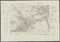
- United States. Army Map Service
- Published / Created:
- 1943
- Call Number:
- 5844 1943
- Container / Volume:
- BRBL_00315
- Image Count:
- 6
- Resource Type:
- Maps, Atlases & Globes
- Found in:
- Beinecke Rare Book and Manuscript Library > Malaya 1:253 440 : Pahang.
- Creator:
- United States. General Land Office
- Published / Created:
- 1876
- Call Number:
- 75 1876
- Container / Volume:
- BRBL_00405
- Image Count:
- 6
- Resource Type:
- Maps, Atlases & Globes
- Found in:
- Beinecke Rare Book and Manuscript Library > Map of the United States and territories, showing the extent of public surveys, Indian and military reservations, land grant R.R., rail roads, canals, and other details / compiled from the official surveys of the General Land Office, and other authentic s
- Published / Created:
- [ca. 1870]
- Call Number:
- 428 1870
- Container / Volume:
- BRBL_00248
- Image Count:
- 6
- Resource Type:
- Maps, Atlases & Globes
- Found in:
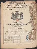
- Beinecke Rare Book and Manuscript Library > Wandkarte von Tirol und Vorarlberg für Volks-und Mittel-Schulen = Carta del Tirolo e Vorarlberg ad uso di scuole popolari e medie / Gezeichnet von G.v. Kaler.
- Creator:
- Mexico. Dirección de Estudios Geográficos y Climatológicos
- Published / Created:
- 1927?]
- Call Number:
- 8819 1927
- Container / Volume:
- BRBL_00652
- Image Count:
- 6
- Resource Type:
- Maps, Atlases & Globes
- Found in:
- Beinecke Rare Book and Manuscript Library > Estado de Chihuahua / Secretaria de Agricultura y Fomento, Direccion de Estudios Geográficos y Clim. ; Dep. Geográfico de Gabinete, Dep. Geogr. de Campo.
- Published / Created:
- 1909
- Call Number:
- 61 1909A
- Container / Volume:
- BRBL_00331
- Image Count:
- 6
- Resource Type:
- Maps, Atlases & Globes
- Found in:
- Beinecke Rare Book and Manuscript Library > Map of Egypt.
- Published / Created:
- 1799
- Call Number:
- 90 1799A
- Container / Volume:
- BRBL_00662
- Image Count:
- 6
- Resource Type:
- Maps, Atlases & Globes
- Found in:
- Beinecke Rare Book and Manuscript Library > Mapa Geográfico de America Meridionale, Dispuesto y Gravado por de Juan de la Cruz Cano y Olmedilla, Geogfo. Pensdo. de S.M. Individluo de la Rl. Academia de Sn. Fernando, y de la Sociedad Bascongada de los Amigos de Pais, teniendo presentes Varios Mapas
- Published / Created:
- 1811
- Call Number:
- 90 1819
- Container / Volume:
- BRBL_00662
- Image Count:
- 6
- Resource Type:
- Maps, Atlases & Globes
- Found in:
- Beinecke Rare Book and Manuscript Library > Outlines of the Physical and Political Divisions of South America: delineated by A. Arrowsmith partly from scarse and Original Documents, published before the year 1806 corrected from accurate Astronomical observations to 1810.
- Creator:
- Lüddecke, Richard
- Published / Created:
- [1891]
- Call Number:
- 60 1891
- Container / Volume:
- BRBL_00328
- Image Count:
- 6
- Resource Type:
- Maps, Atlases & Globes
- Found in:
- Beinecke Rare Book and Manuscript Library > Afrika in 6 Blättern, im Massstab von 1:10,000,000 / bearbeitet von R. Lüddecke (Blatt 2 von B. Domann).
- Creator:
- Survey of India
- Published / Created:
- 1904
- Call Number:
- 59gm 1903
- Container / Volume:
- BRBL_00318
- Image Count:
- 6
- Resource Type:
- Maps, Atlases & Globes
- Found in:
- Beinecke Rare Book and Manuscript Library > Military map of India : Corrected to 1903.
- Creator:
- Walling, Henry Francis, 1825-1888
- Published / Created:
- 1858
- Call Number:
- 764 N76 1858
- Container / Volume:
- BRBL_00458
- Image Count:
- 6
- Resource Type:
- Maps, Atlases & Globes
- Found in:
- Beinecke Rare Book and Manuscript Library > Map of the county of Norfolk, Massachusetts / based upon the details of the trigonometrical survey of the state; the details from actual surveys under the direction of Henry F. Walling. Supt. of the state map.
- Creator:
- Clason Map Co
- Published / Created:
- 1909
- Call Number:
- 831 H36 1909
- Container / Volume:
- BRBL_00580
- Image Count:
- 6
- Resource Type:
- Maps, Atlases & Globes
- Found in:
- Beinecke Rare Book and Manuscript Library > Map of city of Helena, Montana / Copyrighted 1909 by Geo. S. Clason.
- Creator:
- Robinson, Jay
- Published / Created:
- [1956]
- Call Number:
- BrSides Zc10 956ro
- Image Count:
- 4
- Resource Type:
- Books, Journals & Pamphlets
- Found in:
- Beinecke Rare Book and Manuscript Library > Lewis & Clark expedition : Washington & Oregon, 10 October 1805-5 May 1806 / prepared by Lewis and Clark Sesquicentennial Governor's Committee by Jay Robinson, Jr., architect, Pasco, Washington.
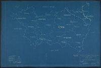
- Creator:
- McGee, W. J., 1853-1912
- Published / Created:
- [1893?]
- Call Number:
- 75CA 1893
- Container / Volume:
- BRBL_00408
- Image Count:
- 10
- Resource Type:
- Maps, Atlases & Globes
- Found in:
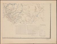
- Beinecke Rare Book and Manuscript Library > Reconnoissance map of the United States showing the distribution of the geologic system so far as known / compiled from data in possession of the U.S. Geological Survey by W.J. McGee, 1893.
- Published / Created:
- [1918]
- Call Number:
- 38hc R283 1918
- Container / Volume:
- BRBL_00173
- Image Count:
- 10
- Resource Type:
- Maps, Atlases & Globes
- Found in:
- Beinecke Rare Book and Manuscript Library > [Collection of maps related to raid of the Second Battalion Infantry Regiment 134 near Remenauville during the night of April 27/28 1918].
- Creator:
- United States. Army. Engineer Aviation Topographic Battalion, 942nd
- Published / Created:
- 1945
- Call Number:
- 57gfb 1945
- Container / Volume:
- BRBL_00306
- Image Count:
- 10
- Resource Type:
- Maps, Atlases & Globes
- Found in:
- Beinecke Rare Book and Manuscript Library > Japan electric power / drawn and reproduced by Co B, 942nd Engr. Avn. Topo. Bn, 325th Ric., US Army.
- Creator:
- Mitchell, John, 1711-1768
- Published / Created:
- 1776]
- Call Number:
- 71 1776D
- Container / Volume:
- BRBL_00365
- Image Count:
- 8
- Resource Type:
- Maps, Atlases & Globes
- Found in:
- Beinecke Rare Book and Manuscript Library > Amérique septentrionale avec les routes : distances en miles, villages, et etablissements françois et anglois / par le docteur Mitchel ; traduit de l'Anglois à Paris par Le Rouge, ingr. géographe du roy, Rue des Grands Augustins 1756.
- Creator:
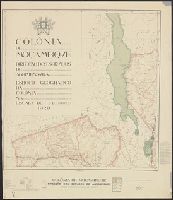
- Mozambique. Direcção dos Serviços de Agrimensura
- Published / Created:
- 1929
- Call Number:
- 636 1929
- Container / Volume:
- BRBL_00337
- Image Count:
- 8
- Resource Type:
- Maps, Atlases & Globes
- Found in:
- Beinecke Rare Book and Manuscript Library > Colónia de Moçambiqve : esboço geografico da colonía na escala de 1/1.000.000 / Direcção dos Serviços de Agrimensura ; comp., B.A. Lourinho ; des., R.J. Ximénes.
- Creator:
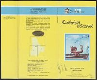
- Ukraïnsʹke aeroheodezychne pidpryi︠e︡mstvo
- Published / Created:
- 1992
- Call Number:
- 3531 1992
- Container / Volume:
- BRBL_00111
- Image Count:
- 8
- Resource Type:
- Maps, Atlases & Globes
- Found in:
- Beinecke Rare Book and Manuscript Library > Kievskai︠a︡ oblastʹ, obshchegeograficheskai︠a︡ karta : masshtab 1:200 000 / Ukrainskoe AGP ; karta sostavlena i podgotovlena k pechati Ukrainskim aėrogeodezicheskim predprii︠a︡tiem v 1992 g.
- Published / Created:
- 1879
- Call Number:
- 40 R66 1879
- Container / Volume:
- BRBL_00218
- Image Count:
- 8
- Resource Type:
- Maps, Atlases & Globes
- Found in:
- Beinecke Rare Book and Manuscript Library > Carta Topografica dell'agro Romano Territori Limitrofi.
- Published / Created:
- 1919
- Call Number:
- 11hcf 1919C-11
- Image Count:
- 8
- Resource Type:
- Maps, Atlases & Globes
- Found in:
- Beinecke Rare Book and Manuscript Library > Base Map of Vosges Department: Taken from File No. 74-A-3 / American Commision to Negotiate Peace, War Damages in Allied Countries.
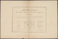
- Published / Created:
- ca. 163--1734]
- Call Number:
- 1973 Folio 18
- Image Count:
- 10
- Resource Type:
- Maps, Atlases & Globes
- Found in:
- Beinecke Rare Book and Manuscript Library > [Composite atlas of the world].
- Published / Created:
- 1919
- Call Number:
- 11hcf 1919C-9
- Container / Volume:
- BRBL_00010V
- Image Count:
- 5
- Resource Type:
- Maps, Atlases & Globes
- Found in:
- Beinecke Rare Book and Manuscript Library > Base Map of Marne Department : Taken from File 74-A-3 / American Commision to Negotiate Peace, War Damages in Allied Countries.
- Creator:
- Woerl, Joseph Edmund
- Published / Created:
- [1840]
- Call Number:
- 40 1840C
- Image Count:
- 5
- Resource Type:
- Maps, Atlases & Globes
- Found in:
- Beinecke Rare Book and Manuscript Library > Karte von Ober-Italien in 6 Blättern : mit roth eingedruckten Strassen, Ortspositionen und Grenzen / entworfen und bearbeitet im Maasstabe van 1.500,000 von Professor Dr. J.E. Woerl.
- Creator:
- Russia. Armii︠a︡. Glavnyi shtab. Voennotopograficheskii otdiel
- Published / Created:
- 1889-.
- Call Number:
- 547 1892
- Container / Volume:
- BRBL_00291
- Image Count:
- 5
- Resource Type:
- Maps, Atlases & Globes
- Found in:
- Beinecke Rare Book and Manuscript Library > Karta iuzhnoī pogranichnoī polosy Asiatskoī Rossīi. Pod redaktsieī General-Maīora Bol' sheva.
- Creator:
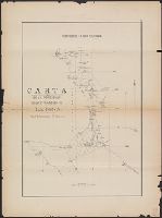
- Lee, Thomas Jefferson, 1808-1891
- Published / Created:
- 1842?]
- Call Number:
- 796fab Sa13 1842H
- Container / Volume:
- BRBL_00530
- Image Count:
- 5
- Resource Type:
- Maps, Atlases & Globes
- Found in:
- Beinecke Rare Book and Manuscript Library > Map of the river Sabine from its mouth on the Gulf of Mexico in the sea to Logan's Ferry in latitude 31⁰, 58', 24" north, shewing the boundary between the United States and the Republic of Texas between said points, as marked and laid down by survey in 18
- Creator:
- Anderson, P., civil engr
- Published / Created:
- 1845
- Call Number:
- 766gme 1845N
- Container / Volume:
- BRBL_00475A
- Image Count:
- 5
- Resource Type:
- Maps, Atlases & Globes
- Found in:
- Beinecke Rare Book and Manuscript Library > Map exhibiting the experimental and located lines for the New-York and New-Haven Rail-Road. Projected and drawn by P. Anderson, civil engr.
- Published / Created:
- 1857
- Call Number:
- 764 P74 1857
- Container / Volume:
- BRBL_00459
- Image Count:
- 5
- Resource Type:
- Maps, Atlases & Globes
- Found in:
- Beinecke Rare Book and Manuscript Library > Map of the county of Plymouth, Massachusetts. From actual survey under the direcction of Henry F. Walling ... 1857.
- Published / Created:
- 1839
- Call Number:
- 785cea C17 1839A
- Container / Volume:
- BRBL_00514
- Image Count:
- 5
- Resource Type:
- Maps, Atlases & Globes
- Found in:
- Beinecke Rare Book and Manuscript Library > Cape Fear River ... by Lieutenant James Glynn ... Continuation of the Survey of Cape Fear River ... by Lieut. James Glynn.
- Published / Created:
- [1760?]
- Call Number:
- 428 1760
- Container / Volume:
- BRBL_00247
- Image Count:
- 5
- Resource Type:
- Maps, Atlases & Globes
- Found in:
- Beinecke Rare Book and Manuscript Library > Atlas Tyrolensis.
- Creator:
- Survey of India
- Published / Created:
- 19--]
- Call Number:
- 59 M26 1917
- Container / Volume:
- BRBL_00318
- Image Count:
- 5
- Resource Type:
- Maps, Atlases & Globes
- Found in:
- Beinecke Rare Book and Manuscript Library > Madras / published under the direction of Colonel Sir S.G. Burrard, K.S.C.I., R.E., F.R.S., Surveyor General of India, 1917.
- Creator:
- Geological Survey of Great Britain
Great Britain. Ordnance Survey
- Published / Created:
- 1864
- Call Number:
- 32625 1865
- Container / Volume:
- BRBL_00071
- Image Count:
- 5
- Resource Type:
- Maps, Atlases & Globes
- Found in:
- Beinecke Rare Book and Manuscript Library > Stirlingshire.
- Creator:
- Canada. Dept. of the Interior
- Published / Created:
- [1914?]
- Call Number:
- 737 C88 1914
- Container / Volume:
- BRBL_00385
- Image Count:
- 5
- Resource Type:
- Maps, Atlases & Globes
- Found in:
- Beinecke Rare Book and Manuscript Library > Map of Crowsnest Forest and Waterton Lakes Park, Rocky Mountains Forest Reserve / drawn and printed at the Surveyor General's Office.
- Creator:
- Freyhold, Edward
- Published / Created:
- 1879
- Call Number:
- 80 1879
- Container / Volume:
- BRBL_00536
- Image Count:
- 5
- Resource Type:
- Maps, Atlases & Globes
- Found in:
- Beinecke Rare Book and Manuscript Library > Map of the territory of the United States, west of the Mississippi River / prepared by authority of the Hon. the Secretary of War, in the office of the Chief of Engineers under the direction of Brig. Gen. A.A. Humphreys, Chief of Engrs. Bvt. Major General
- Published / Created:
- 1861
- Call Number:
- 899 1861
- Container / Volume:
- BRBL_00660
- Image Count:
- 5
- Resource Type:
- Maps, Atlases & Globes
- Found in:
- Beinecke Rare Book and Manuscript Library > Interoceanic ship canal via the Atrato and Truando Rivers.
- Creator:
- Topografische Inrichting (Jakarta, Indonesia)
- Published / Created:
- 1910?]
- Call Number:
- 276 B43 1910
- Container / Volume:
- BRBL_00023C
- Image Count:
- 5
- Resource Type:
- Maps, Atlases & Globes
- Found in:
- Beinecke Rare Book and Manuscript Library > Residentie Benkoelen.
- Published / Created:
- 1823
- Call Number:
- 32 L9431 1823
- Container / Volume:
- BRBL_00701
- Image Count:
- 5
- Resource Type:
- Maps, Atlases & Globes
- Found in:
- Beinecke Rare Book and Manuscript Library > [Manuscript map of Lovell Hill, Berkshire].
- Creator:
- Netherlands. Topografische Inrichting
- Published / Created:
- 1919
- Call Number:
- 2692 1919
- Container / Volume:
- BRBL_00023A
- Image Count:
- 5
- Resource Type:
- Maps, Atlases & Globes
- Found in:
- Beinecke Rare Book and Manuscript Library > Schetskaart van Nieuw Guinee : (Nederlandsch gebied).
- Published / Created:
- 1918
- Call Number:
- 3891 1918
- Container / Volume:
- BRBL_00183
- Image Count:
- 5
- Resource Type:
- Maps, Atlases & Globes
- Found in:
- Beinecke Rare Book and Manuscript Library > Massif de la Chartreuse / par C. Buisson.
- Creator:
- Survey of India
- Published / Created:
- 19--]
- Call Number:
- 59 B639 1932
- Container / Volume:
- BRBL_00318
- Image Count:
- 5
- Resource Type:
- Maps, Atlases & Globes
- Found in:
- Beinecke Rare Book and Manuscript Library > Bombay / published under the direction of Lieutenant Colonel C.P. Gunter, O.B.E., R.E., Officiating Surveyor General of India, 1926.
- Creator:
- Germany. Heer. Abteilung für Kriegskarten- und Vermessungswesen. IV. Mil.-Geo
- Published / Created:
- 1942
- Call Number:
- 32 Sh39 1942
- Container / Volume:
- BRBL_00054
- Image Count:
- 5
- Resource Type:
- Maps, Atlases & Globes
- Found in:
- Beinecke Rare Book and Manuscript Library > Sheffield.
- Published / Created:
- [19--?]
- Call Number:
- 32 L84 1900
- Container / Volume:
- BRBL_00051
- Image Count:
- 5
- Resource Type:
- Maps, Atlases & Globes
- Found in:
- Beinecke Rare Book and Manuscript Library > [Map of London and Environs].
- Creator:
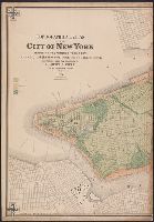
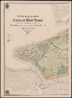
- Viele, Egbert L. (Egbert Ludovicus), 1825-1902
- Published / Created:
- 1874
- Call Number:
- 771 N49 1874
- Container / Volume:
- BRBL_00488
- Image Count:
- 5
- Resource Type:
- Maps, Atlases & Globes
- Found in:
- Beinecke Rare Book and Manuscript Library > Topographical atlas of the City of New York including the annexed territory, showing original water courses and made land / prepared under the direction of Egbert L. Viele ; Eugene Quackenbush ; Julius Bien photo lith.
- Published / Created:
- 1946]
- Call Number:
- 816fb Sa24 1946
- Container / Volume:
- BRBL_00563
- Image Count:
- 5
- Resource Type:
- Maps, Atlases & Globes
- Found in:
- Beinecke Rare Book and Manuscript Library > Map of St. Louis, 1946.
- Creator:
- Viele, Egbert L. (Egbert Ludovicus), 1825-1902
- Published / Created:
- 1874
- Call Number:
- 771 N49 1874
- Container / Volume:
- BRBL_00488
- Image Count:
- 5
- Resource Type:
- Maps, Atlases & Globes
- Found in:
- Beinecke Rare Book and Manuscript Library > Topographical atlas of the City of New York including the annexed territory, showing original water courses and made land / prepared under the direction of Egbert L. Viele ; Eugene Quackenbush ; Julius Bien photo lith.
- Creator:
- Northern Transcontinental Survey. Agricultural Dept
- Published / Created:
- 1883
- Call Number:
- 847gc Y12 1883
- Container / Volume:
- BRBL_00628
- Image Count:
- 5
- Resource Type:
- Maps, Atlases & Globes
- Found in:
- Beinecke Rare Book and Manuscript Library > Map bulletin no. 1 / by E.W. Hilgard ; Northern Transcontinental Survey, Agricultural Department.
- Creator:
- Tinoco, Manuel
- Published / Created:
- 1885?]
- Call Number:
- 88192 1885
- Container / Volume:
- BRBL_00653
- Image Count:
- 5
- Resource Type:
- Maps, Atlases & Globes
- Found in:
- Beinecke Rare Book and Manuscript Library > Territorio de la Baja California / yngo. Manuel Tinoco.
- Creator:
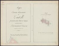
- Giunta, I.R
- Published / Created:
- 1847
- Call Number:
- 40 V55 1847B
- Container / Volume:
- BRBL_00224
- Image Count:
- 10
- Resource Type:
- Maps, Atlases & Globes
- Found in:
- Beinecke Rare Book and Manuscript Library > Mappa del comune censuario di Castello : porzione della citta di Venezia, distretto I, provincia di Venezia, rettificata nell' anno 1842.