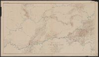
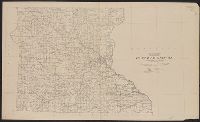
"Surveyed in 1903; additional areas from surveys made in 1900 and 1901 by U.S. Geological Survey". and Relief shown by contours; contour interval 200 feet.
Publisher:
U.S.G.S.,
Subject (Geographic):
Seward Peninsula (Alaska)--Maps
Subject (Name):
Brooks, Alfred H. (Alfred Hulse), 1871-1924 and Witherspoon, D. C
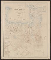
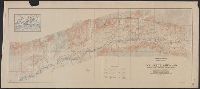
"Surveyed in 1898, 1914,1915,1916, and 1919.", Key map of surveyors' areas of responsiblity in margin., and Relief shown by contours, land forms and spot heights.
Publisher:
Geological Survey,
Subject (Geographic):
Kuskokwim Bay Region (Alaska)--Maps and Kuskokwim River Region (Alaska)--Maps
Subject (Name):
Brooks, Alfred H. (Alfred Hulse), 1871-1924, Maddren, A. G, Post, W. S, and Sargent, Rufus Harvey, b. 1875
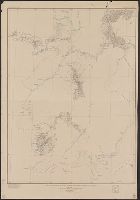
Imperfect: only "Sheet No. 3", sheets 1 and 2 wanting., Relief shown by contours and spot heights., Sheets issued in various editions and reprints., and Text and ill. on verso.
States of Massachusetts, Rhode Island and Connecticut
Description:
"1919.", "Advance sheet. Subject to correction.", Includes index of power stations., and Shows power plants and transmission lines.
Publisher:
U.S. Geological Survey,
Subject (Name):
Thomas, G. D
Subject (Topic):
Electric lines--Connecticut--Maps, Electric lines--Massachusetts--Maps, Electric lines--Rhode Island--Maps, Electric power transmission--Connecticut--Maps, Electric power transmission--Massachusetts--Maps, Electric power transmission--Rhode Island--Maps, Power-plants--Connecticut--Maps, Power-plants--Massachusetts--Maps, and Power-plants--Rhode Island--Maps
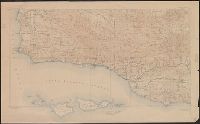
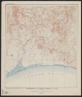
"Surveyed in 1909 and 1913 ; topography by Alaskan Branch, R.H. Sargent, topographic engineer.", Includes regional location map., and Relief shown by contours and spot heights.
Contour interval 100 feet. Datum is mean sea level., Includes examples of "Conventional signs" used on the map in the upper right margin., and Relief shown by contours and spot heights.
Publisher:
Engraved and printed by the U.S. Geological Survey,
Contour interval 100 feet. Datum is mean sea level., Dissected and mounted on linen., Includes examples of "Conventional signs" used on the map in the upper right margin., and Relief shown by contours and spot heights.
Publisher:
Engraved and printed by the U.S. Geological Survey,