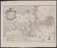
Based on John Bonner's map, "The town of Boston in New England" (1722)., In cartouche below title: "To His Excellency Jonathan Belcher Esqr"., Includes description of Boston, indexes of wards and buildings, and dates of fires and smallpox epidemics., and Oriente
Publisher:
William Price,
Subject (Geographic):
Boston (Mass.)--Maps--Early works to 1800
Subject (Name):
Belcher, Jonathan, 1682-1757. dedication and Bonner, John, ca. 1643-1726. The town of Boston in New England 1722
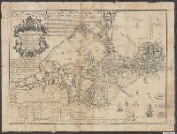
Based on John Bonner's map, "The town of Boston in New England" (1722)., Copy 1: Verso: Stamped "Yale Horace Brown 1900S"., In cartouche below title: "To His Excellency Jonathan Belcher Esqr"., and Includes description of Boston, indexes of wards and buildings,
Publisher:
William Price,
Subject (Geographic):
Boston (Mass.)--Maps--Early works to 1800
Subject (Name):
Belcher, Jonathan, 1682-1757. dedication and Bonner, John, ca. 1643-1726. The town of Boston in New England 1722
Covers also town of North Andover and a portion of the City of Lawrence, Massachusetts., Imperfect: Mutilated with slight loss of text. Mounted on board., Relief shown by hachures., and Shows buildings with names of property owners.
Publisher:
Pendleton's Lithogy.,
Subject (Geographic):
Andover (Mass. : Town)--Buildings, structures, etc.--Maps., Andover (Mass. : Town)--Maps., Lawrence (Mass.)--Maps., and North Andover (Mass. : Town)--Maps.
Subject (Name):
Pendleton's Lithography.
Subject (Topic):
Landowners--Massachusetts--Andover (Town)--Maps., Landowners--Massachusetts--Lawrence--Maps., Landowners--Massachusetts--North Andover (Town)--Maps., Real property--Massachusetts--Andover (Town)--Maps., Real property--Massachusetts--Lawrence--Maps., and Real property--Massachusetts--North Andover (Town)--Maps.
"February, 1814.", "Printed and coloured typographically, in the new constructed Letter-Press, lately invented by Benjamin Dearborn.", and Removed from Massachusetts House Document no. 18 of June 1814 -- petitions to incorporate Boston and Roxbury Mill Corp.
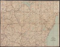
Automobile map of New Hampshire, central and Automobile map of New Hampshire, south
Description:
Automobile map of New Hampshire, south, No. 13 -- Automobile map of New Hampshire central, No. 14., Maps mounted on cloth backing., Relief shown by hachures., Shows southeastern New Hampshire and some of Maine and Massachusetts, from Saco, Me. in the northeast to Newbury, Mass. in the southeast and Orange, N.H. in the northwest to Rindge, N.H. in the southwest., and Title from panel.
Copyright: 1905 by the Federal Engraving and Publishing Co., Boston, Mass., Index to points of interest on cover., Oriented with north to the left., and Title from cover.
Publisher:
Published by John F. Murphy,
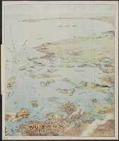
Subject (Geographic):
Boston Harbor (Mass.)--Maps, Boston Harbor Islands (Mass.)--Maps, Boston Harbor Region (Mass.)--Maps, and South Shore Region (Mass. : Coast)--Maps