Search
You Searched For
Search Results
- Creator:
- De Lacy, W. W. (Walter Washington), 1819-1892
- Call Number:
- WA MSS 443
- Collection Title:
- Isaac Ingalls Stevens papers
- Container / Volume:
- Box 1 | Folder 29
- Image Count:
- 1
- Resource Type:
- Maps, Atlases & Globes
- Found in:
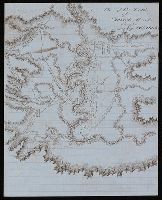
- Beinecke Rare Book and Manuscript Library > Plan of the battle of Grande Ronde fought Jul 17, 1856.
- Creator:
- Cóvens et Mortier
- Published / Created:
- ca. 1730-ca. 1800]
- Call Number:
- 1973 Folio 71
- Image Count:
- 1
- Resource Type:
- Maps, Atlases & Globes
- Found in:
- Beinecke Rare Book and Manuscript Library > [Atlas nouveau contenant toutes les parties du monde ou sont exactement marqués les empires, monarchies, royaumes, états, republiques &c. Le tout recueilli par les meilleurs geógraphes.]
- Published / Created:
- 1831
- Call Number:
- 1988 482
- Image Count:
- 1
- Resource Type:
- Maps, Atlases & Globes
- Found in:
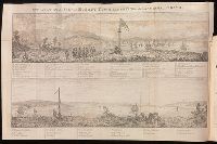
- Beinecke Rare Book and Manuscript Library > Description of a view of Hobart Town, Van Dieman's Land, and the surrounding country : now exhibiting at the Panorama, Strand / painted by the proprietor, Mr. R. Burford.
- Creator:
- Stockdale, John, 1749?-1814
- Published / Created:
- 1800 Nov. 24
- Call Number:
- CF1921 E38 1801
- Collection Title:
- An historical survey of the island of Saint Domingo, together with an account of the Maroon negroes
- Image Count:
- 1
- Resource Type:
- Maps, Atlases & Globes
- Found in:
- Beinecke Rare Book and Manuscript Library > A Map of the Island of St. Domingo
- Creator:
- Bode, Johann Elert, 1747-1826.
- Published / Created:
- 1801
- Call Number:
- QQn32 009
- Image Count:
- 1
- Resource Type:
- Maps, Atlases & Globes
- Found in:
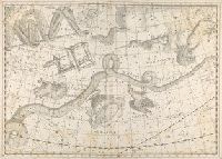
- Beinecke Rare Book and Manuscript Library > Uranographia sive astrorum descriptio viginti tabul oeneis incisa ex recentissimis et absolutissimis Astrononmorum observationibus...
- Creator:
- Pi︠a︡dyshev, Vasiliĭ Petrovich, 1768-1835.
Пядышев, Василий Петрович, 1768-1835.
- Published / Created:
- 1820-1827.
- Call Number:
- EEdb 828P
- Image Count:
- 1
- Resource Type:
- Maps, Atlases & Globes
- Found in:
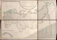
- Beinecke Rare Book and Manuscript Library > Geograficheskīĭ atlas Rossīĭskoĭ Imperīi T︠s︡arstva Polʹskago i Velikago Kni︠a︡zhestva Finli︠a︡ndskago [cartographic material] : raspolozhennyĭ po gubernīi︠a︡m na 80 listakh ... s generalʹnoi︠u︡ kartoi︠u︡ ... / sochinen po novi︠e︡ĭshim i dostovi︠e︡rnym svi︠e︡denīi︠a︡m ... Pi︠a︡dyshevym, nachat 1820-go, okonchen 1827-go goda = Atlas géographique de l'empire de Russie, du royaume de Pologne et du grand duché de Finlande ; divisé en gouvernements ... ; avec une carte générale ... / composé ... par ... Pi︠a︡discheff ...
- Creator:
- Burritt, Elijah H. (Elijah Hinsdale), 1794-1838.
- Published / Created:
- c1835.
- Call Number:
- 2000 Folio 110
- Image Count:
- 1
- Resource Type:
- Maps, Atlases & Globes
- Found in:
- Beinecke Rare Book and Manuscript Library > Atlas, designed to illustrate the geography of the heavens ... By Elijah H. Burritt ...
- Creator:
- Tanner, Henry Schenck, 1786-1858
- Published / Created:
- [1839?]
- Call Number:
- G1200 T34 1839 (LC)
- Image Count:
- 4
- Resource Type:
- Maps, Atlases & Globes
- Found in:
- Beinecke Rare Book and Manuscript Library > A new American atlas [cartographic material] : containing maps of the several states of the North American union ... / by Henry S. Tanner.
- Creator:
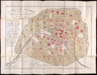
- Montigny, Léon.
- Published / Created:
- [1869]
- Call Number:
- 2015 523
- Image Count:
- 5
- Resource Type:
- Maps, Atlases & Globes
- Found in:
- Beinecke Rare Book and Manuscript Library > Les élections parisiennes de mai et juin 1869 [cartographic material] : application de la géométrie à la statistique / par Léon Montigny.
- Creator:
- Moll, Herman, d. 1732
- Published / Created:
- [178-?]
- Call Number:
- 1973 Folio 113
- Image Count:
- 2
- Resource Type:
- Maps, Atlases & Globes
- Found in:
- Beinecke Rare Book and Manuscript Library > Atlas minor: or A new and curious set of sixty two maps, in which are shewn all the empires, kingdoms, countries, states in all the known parts of the earth ... by Herman Moll ...
- Creator:
- Wytfliet, Corneille.
- Published / Created:
- 1597
- Call Number:
- 1977 +400
- Image Count:
- 2
- Resource Type:
- Maps, Atlases & Globes
- Found in:
- Beinecke Rare Book and Manuscript Library > Descriptionis Ptolemaicae avgmentvm, siue Occidentis notitia breui commentario illustrata, studio et opera Cornely Wytfliet Louaniensis.
- Creator:
- Great Britain. Hydrographic Dept.
- Call Number:
- Conrad +Zz1
- Image Count:
- 2
- Resource Type:
- Maps, Atlases & Globes
- Found in:
- Beinecke Rare Book and Manuscript Library > Original navigation charts used by Joseph Conrad.
- Creator:
- Kitchin, Thomas, d. 1784.
- Published / Created:
- 1773
- Call Number:
- 1979 Folio 59
- Image Count:
- 2
- Resource Type:
- Maps, Atlases & Globes
- Found in:
- Beinecke Rare Book and Manuscript Library > A general atlas, describing the whole universe. Being a compleat and new collection of the most approved maps extant; corrected with the utmost care, and augmented from the latest discoveries: the whole being an improvement of the maps of d'Anville and Robert ... By Thomas Kitchen, senior, and others ...
- Creator:
- Stieler, Adolf, 1775-1836
- Call Number:
- Lxe2 +842s
- Image Count:
- 2
- Resource Type:
- Maps, Atlases & Globes
- Found in:
- Beinecke Rare Book and Manuscript Library > Schul-Atlas über alle Theile der Erde nach dem neuesten Zustande, und über das Weltgebäude : nach Stieler's Hand-Atlas verkleinert.
- Creator:
- Beautemps-Beaupré, Charles François, 1766-1854.
- Published / Created:
- 1822-43.
- Call Number:
- 1975 +8
- Image Count:
- 3
- Resource Type:
- Maps, Atlases & Globes
- Found in:
- Beinecke Rare Book and Manuscript Library > Pilote français... rédigé par M. Beautemps-Beaupré, ingénieur hydrographe en chef de la Marine... Publié par ordre du roi...
- Published / Created:
- [ca. 1896]
- Call Number:
- 36 N93 1896
- Container / Volume:
- BRBL_00125
- Image Count:
- 1
- Resource Type:
- Maps, Atlases & Globes
- Found in:
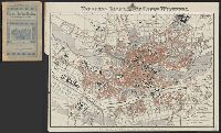
- Beinecke Rare Book and Manuscript Library > Neuester Plan der k[öniglichen] bayr[ischen] Stadt Nürnberg.
- Published / Created:
- 1797
- Call Number:
- 3213 1797
- Container / Volume:
- BRBL_00055
- Image Count:
- 1
- Resource Type:
- Maps, Atlases & Globes
- Found in:
- Beinecke Rare Book and Manuscript Library > A map of Kent.
- Creator:
- Des Barres, Joseph F. W. (Joseph Frederick Wallet), 1722-1824
- Published / Created:
- 1775?-1781?]
- Call Number:
- 1983 Folio 25
- Image Count:
- 3
- Resource Type:
- Maps, Atlases & Globes
- Found in:
- Beinecke Rare Book and Manuscript Library > [The Atlantic Neptune : published for the use of the Royal Navy Great Britain / by Joseph F.W. Des Barres, esq.].
- Creator:
- Bowles, Carington, 1724-1793
- Published / Created:
- [1766]
- Call Number:
- ByzL 79t
- Collection Title:
- A new and accurate history and survey of London, Westminster, Southwark, and places adjacent
- Image Count:
- 1
- Resource Type:
- Maps, Atlases & Globes
- Found in:
- Beinecke Rare Book and Manuscript Library > The London guide, or, a pocket plan of the cities of London & Westminster and Borough of Southwark; with the new buildings, &c. to the present year
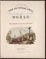
- Published / Created:
- 1854
- Call Number:
- 1976 Folio 96
- Collection Title:
- A new universal atlas containing maps of the various empires, kingdoms, states and republics of the
- Image Count:
- 1
- Resource Type:
- Maps, Atlases & Globes
- Found in:
- Beinecke Rare Book and Manuscript Library > A new universal atlas containing maps of the various empires, kingdoms, states and republics of the world ...