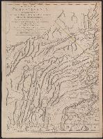
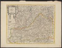
Imprint in three places along lower left, center, and right margin., Prime meridian: London. "Longitude west from London.", Relief shown by shading and hachures., and Revolutionary War era map of Pennsylvania, compiled by Sayer & Bennett, primarily from William
Publisher:
Printed for Robt. Sayer & J. Bennett, map & printseller No. 53 in Fleet Street. Published as the Act directs,
Subject (Geographic):
Pennsylvania--Administrative and political divisions--Maps--Early works to 1800. and Pennsylvania--Maps--Early works to 1800.
Subject (Name):
Penn, Richard, 1706-1771, dedicatee., Penn, Thomas, 1702-1775, dedicatee., and Robert Sayer and John Bennett (Firm), publisher, printseller.
Imprint in three places along lower left, center, and right margin., Prime meridian: London. "Longitude west from London.", Relief shown by shading and hachures., Revolutionary War era map of Pennsylvania, compiled by Sayer & Bennett, primarily from William Schull's map. The detailed map extending from Fort Pitt (formerly Fort Duquesne) in the west to the New Jersey border along the Delaware river to the east., Scale of "English Miles 69 1/2 to a Degree"., Separately published and in editions of "The North American Atlas" published by Faden; and Thomas Jefferys' The American atlas. 1775;, and Shows counties, townships, towns and cities, Indian villages, stores, churches, taverns, and names of residents in the countryside; rivers and streams, waterfalls, ferries, swamps, springs, and landmarks; mills, mines, furnaces, and forges; and forts and French and Indian War battle sites. - Cf. Seller & Van Ee, Maps and charts of North America and West Indies, 1750-1789, entry 1296.
Publisher:
Printed for Robt. Sayer & J. Bennett, map & printseller No. 53 in Fleet Street. Published as the Act directs,
Subject (Geographic):
Pennsylvania--Administrative and political divisions--Maps--Early works to 1800. and Pennsylvania--Maps--Early works to 1800.
Subject (Name):
Penn, Richard, 1706-1771, dedicatee., Penn, Thomas, 1702-1775, dedicatee., and Robert Sayer and John Bennett (Firm), publisher, printseller.
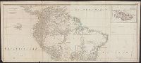
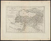
Also appeared in Kitchin's General atlas describing the whole universe. London : Printed for Robert Sayer, [1780]., Includes descriptive notes and text "Division of South America with a summary account of its trade," and large ornamental cartouche., Inset map: Chart of the Falkland's Islands : named by the French Malouine Islands, and discovered by Hawkins in the year 1595. Scale [ca. 1:2,000,000]., Prime meridian: Ferro., Relief shown pictorially; depths by soundings., Sheets measures 54 x 122.7 cm., and Sheets mounted together to form 2 sheets.
Publisher:
Printed for Robert Sayer,
Subject (Geographic):
Falkland Islands--Maps--Early works to 1800 and South America--Maps--Early works to 1800
Subject (Name):
Anville, Jean Baptiste Bourguignon d', 1697-1782, Kitchin, Thomas, d. 1784, and Kitchin, Thomas, d. 1784. General atlas describing the whole universe
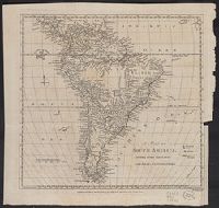
Both sheets backed with paper., Includes text and historical notes., Inset: Chart of Falkland Islands named by the French Malouine Islands and discovered by Hawkins in the year 1593., Outline color., Prime meridian: Ferro., Relief sh, and Watermarks on both sheets.
Publisher:
Sayer and Bennett,
Subject (Geographic):
Falkland Islands--Maps--Early works to 1800 and South America--Maps--Early works to 1800
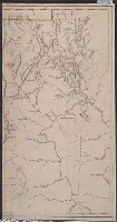
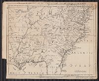
London magazine, or, Gentleman's monthly intellegencer. v. 24. July 1755.
Description:
Appears in: London magazine, or, Gentleman's monthly intelligencer. (July 1755) v.24, p. 312., Covers also part of Pennsylvania, Delaware, Louisiana, and Arkansas., Hand col. Sheet measures 64.3 x 54.8 cm. Ms. no.: 15. Cross Collection no. 184., Prime meridian: London., Relief shown by landform drawings., and Shows names of English settlements, Native territories, drainage, and other points of interest.
Publisher:
Printed for R. Baldwin ...,
Subject (Geographic):
Maryland--Maps--Early works to 1800, New Jersey--Maps--Early works to 1800, and South Atlantic States--Maps--Early works to 1800