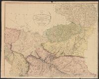
Electorate of Brunswick-Luneburg with its dependencies
Description:
Imperfect: torn along fold, with some loss of text. Sheet measures 75.0 x 62.4 cm. No. 30 of 34 maps bound together., Inset map: Plan of the battle of Minden on the 1st of August 1759., Prime meridian: Ferro., and Relief shown pictorially.
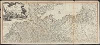
Also appeared in Faden's General atlas. London : William Faden, 1811?., Includes ornamental cartouche., Prime meridians: Ferro and London., Relief shown pictorially., and Sheets fit together with overlap.
Publisher:
Printed for Wm. Faden, Charing Cross,
Subject (Geographic):
Mediterranean Sea--Maps--Early works to 1800
Subject (Name):
Abbot, Charles,--Baron Colchester,--1757-1829--Bookplate and Faden, William, 1749-1836. General atlas