Skip to search
Skip to main content
Skip to first result
Search
You Searched For
Genre
Engravings
Resource Type
Maps, Atlases & Globes
New Search
Search Results
Call Number:
1985 +31
Collection Title:
L'isole piu famose del mondo / descritte da Thomaso Porcacchi da Castiglione Arretino e intagliate
Image Count:
1
Resource Type:
Maps, Atlases & Globes
Subject (Geographic):
Cuba
Subject (Topic):
Geography--Early works to 1800
Collection Created:
In Venetia : Appresso Simon Galignani & Girolamo Porro, 1572
Found in:
Beinecke Rare Book and Manuscript Library > Descrittione dell'isola Cuba, che dal Colombo fu scoperta insieme con la Spagnuloa
Call Number:
1976 +310
Collection Title:
L'isole piv famose del mondo descritte da Thomaso Porcacchi da Castiglione Arretino e intagliate da
Image Count:
1
Resource Type:
Maps, Atlases & Globes
Subject (Geographic):
Hispaniola
Subject (Topic):
Geography--Early works to 1800 and Islands
Collection Created:
Venetia, Appresso S. Galignani & G. Porro, 1576
Found in:
Beinecke Rare Book and Manuscript Library > Descrittione dell'isola Spagnuola
Call Number:
1975 +1
Collection Title:
L'isole piv famose del mondo descritte da Thomaso Porcacchi da Castiglione Arretino e intagliate da
Image Count:
1
Resource Type:
Maps, Atlases & Globes
Subject (Geographic):
Hispaniola
Subject (Topic):
Geography--Early works to 1800 and Islands
Collection Created:
Venetia, Appresso gli heredi di S. Galignani, 1604
Found in:
Beinecke Rare Book and Manuscript Library > Descrittione dell'isola Spagnuola
Call Number:
1985 +31
Collection Title:
L'isole piu famose del mondo / descritte da Thomaso Porcacchi da Castiglione Arretino e intagliate
Image Count:
1
Resource Type:
Maps, Atlases & Globes
Subject (Geographic):
Hispaniola
Subject (Topic):
Geography--Early works to 1800
Collection Created:
In Venetia : Appresso Simon Galignani & Girolamo Porro, 1572
Found in:
Beinecke Rare Book and Manuscript Library > Descrittione dell'isola Spagnuola prima iso la scoperta dal Colombo
Call Number:
1977 +246
Collection Title:
Geografia; cioè, Descrittione vniversale della terra. Partita in due volumi, nel primo de' quali si
Image Count:
1
Resource Type:
Maps, Atlases & Globes
Description:
Chapter XXXIIII [i.e. 34 cm.]
Collection Created:
In Padova, Appresso Paolo & Francesco Galignani, 1621, '20
Found in:
Beinecke Rare Book and Manuscript Library > Descrittione di tvtto'l mondo, secondo la prattica de Marinari. Vniversi orbis descriptio ad vsvm navigantivm
Call Number:
1977 +250
Collection Title:
Geografia; cioe, Descrittione vniversale della terra. Partita in due volumi, nel primo de’ quali si
Image Count:
1
Resource Type:
Maps, Atlases & Globes
Subject (Topic):
Geography, Ancient
Collection Created:
In Venetia, Appresso Gio. Battista & Giorgio Galignani, fratelli, 1597-8 [v.1 1598]
Found in:
Beinecke Rare Book and Manuscript Library > Descrittione di tvtto'l mondo, secondo la prattica de Marinari. Vniversi orbis descriptio ad vsvm navigantivm
Creator:
Published / Created:
[ca. 1696]
Call Number:
1973 Folio 10
Image Count:
1
Resource Type:
Maps, Atlases & Globes
Description:
Bar scales in Milliaria Germanica Communia and Milliaria Gallica Communia., Ferro meridian., No. 37 of 69 maps bound together in composite atlas., Relief shown pictorially., and Scale [ca. 1:775 000].
Publisher:
[Frederik de Wit]
Subject (Geographic):
Prussia, east (Poland and Russia) --Maps --Early works to 1800
Found in:
Beinecke Rare Book and Manuscript Library > Ducatus Prussiae tam Polono Regiae quam Brandenburgo Ducalis : correcta descriptio et divisio Regiae scilicet in tres Palatinatus, et Ducalis in totidem circulos, cum utrius[que] subdivisione in tractus minores
Published / Created:
1739
Call Number:
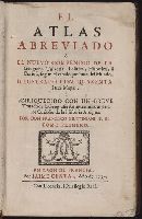
1975 2757
Collection Title:
El atlas abreviado, o, El nuevo compendio de la geografia universal, politica, historica, i curiosa
Image Count:
1
Resource Type:
Maps, Atlases & Globes
Description:
Verso blank.
Subject (Topic):
Atlases --Early works to 1900
Collection Created:
Leon de Francia : J. Certa, 1739
Found in:
Beinecke Rare Book and Manuscript Library > El atlas abreviado, o, El nuevo compendio de la geografia universal, politica, historica, i curiosa segun el estado presente del mundo ...
Creator:
Published / Created:
1680
Call Number:
1973 Folio 10
Image Count:
1
Resource Type:
Maps, Atlases & Globes
Alternative Title:
Europe divided into its principall parts viz. the Brittish [sic] Islands, Scandinavia, Moscovia, France, Germany, Poland, Spain, Italy, Turky [sic] in Europe ... described by Sanson, corrected and amended by William Berry
Description:
Dedicated To the most serene and most sacred majesty of Charles II ... by William Berry., Includes coat of arms and decorative cartouche containing dedication., No. 2 of 69 maps bound together in composite atlas., Prime meridian: Ferro., Relief shown pictorially., and Scale [ca. 1:75 000 000].
Publisher:
Sold by William Berry at ye sign of the globe between Charing-Cross and White-Hall
Subject (Geographic):
Europe --Maps --Early works to 1800, Russia --Maps --Early works to 1800, and Turkey --Maps --Early works to 1800
Found in:
Beinecke Rare Book and Manuscript Library > Europe divided into its principall states, which are subdivided into their principall provinces
Creator:
Published / Created:
[ca. 1680]
Call Number:
1973 Folio 10
Image Count:
1
Resource Type:
Maps, Atlases & Globes
Description:
No. 45 of 69 maps bound together in composite atlas., Oriented with north to bottom right., Place-names in Dutch., and Scale not given.
Publisher:
Gedruckt tot Amsterdam by Fredrick de Wit ...
Subject (Geographic):
Amsterdam (Netherlands) --Aerial views --Early works to 1800 and Amsterdam (Netherlands) --Maps --Early works to 1800
Found in:
Beinecke Rare Book and Manuscript Library > Exactissima Amstelodami veteris et novissimi delineatio
Branch:v1.61.6 ,Deployed:2024-06-12T09:55:36-04:00