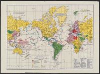
Ancillary maps on verso: [1.] The far east. Scale [ca. 1:40 900 000] at equator -- [2.] Western hemisphere defense map. Scale [ca. 1:35 000 000]. and Legend and dates of war declarations.
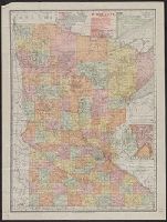
Includes index to railroads, and insets of Cook County and Minneapolis-St. Paul vicinity. and Index to "Counties, creeks, Indian reservations ..." and advertisement on verso.
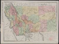
Also shows railroads., Below scale: Rand McNally's new business atlas map of Montana. Copyright 1911 .... Copyright 1909 ...., Indexed., and Relief shown by hachures and spot heights.
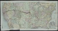
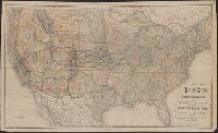
Lists general superintendents and general passenger and ticket agents for Union Pacific Railroad Company and Central Pacific Railroad Company., Relief shown by hachures., and Shows Union Pacific-Central Pacific transcontinental railroad, its land grants, other railroads, proposed railroads, and stage routes.
Publisher:
Rand, McNally & Co.,
Subject (Name):
Central Pacific Railroad Company, Central Pacific Railroad Company--Maps, Union Pacific Railroad Company, and Union Pacific Railroad Company--Maps
Subject (Topic):
Railroad land grants--West (U.S.)--Maps, Railroads--United States--Maps, and Railroads--West (U.S.)--Maps
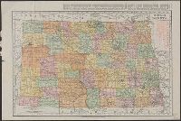
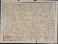
Rand McNally & Co.'s new business atlas map of North Dakota.
Description:
Below scale: Rand McNally & Co.'s new business atlas map of North Dakota. Copyright 1911 ... Copyright 1909 by Rand McNally & Co., Indexed., Relief shown by hachures., and Shows railroads, counties, and drainage.
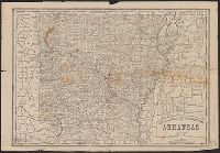
Copyright: Rand, McNally & Co., Includes tables of taxable property and rainfall measures, list of railway lines, and text of state finances., Relief shown by hachures., and Shows counties and railroads.
Publisher:
Rand, McNally & Co.,
Subject (Geographic):
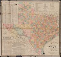
Texas--Administrative and political divisions--Maps and Texas--Maps
Subject (Name):
Spaight, A. W and Texas. Dept. of Agriculture, Insurance, Statistics and History. Resources, soil, and climate of Texas
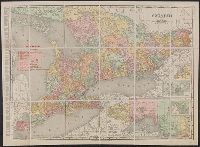
Rand McNally & Co.'s New Business Atlas Map of Ontario
Description:
"Rand McNally & Co.'s New Business Atlas Map of Ontario. Copyright, 1909, by Rand McNally & Co. Copyright, 1892, by Rand McNally & Co.", "The Municpal Counties are shown in tints.", and Includes insets of varying scales: Western Portion of Ontario, River St. Ma