Atlas accompanying geological survey of Wisconsin. and Geology of Wisconsin. Survey of 1873-1879.
Description:
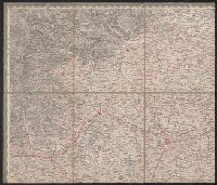
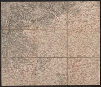
Accompanies: Geology of Wisconsin. Survey of 1873-1879. 4 v. ; 27 cm., Cover title: Atlas accompanying ... geological survey of Wisconsin., Imperfect: library has only plates 3, 4, 5, 6, and 7 (Moses Strong) and plates 3 and 9 (T.C., and Includes cross-sections.
Publisher:
Wisconsin Geological Survey,
Subject (Geographic):
Wisconsin--Maps
Subject (Name):
Chamberlin, Thomas C. (Thomas Chrowder), 1843-1928, Irving, Roland Duer, 1847-1888, Milwaukee Lith. & Engr. Co, and Strong, Moses, 1846-1877
Subject (Topic):
Geology--Wisconsin--Maps and Mines and mineral resources--Wisconsin--Maps
Copy 2: Imperfect: disbound; all sheets but Belluno, Trient, Padua, and Verona wanting; trimmed along neat line, with loss of marginal data. Sheets dissected and mounted on cloth. Stamps on verso: K.K. Un and Relief shown by hachures and spot heights.
Publisher:
Im Verlage der Herder'schen Kunst und Buchhandlung,
Copy 1: Imperfect: disbound; all sheets but Padua, Verona, and Milano wanting; trimmed along neat line, with loss of marginal data. Sheets dissected and mounted on cloth. and Relief shown by hachures and spot heights.
Publisher:
Im Verlage der Herder'schen Kunst und Buchhandlung,
Ferro meridian., From Bleau's Atlas major (German ed.). Zu Amsterdam : Bey Johannem Blaeu, [ca. 1670]., No. 58 of 69 maps bound together in composite atlas., Relief shown pictorially., and Scale [ca. 1:4 000 000].
[Atlas factice of 42 maps, produced by the Homann Erben firm]
Image Count:
1
Resource Type:
Maps, Atlases & Globes
Alternative Title:
Belgium Catholicum seu decem provinciae Germaniae inferioris and Carte des Pais Bas catholiques ou des X provinces de l’Allegmagne inferieure, etc. dessinee au juste selon les exactes observations astronomiques et operations geometriques des Messur. Cassini, Snellius, Muschenbrok, etc. dressee par Sr. Tobias Maier, mathematicien; aux depens des Heritiers de Homann
Publisher:
Edentibus Homannianis heredib
Subject (Geographic):
Belgium --Maps --Early works to 1800 and Luxembourg --Maps --Early works to 1800
Bar scales in Milliaria Germanica Communia and Milliaria Gallica Communia., Ferro meridian., No. 37 of 69 maps bound together in composite atlas., Relief shown pictorially., and Scale [ca. 1:775 000].
Publisher:
[Frederik de Wit]
Subject (Geographic):
Prussia, east (Poland and Russia) --Maps --Early works to 1800
Europe divided into its principall parts viz. the Brittish [sic] Islands, Scandinavia, Moscovia, France, Germany, Poland, Spain, Italy, Turky [sic] in Europe ... described by Sanson, corrected and amended by William Berry
Description:
Dedicated To the most serene and most sacred majesty of Charles II ... by William Berry., Includes coat of arms and decorative cartouche containing dedication., No. 2 of 69 maps bound together in composite atlas., Prime meridian: Ferro., Relief shown pictorially., and Scale [ca. 1:75 000 000].
Publisher:
Sold by William Berry at ye sign of the globe between Charing-Cross and White-Hall
Subject (Geographic):
Europe --Maps --Early works to 1800, Russia --Maps --Early works to 1800, and Turkey --Maps --Early works to 1800
Bat. cum Privil. Ordin. Gener, Belgii Faederati--Title cartouche., Features include ornate title cartouche (top left) with cherubs, male and female figures and royal coat-of-arms supported by lion and unicorn, arms of Scotland supported by cherubs (above scale cartouche at top right), compass indicator and coasts shaded outwards., In Latin with some place names in English; explanations and title for index to places in Dutch and English., No. 7 of 69 maps bound together in composite atlas., Relief shown pictorially., Scale [ca. 1:960 000]., Scale statement reads: Milliaria Germanica Communia 15 in uno Gradu, with scale bar graded [0]-10; Milliaria Scotica Communia quorum 50 in uno Gradu, with scale bar graded [0]-34; Milliaria Gallica quae et Horae Itineris 20 in uno Gradu, with scale bar graded [0]-14., Shows grid, rivers and tributaries, lochs (shaded), trees, place and county names, settlements (symbols classified by importance in legend), territorial boundaries., Shows Scotland including the Hebrides and Orkney Islands., and The four cardinal points are written in the borders.