
You Searched For
« Previous
| 1 - 10 of 236 |
Next »
Search Results


- Published / Created:
- 1850
- Call Number:
- 1976 Folio 96
- Collection Title:
- A new universal atlas containing maps of the various empires, kingdoms, states and republics of the
- Image Count:
- 1
- Resource Type:
- Maps, Atlases & Globes
- Publisher:
- Thomas, Cowperthwait & Co
- Subject (Geographic):
- Connecticut
- Collection Created:
- Philadelphia, Cowperthwait, DeSilver & Butler, 1854, c1850
- Found in:
- Beinecke Rare Book and Manuscript Library > 10. Map of Connecticut
- Creator:
- Erdoes, Richard, 1912-2008
- Published / Created:
- 1976-1983, undated
- Call Number:
- WA MSS S-2609
- Collection Title:
- Richard Erdoes papers
- Container / Volume:
- Box 46 | Plains Indian History II
- Image Count:
- 40
- Description:
- The description of this slide reflects the way that Erdoes organized 35mm slides. Erdoes arranged his slides in labeled containers that were sub-divided into labeled sections. The title for this image has been transcribed from its sub-section label; images of other slides from the same sub-section share the container title. The date listed here reflects a span of known dates associated the sub-section. In some cases, titles have been expanded to note particular individuals who appear frequently and who were identified by Erdoes in captions. Individual slide captions have not been transcribed or captured during digitization.
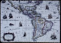
- Subject (Geographic):
- North America--Maps--Early works to 1800 and South America--Maps--Early works to 1800
- Found in:
- Beinecke Rare Book and Manuscript Library > 18th Century Maps

- Published / Created:
- 1846
- Call Number:
- 1976 Folio 93
- Collection Title:
- A new universal atlas containing maps of the various empires, kingdoms, states and republics of the
- Image Count:
- 1
- Resource Type:
- Maps, Atlases & Globes
- Publisher:
- S. Augustus Mitchell
- Subject (Geographic):
- Connecticut
- Collection Created:
- Philadelphia, S.A. Mitchell, 1847, c1844
- Found in:
- Beinecke Rare Book and Manuscript Library > 9. Connecticut

- Creator:
- Russell, John, fl. 1733-1795
- Published / Created:
- 1794 July 26
- Call Number:
- 1986 102
- Collection Title:
- An historical, geographical, commercial, and philosophical view of the American United States, and
- Image Count:
- 1
- Description:
- Engraved by J. Russell, Constitution Row, Grays Inn Lane. and Facing p. 157.
- Publisher:
- Publish'd as the Act directs, by H.D. Symonds, No. 20 Pater Noster Row
- Subject (Geographic):
- America --Description and travel, America --History --To 1810, United States --Description and travel, and United States --Maps --Early works to 1800
- Collection Created:
- London, Printed for the editor; J. Ridgway [etc.] 1795
- Found in:
- Beinecke Rare Book and Manuscript Library > A General map of North America drawn from the best sources
6.

- Creator:
- Hutchins, Thomas, 1730-1789
- Call Number:
- Vanderbilt 147
- Collection Title:
- An historical account of the expedition against the Ohio Indians, in the year 1764. Under the
- Image Count:
- 1
- Alternative Title:
- A Topographical plan of that part of the Indian country thro
- Description:
- Between p. 32 & p. 33.
- Subject (Geographic):
- Fort Pitt (Pa.) --History, Ohio River Valley --History --Revolution, 1775-1783, and Pennsylvania --History
- Subject (Name):
- Bouquet, Henry, 1719-1765
- Subject (Topic):
- Bouqet’s Expedition, 1764, Bushy Run, Battle of, Pa., 1763, Indians of North America --Wars --1750-1815, and Indians --Warfare
- Collection Created:
- Philadelphia, Printed and sold by W. Bradford, 1765
- Found in:
- Beinecke Rare Book and Manuscript Library > A General map of the country on the Ohio and Mushkingham shewing the situation of the Indian-towns with respect to the army under the command of Colonel Bouquet by Thos. Hutchins. Asst. Engineer
7.

- Published / Created:
- 1776
- Call Number:
- Cb23 27
- Collection Title:
- The American military pocket atlas : being an approved collection of correct maps, both general and
- Image Count:
- 1
- Alternative Title:
- The Seat of war, in the northern colonies, containing the province of Quebec, Newfoundland, Nova-Scotia, New-England, New-York, New-Jersey, Pennsylvania, &ca
- Description:
- 14th August 1776. and Teaching resource: Professor John Mack Faragher, History 141: The American West.
- Publisher:
- Printed for Robt. Sayer & Jno. Bennett, Map and Sea Chartsellers, No. 53, Fleet Street, as the Act directs
- Subject (Geographic):
- New England --Maps --Early works to 1800, North America --Maps --Early works to 1800, and United States --History --Revolution, 1775-1783 --Maps
- Collection Created:
- London : Printed for R. Sayer and J. Bennet, [1776]
- Found in:
- Beinecke Rare Book and Manuscript Library > A General map of the northern British colonies in America. which comprehends the province of Quebec, the government of Newfoundland, Nova-Scotia, New-England and New-York. From the maps published by the Admiralty and Board of Trade regulated by the astronomic and trigonometric observations of M. von Holland and corrected from Governor Pownall's late map 1776.
8.

- Creator:
- Romans, B
- Published / Created:
- 1776
- Call Number:
- Cb23 27
- Collection Title:
- The American military pocket atlas : being an approved collection of correct maps, both general and
- Image Count:
- 1
- Alternative Title:
- The Seat of war, in the southern British colonies, comprehending North and South Carolina, Georgia, east and west Florida, &ca
- Description:
- 15th Oct. 1776., Inset: Plan of Charlestown and plan of St. Augustine., and Teaching resource: Professor John Mack Faragher, History 141: The American West.
- Publisher:
- Printed for R. Sayer & J. Bennett, Map, Chart and Printsellers, No. 53 Fleet Street, as the Act directs
- Subject (Geographic):
- North America --Maps --Early works to 1800, Southern States --Maps --Early works to 1800, and United States --History --Revolution, 1775-1783 --Maps
- Collection Created:
- London : Printed for R. Sayer and J. Bennet, [1776]
- Found in:
- Beinecke Rare Book and Manuscript Library > A General map of the southern British colonies, in America, comprehending North and South Carolina, Georgia, east and west Florida, with the neighbouring Indian countries. From the modern surveys of engineer de Brahm, Capt. Collet, Mouzon & others; and from the large hydrographical survey of the coasts of east and west Florida

- Creator:
- J. F. L
- Call Number:
- 1998 2141
- Collection Title:
- Der ausfuehrlichen nachrichten von der koeniglich-gross-britannischen colonie saltzburgischer
- Image Count:
- 1
- Description:
- Preceding Avertissement.
- Subject (Geographic):
- Augsburg. Evangelisches Armenhaus, Georgia --History --Colonial period, ca. 1600-1775, and Savannah (Ga.)
- Subject (Name):
- Kraus, Marcus Friedrich, 1723-1772 and Urlsperger, Maria Magdalena
- Subject (Topic):
- Germans --Georgia, Indians of North America, Lutherans --Georgia, Salzburgers --Georgia, and Slavery --Georgia
- Collection Created:
- Halle, In verlegung des Weysenhauses, 1741 [1735]-52
- Found in:
- Beinecke Rare Book and Manuscript Library > A Map of the county of Savannah

- Call Number:
- Egf 789
- Collection Title:
- The American geography; or, A view of the present situation of the United States of America
- Image Count:
- 1
- Description:
- Preceding p. 33.
- Subject (Geographic):
- France --History --Revolution, 1789-1799, United States --Description and travel, and United States --Maps --Early works to 1800
- Subject (Topic):
- Geography --Textbooks --Early works to 1800 and Maps --United States --1788
- Collection Created:
- Elizabeth Town : Printed by Shepard Kollock, for the author, M,DCC,LXXXIX
- Found in:
- Beinecke Rare Book and Manuscript Library > A Map of the northern and middle states; comprehending the western Territory and the British dominions in North America. Compiled from the best authorities