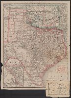
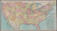
Rand, McNally & Co.'s Texas and Indian Territory and Texas and the Indian Territory
Description:
Includes map of western portion of Texas., Library's copy annotated in red ink and blue pencil., Library's copy attached to map showing, Prime meridians: Greenwich and Washington., Relief shown by hachures., and Shows county outlines, county seats, and railroads.
Publisher:
Rand, McNally & Co.,
Subject (Geographic):
Indian Territory--Maps, Texas--Administrative and political divisions--Maps, and Texas--Maps
Subject (Topic):
Railroads--Indian Territory--Maps, Railroads--Texas--Denison--Maps, and Railroads--Texas--Maps
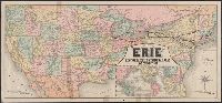
"Jno. B. Loveland, Gen'l European Passenger Agent, Liverpool, England.", "Martin B. Brown, Railroad Printer, 49 & 51 Park Place, New York.", Includes text and timetables on verso., Inset: Around the world, across the American continent via Erie Railway., and Show
Publisher:
Rand, McNally & Co.,
Subject (Name):
New York, Lake Erie, and Western Railroad Company and New York, Lake Erie, and Western Railroad Company--Maps
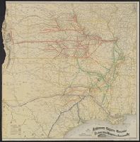
"12-20'27" and "5410." and Includes inset of "Canadian Pacific Railway and steamship lines."
Publisher:
Poole Bros.,
Subject (Geographic):
Canada--Maps and United States--Maps
Subject (Name):
Canadian Pacific Railway Company, Duluth, South Shore, and Atlantic Railway Company, Duluth, South Shore, and Atlantic Railway Company--Maps, and Spokane International Railway--Maps
Subject (Topic):
Railroads--Canada--Maps and Railroads--United States--Maps
Sportsman's map of Canada and the Northwest Territory.
Description:
Date taken from Yale card catalog indicating map was originally in cover with date of issue, March 1901; also with a cover title, "The sportsman's map of Canada and the Northwest Territory." and Relief shown by hachures.
Publisher:
Poole Bros.,
Subject (Geographic):
Canada--Maps and United States--Maps
Subject (Name):
Canadian Pacific Railway Company, Canadian Pacific Railway Company--Maps, Duluth, South Shore, and Atlantic Railway Company, and Duluth, South Shore, and Atlantic Railway Company--Maps
Subject (Topic):
Railroads--Canada--Maps and Railroads--United States--Maps
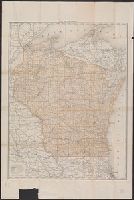
Cover title: Map of Beaver County, Oklahoma and Surrounding Country, showing Town of Hooker. and Verso: Beaver County, Oklahoma [Scale not given ; 11 x 43 cm.].