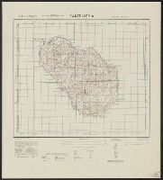
Great Britain. War Office. General Staff. Geographical Section
Published / Created:
1943
Call Number:
40 P19 1942
Container / Volume:
BRBL_00213
Image Count:
1
Resource Type:
Maps, Atlases & Globes
Alternative Title:
Geographical Section, General Staff ; no. 4162 and GSGS (Series) ; 4162.
Description:
"3-43.", "Copied from an Italian map of 1896.", "Grid added November 1942.", Military grid., and Relief shown by contours, rock drawings, and spot heights.
Great Britain. War Office. General Staff. Geographical Section
Published / Created:
1942
Call Number:
67 T21 1942
Container / Volume:
BRBL_00349
Image Count:
1
Resource Type:
Maps, Atlases & Globes
Alternative Title:
Geographical Section, General Staff ; no. 4241, GSGS (Series) ; 4241., and Morocco 10 000.
Description:
"Copied from a French map dated 1920. Revised ... by War office, 1941., Elevations shown by spot heights and form lines., In upper margin: Morocco 1:10,000 ..., and Military grid.
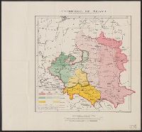
Great Britain. War Office. General Staff. Geographical Section
Published / Created:
1918]
Call Number:
356ed 1918
Container / Volume:
BRBL_00114
Image Count:
1
Resource Type:
Maps, Atlases & Globes
Alternative Title:
G.S.G.S. ; no. 3703a and GSGS (Series) ; 3703a.
Description:
"The information for Austria-Hungary and Poland is derived from documents prepared by the Naval Staff I.D. 32." and Ancillary map shows population density.
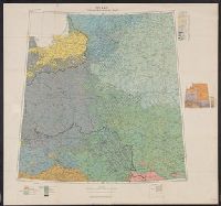
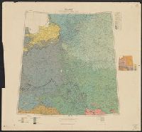
Great Britain. War Office. General Staff. Geographical Section
Published / Created:
1918
Call Number:
11hcf 1919D-3
Container / Volume:
BRBL_00010X
Image Count:
1
Resource Type:
Maps, Atlases & Globes
Alternative Title:
G.S.G.S. ; 3703a and GSGS (Series) ; 3703a.
Description:
Includes chart "Population of certain towns," and index to adjoining maps in series. and Inset map: Density of population.
Publisher:
War Office [G.S.G.S.],
Subject (Topic):
Ethnology--Europe, Central--Maps, Ethnology--Europe, Eastern--Maps, Ethnology--Poland--Maps, Population density--Europe, Central--Maps, Population density--Europe, Eastern--Maps, and Population density--P
Great Britain. War Office. General Staff. Geographical Section
Published / Created:
1943
Call Number:
38 L562 1943
Container / Volume:
BRBL_00158
Image Count:
1
Resource Type:
Maps, Atlases & Globes
Alternative Title:
France 1:4,000, Geographical Section, General Staff ; no. 4234, and GSGS (Series) ; 4234.
Description:
"2nd edition, 1943.", "6-43.", "Air photographs have been used in the production of this plan.", "Grid provisional, Nord de guerre grid.", "Published by War Office, 1943.", Important streets and buildings are named., and Relief shown by rock drawings.
Great Britain. War Office. General Staff. Geographical Section
Published / Created:
1905
Call Number:
5616 1905
Container / Volume:
BRBL_00299
Image Count:
1
Resource Type:
Maps, Atlases & Globes
Alternative Title:
GSGS (Series) ; 1936., Province of Shandong, and T.S.G.S. ; no. 1936
Description:
Includes an English, Chinese explanation and a list of sources of information., Map of the Chinese province Shandong showing province and colonial boundaries, transportation, communications, ground and water features, missions and populated places., and Relief
Publisher:
Reproduced and printed for the Topographical Section, General Staff, at the Ordnance Survey Office,
Great Britain. War Office. General Staff. Geographical Section
Published / Created:
1942, 1943 printing.
Call Number:
331gm 1943
Container / Volume:
BRBL_00080
Image Count:
1
Resource Type:
Maps, Atlases & Globes
Alternative Title:
Geographical Section, General Staff ; no. 4183 and GSGS (Series) ; 4183.
Description:
"5-43.", "6/42/G.S.G.S.", "N5047-E402/239x309.", "War Office, 1942.", Five classes of railroads with various traffic facilities, and navigable canals and rivers are shown., and Includes inset maps: Continuation west -- Amsterdam -- Rotterdam -- Antwerp.
Publisher:
Army Map Service, U.S. Army, and War Office ;
Subject (Topic):
Nautical charts--Netherlands, Railroads--Netherlands--Maps, and Waterways--Netherlands--Maps