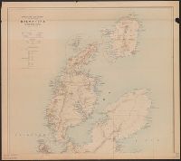
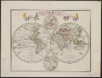
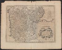
"C. Sepp del. et sculps. 1744.", Cross collection no. 37., In Dutch., Includes 2 smaller circular polar maps, and decorative cartouche., Mounted on linen., Ms. note at head of map: No. J., Relief shown pictorially., and Scale measured at center of hemisphere.
Maps numbered in manuscript 1 to 97; wanting 2, 42, 45, 51, 52, 74, 85, 89, 92 and 93., Some maps dated 1704-1717, others without date., Some maps first published in J. van Keulen's De nieuwe groote lichtende zee-fackel and G. van Keulen's De groote nieuwe vermeerderde zee-atlas., Title devised by cataloger., and With engraved title-page: "Gedruckt tot Amsterdam bÿ Ioannes van Keulen, boeck zee-kaardt verkooper en graad-boogh maker aande oost zÿde vande Nieuwebrug inde gekroonde Lootsman. Met previlegie ... 1718"; engraved title-page has same illustration as J. van Keulen's De groote nieuwe vermeerderde zee-atlas ofte water-werelt ... 1681.
Publisher:
s.n.,
Subject (Name):
Keulen, Gerard van., Keulen, Johannes van, 1654-1715. Groote nieuwe vermeerderde zee-atlas ofte water-waereld., Keulen, Johannes van, 1654-1715. Nieuwe groote lichtende zee-fakkel., Schenk, Peter, 1660-1718 or 1719., and Valck, G. (Gerard), 1651 or 1652-1726.
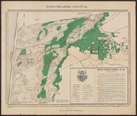
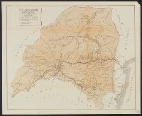
Coverage includes Breda, Leuven, Maastricht, Eindhoven, and the portion of Germany containing Aachen., Legend in German; place names in Dutch with parenthetical German forms., and Title supplied by cataloger.
Publisher:
s.n.,
Subject (Geographic):
Belgium--Boundaries--Netherlands--Maps and Netherlands--Boundaries--Belgium--Maps