Search
You Searched For
Search Results
- Published / Created:
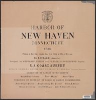
- 1876
- Call Number:
- 766cea N46 1876
- Container / Volume:
- BRBL_00474
- Image Count:
- 15
- Resource Type:
- Maps, Atlases & Globes
- Found in:
- Beinecke Rare Book and Manuscript Library > Harbor of New Haven, Connecticut.
- Published / Created:
- [ca. 1840-1841]
- Call Number:
- WA MSS S-2050 J774
- Image Count:
- 15
- Resource Type:
- Archives or Manuscripts
- Found in:
- Beinecke Rare Book and Manuscript Library > Joseph Valliere Spanish land grant papers
- Creator:
- Chishitsu Chōsajo (Japan)
- Published / Created:
- 1899
- Call Number:
- 57 1899A
- Container / Volume:
- BRBL_00302
- Image Count:
- 15
- Resource Type:
- Maps, Atlases & Globes
- Found in:
- Beinecke Rare Book and Manuscript Library > Topographical map of the Japanese Empire, 1899 / Imperial Geological Survey of Japan ; drawn by T. Togawa and K. Suzuki ; engraved by N. Matsudaira.
- Call Number:
- 766 N46 1917
- Container / Volume:
- BRBL_00473A
- Image Count:
- 15
- Resource Type:
- Maps, Atlases & Globes
- Found in:
- Beinecke Rare Book and Manuscript Library > [City of New Haven] 1913-1917.
- Published / Created:
- 1878
- Call Number:
- 32 L84 1741A
- Container / Volume:
- BRBL_00048
- Image Count:
- 16
- Resource Type:
- Maps, Atlases & Globes
- Found in:
- Beinecke Rare Book and Manuscript Library > Environs of London By John Rocque 1741-1745. London, 1746-63.
- Creator:
- United States. Congress. House. Committee on the Public Lands
- Published / Created:
- [1878?].
- Call Number:
- 75 1878
- Container / Volume:
- BRBL_00406
- Image Count:
- 16
- Resource Type:
- Maps, Atlases & Globes
- Found in:
- Beinecke Rare Book and Manuscript Library > 1876 Centennial map of the United States and territories : showing the extent of public surveys, indian and military reservations, land grant R.R. rail roads, canals, cities, towns & other details / compiled from the official surveys of the General Land O
- Creator:
- Allied Forces
Great Britain. War Office. General Staff. Geographical Section
- Published / Created:
- 1943-
- Call Number:
- 11hd 1942D-44
- Image Count:
- 14
- Resource Type:
- Maps, Atlases & Globes
- Found in:
- Beinecke Rare Book and Manuscript Library > Central Europe 1:100,000.
- Creator:
- Rocque, John, -1762.
- Published / Created:
- 1746
- Call Number:
- 2002 Folio 94
- Image Count:
- 16
- Resource Type:
- Maps, Atlases & Globes
- Found in:
- Beinecke Rare Book and Manuscript Library > An exact survey of the city's of London and Westminster, ye borough of Southwark and the country near ten miles round : begun in 1741, finished in 1745, and published in 1746, according to act of Parliament / by John Rocque ; engrav'd by Richard Parr and printed by W. Pratt ... = Urbium maxime insignium Londini et Westmonasterii nec non municipii Sudovercencis, regionumque ad decem quasi milliaria circumjacentium : delineatio ichnographica anno 1741 incohata 1745 absoluta / a Johanne Rocque ... = Carte topographique des villes de Londres, Westminster, et bourg de Southwark et de leurs environs : levée très exactement sur les lieux, en 1741, achevée en 1745, et publieé selon un acte de Parlement en 1746 / par Jean Rocque.
- Published / Created:
- [1750?]
- Call Number:
- 38cea 1750
- Container / Volume:
- BRBL_00169
- Image Count:
- 17
- Resource Type:
- Maps, Atlases & Globes
- Found in:
- Beinecke Rare Book and Manuscript Library > [North and East Coast of France].
- Creator:
- Morgan, William, -1690
- Published / Created:
- 1682] and 1904.
- Call Number:
- 32 L84 1682/1904
- Container / Volume:
- BRBL_00737
- Image Count:
- 12
- Resource Type:
- Maps, Atlases & Globes
- Found in:
- Beinecke Rare Book and Manuscript Library > London &c. actually surveyed, by Wm. Morgan, his ma[jes]ties cosmogr., 1681/2.
- Creator:
- Newcourt, Richard, d. 1679
- Published / Created:
- 1658. and 1905.
- Call Number:
- 32 L84 1658/1905
- Container / Volume:
- BRBL_00737
- Image Count:
- 12
- Resource Type:
- Maps, Atlases & Globes
- Found in:
- Beinecke Rare Book and Manuscript Library > An exact delineation of the cities of London and Westminster and the suburbs thereof, together wth. ye burrough of Sovthwark and all ye through-fares, highwaies, streetes, lanes & common allies wthin. ye same. Composed by a scale, and ichnographically described by Richard Newcovrt of Somerton in the countie of Somersett, gentleman. Willm. Faithorne, sculpsit.
- Creator:
- Kip, Johannes, 1653-1722
- Published / Created:
- 1903
- Call Number:
- 32 L84 1720/1903
- Container / Volume:
- BRBL_00736
- Image Count:
- 12
- Resource Type:
- Maps, Atlases & Globes
- Found in:
- Beinecke Rare Book and Manuscript Library > A prospect of the city of London, Westminster and St. James Park = veue et perspective de la ville de Londre, Westminster et Parc St. Jacques / John Kip delineavit et sculpsit.
- Creator:
- Great Britain. Ordnance Survey
- Published / Created:
- 1920-21.
- Call Number:
- 32 1920B
- Container / Volume:
- BRBL_00745
- Image Count:
- 11
- Resource Type:
- Maps, Atlases & Globes
- Found in:
- Beinecke Rare Book and Manuscript Library > Ordnance Survey of Great Britain 1/4 inch to one mile.
- Creator:
- Jones, Lewis A
- Published / Created:
- 1915
- Call Number:
- 794gcf B48 1914
- Container / Volume:
- BRBL_00521
- Image Count:
- 11
- Resource Type:
- Maps, Atlases & Globes
- Found in:
- Beinecke Rare Book and Manuscript Library > A report on the methods and cost of reclaiming the overflowed lands along the Big Black River, Mississippi / by Lewis A. Jones ; assisted by W.J. Schlick and C.E. Ramser.
- Published / Created:
- 1769
- Call Number:
- 32 1769
- Container / Volume:
- BRBL_00043
- Image Count:
- 11
- Resource Type:
- Maps, Atlases & Globes
- Found in:
- Beinecke Rare Book and Manuscript Library > England and Wales ... Engraved by Thos. Kitchin.
- Creator:
- Geo. W. Stadly & Co
- Published / Created:
- [186-?]
- Call Number:
- 754hc 1862C
- Container / Volume:
- BRBL_00421
- Image Count:
- 13
- Resource Type:
- Maps, Atlases & Globes
- Found in:
- Beinecke Rare Book and Manuscript Library > [13 maps showing positions of the Union and Confederate armies during the year 1862] / drawn and printed by Geo. W. Stadly & Co.
- Published / Created:
- 1888
- Call Number:
- 32 Ox1 1768
- Container / Volume:
- BRBL_00052A
- Image Count:
- 20
- Resource Type:
- Maps, Atlases & Globes
- Found in:
- Beinecke Rare Book and Manuscript Library > Sixteen Old Maps of Properties in Oxfordshire (with one in Berkshire) ... Illustrating the open field system. 1605-1768.
- Creator:
- Assam (India). Survey Office
- Published / Created:
- [1943?]
- Call Number:
- 59gm As72 1943
- Container / Volume:
- BRBL_00319
- Image Count:
- 21
- Resource Type:
- Maps, Atlases & Globes
- Found in:
- Beinecke Rare Book and Manuscript Library > Map of Assam showing roads & railways
- Creator:
- King, Nicholas, d. 1812
- Published / Created:
- [1888]
- Call Number:
- 779 W27 1803
- Container / Volume:
- BRBL_00505
- Image Count:
- 19
- Resource Type:
- Maps, Atlases & Globes
- Found in:
- Beinecke Rare Book and Manuscript Library > The King plats of the city of Washington in the District of Columbia 1803.
- Creator:
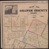
- Walling, Henry Francis, 1825-1888
- Published / Created:
- 1858, c1856.
- Call Number:
- 763 Or1 1858
- Container / Volume:
- BRBL_00452
- Image Count:
- 4
- Resource Type:
- Maps, Atlases & Globes
- Found in:
- Beinecke Rare Book and Manuscript Library > Map of Orange County, Vermont / from surveys under the direction of H.F. Walling ; engraved, printed, colored & mounted at H.F. Walling's map establishment.