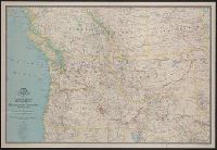
National Geographic Society (U.S.). Cartographic Section
Published / Created:
1941
Call Number:
80 1941
Container / Volume:
BRBL_00536
Image Count:
1
Resource Type:
Maps, Atlases & Globes
Description:
"Culture by Apphia E. Holdstock. Research by Wellman Chamberlin. Physiography by John J. Brehm.", Issued with the National geographic magazine, v. 79, no. 6, June 1941., Relief shown by hachures and spot heights., and Shows routes of exploration and includes notes on historical sites and points of interest.
Publisher:
The Society,
Subject (Geographic):
Alberta--Maps, British Columbia--Maps, Northwest, Pacific--Maps, and Saskatchewan--Maps
Subject (Name):
Brehm, J. J, Chamberlin, Wellman, Darley, James M. (James Morrison), and Holdstock, A. E
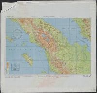
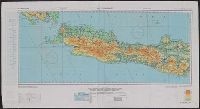
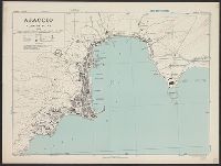
"3/45 SS" and "4/45 SS", Cloth maps., Includes sheet index, map "Index to boundaries," and "Conversion table.", and Relief shown by gradient tints and spot heights.
Publisher:
Army Map Service,
Subject (Geographic):
Indonesia--Maps
Subject (Name):
United States. Aeronautical Chart Service and United States. Army Map Service
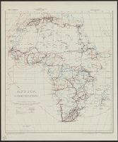
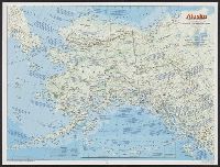
National Geographic Society (U.S.). Cartographic Division
Published / Created:
1983
Call Number:
848 1983
Container / Volume:
BRBL_00631
Image Count:
2
Resource Type:
Maps, Atlases & Globes
Alternative Title:
The making of America: Alaska.
Description:
"Supplement to the National Geographic, January 1984, page 50A, vol. 165, no. 1.", Inset: Continuation of the Aleutian Islands on same scale as main map., Relief shown by shading and spot heights., Text, maps, ill. on verso., and Title when folded: The making of America: Alaska.