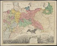
Preliminary record. and The map (bounded by Frisia, Jutland, Prussia, Poland and extending South to include Silesia and parts of Bavaria and Lotharingia) occupies the upper half of the sheet; the lower half shows an engraved battle scence ...
Russian S.F.S.R. Narodnyĭ komissariat vnutrennikh del Russian S.F.S.R. Народный комиссариат внутренних дел
Published / Created:
1930]
Call Number:
352 1930B
Container / Volume:
BRBL_00106
Image Count:
2
Resource Type:
Maps, Atlases & Globes
Alternative Title:
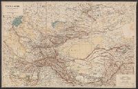
Административная карта европеиской частьи С.С.С.Р. / составлена и издана Kартоиздательством Н.К.В.Д. Р.С.Ф.С.Р.
Description:
"Glavlit No. A-52827.", "Granit︠s︡y na 1-e i︠a︡nvari︠a︡ 1930 g.", "Vypusk 2/24.", "Выпуск 2/24.", "Главлит No. А-52827.", "Границы на 1-е января 1930 г.", and 352 1930B: Imperfect: Mutilated with loss of text.
Publisher:
Kartoizdatelʹstvo N.K.V.D. R.S.F.S.R., and Kартоиздательство Н.К.В.Д. Р.С.Ф.С.Р.,
Subject (Geographic):
Soviet Union, Western--Administrative and political divisions--Maps
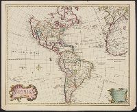
Includes text., Prime meridian: Ferro., Relief shown pictorially., Shows northwest coast in the form used in Guillaume De L'Isle's 1722 map of America. Cf. Wagner, H.R. Cartog. of the NW coast, p. 142., and Tooley refers to this map in Mapping of America, p. 13,
Publisher:
s.n.,
Subject (Geographic):
America--Maps--Early works to 1800
Subject (Name):
L'Isle, Guillaume de, 1675-1726 and L'Isle, Joseph Nicolas de, 1688-1768
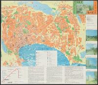
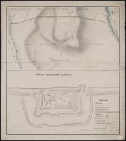
[Gorod Baku = City of Baku] -- [Baku i okrestnosti, Apsheronskiĭ poluostrov = Baku and vicinity, Apsheron Peninsula]., Includes text, 2 island insets, ancillary subway-system map, and col. ill., Panel title., and Russian and English.
Publisher:
Gos. kom-t Azerbaĭdzhanskoĭ Respubliki po geodezii i kartografii,
Subject (Geographic):
Apsheron Peninsula (Azerbaijan)--Maps, Baku (Azerbaijan)--Maps, and Baku Metropolitan Area (Azerbaijan)--Maps
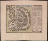
Appears in Blaeu's Atlas major, Fre, Hand col. Sheet measures 54 x 63 cm. Lanman Collection., Russian, Latin and French., Title text in cyrillic; transliteration in Koeman., and Verso: Title "Moskow, ville metropolitaine de Moscovie"; pg. no. 20,b; signature F 2.
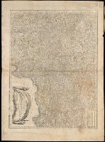
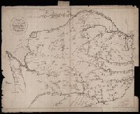
Чертезъ украинским и черкаскимъ городамъ от Москвы до Киева, и въ крымскую землу, дороги болшие, красные, черние, малшие.
Description:
Relief shown pictorially. and Stamp: Koenigl. Kartograph. Institut, Berlin. On verso in manuscript: "Mappa Expeditionis Moscovitica Duce Galicin Aõ 1681". Piece of paper with shelf mark attached at upper edge: "Cl. N. 16 [undeciphered].
Subject (Geographic):
Kiev (Ukraine : Oblast)--Maps--Early works to 1800.