Skip to search
Skip to main content
Skip to first result
Search
You Searched For
Format
cartographic
Publication Place
Chicago :
New Search
Search Results
Creator:
Published / Created:
[1856?]
Call Number:
815 1856D
Container / Volume:
BRBL_00560
Image Count:
1
Resource Type:
Maps, Atlases & Globes
Alternative Title:
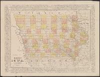
Cerographic map of Iowa
Description:
"Entered according to act of Congress in the year 1856 by Charles W. Morse in the clerk's office of the district court of the United States for the southern district of New York." and Prime meridians: Greenwich and Washington.
Publisher:
Rufus Blanchard,
Subject (Geographic):
Iowa--Maps
Subject (Name):
Blanchard, Rufus, 1821-1904
Found in:
Beinecke Rare Book and Manuscript Library > Morse's cerographic map of Iowa.
Published / Created:
1910
Call Number:
773 1910
Image Count:
1
Resource Type:
Maps, Atlases & Globes
Description:
List of New Jersey railroads denoted in red.
Publisher:
Rand McNally & Co. ,
Subject (Geographic):
New Jersey--Maps
Found in:
Beinecke Rare Book and Manuscript Library > New Jersey / Published by the NJ Board of railroad commissioners.
Published / Created:
1881
Call Number:
787 1881
Container / Volume:
BRBL_00517
Image Count:
1
Resource Type:
Maps, Atlases & Globes
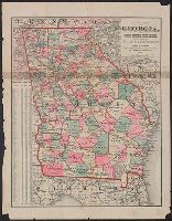
Publisher:
Henry S. Stebbens
Subject (Geographic):
Georgia--Maps
Found in:
Beinecke Rare Book and Manuscript Library > New Map of Georgia: showing railroads, Congressional districts and counties / Prepared expressly for the State Railroad Commission.
Published / Created:
c1914.
Call Number:
75gme 1914
Container / Volume:
BRBL_00414A
Image Count:
1
Resource Type:
Maps, Atlases & Globes
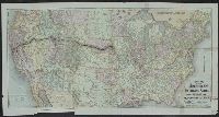
Publisher:
Rand McNally & Co.,
Subject (Geographic):
United States--Maps
Found in:
Beinecke Rare Book and Manuscript Library > New Official Railroad Map of the United States and Dominion of Canada.
Published / Created:
1858
Call Number:
806 C43 1858
Container / Volume:
BRBL_00548
Image Count:
1
Resource Type:
Maps, Atlases & Globes
Description:
Advertisment for N.P. Ingelhart at header.
Publisher:
N.P. Inglehart & Co.,
Subject (Geographic):
Chicago (Illinois)--Maps
Found in:
Beinecke Rare Book and Manuscript Library > New map of Chicago : comprising the whole city, taken from Lowe's map, with all the recent additions, subdivisions & extentions.
Creator:
Published / Created:
[ca. 1874].
Call Number:
75gme 1874
Container / Volume:
BRBL_00412
Image Count:
1
Resource Type:
Maps, Atlases & Globes
Description:
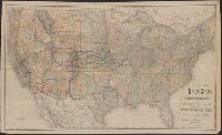
Lists general superintendents and general passenger and ticket agents for Union Pacific Railroad Company and Central Pacific Railroad Company., Relief shown by hachures., and Shows Union Pacific-Central Pacific transcontinental railroad, its land grants, other railroads, proposed railroads, and stage routes.
Publisher:
Rand, McNally & Co.,
Subject (Name):
Central Pacific Railroad Company, Central Pacific Railroad Company--Maps, Union Pacific Railroad Company, and Union Pacific Railroad Company--Maps
Subject (Topic):
Railroad land grants--West (U.S.)--Maps, Railroads--United States--Maps, and Railroads--West (U.S.)--Maps
Found in:
Beinecke Rare Book and Manuscript Library > New map of the American overland route : showing its connections, and land grants of 30,000,000 acres / engraved and published by Rand McNally & Co.
Creator:
Published / Created:
[1882?]
Call Number:
75gme 1882A
Container / Volume:
BRBL_00413
Image Count:
1
Resource Type:
Maps, Atlases & Globes
Alternative Title:
New map of the United States
Description:
Prime meridians: Greenwich and Washington. and Shows major railways west of the Mississippi River.
Publisher:
Rand, McNally,
Subject (Name):
Crofutt, George A. Crofutt's New overland tourist and Pacific coast guide and Overland Publishing Company
Subject (Topic):
Railroads--United States--Maps and Railroads--West (U.S.)--Maps
Found in:
Beinecke Rare Book and Manuscript Library > New map of the United States showing the complete railway system of the trans-Missouri country / prepared expressly for Crofutt's New overland tourist and Pacific coast guide, 1882, the Overland Publishing Company, Omaha, Neb., and Denver, Colo.
Creator:
Published / Created:
1882
Call Number:
818 1882
Container / Volume:
BRBL_00565
Image Count:
2
Resource Type:
Maps, Atlases & Globes
Description:
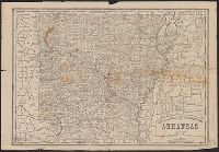
Relief shown by hachures. and Text of "The Arkansas forest and farm", pages 6 and 3, on verso.
Publisher:
Rand, McNally,
Subject (Geographic):
Arkansas--Maps
Subject (Topic):
Railroads--Arkansas--Maps
Found in:
Beinecke Rare Book and Manuscript Library > New railroad and township map of Arkansas.
Creator:
Published / Created:
1911
Call Number:
822 1911
Container / Volume:
BRBL_00567
Image Count:
1
Resource Type:
Maps, Atlases & Globes
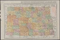
Alternative Title:
Rand McNally & Co.'s new business atlas map of North Dakota.
Description:
Below scale: Rand McNally & Co.'s new business atlas map of North Dakota. Copyright 1911 ... Copyright 1909 by Rand McNally & Co., Indexed., Relief shown by hachures., and Shows railroads, counties, and drainage.
Publisher:
Rand McNally,
Subject (Geographic):
North Dakota--Maps
Subject (Topic):
Railroads--North Dakota--Maps
Found in:
Beinecke Rare Book and Manuscript Library > North Dakota.
Creator:
Published / Created:
[1898]
Call Number:
855 1899
Container / Volume:
BRBL_00641
Image Count:
2
Resource Type:
Maps, Atlases & Globes
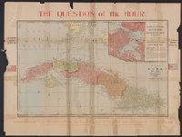
Alternative Title:
Correct map of the island of Cuba, the city and harbor of Havana, showing location of U.S.S. Maine at the time of her destruction, 9:40 p.m., February 15th 1898 and Question of the hour
Description:
Includes description of "Cuban revolutionary government.", Inset: City of Habana., Relief shown by hachures., and World map, text, and tables included on verso.
Publisher:
A.C. Shewey, Map Publisher,
Subject (Geographic):
Cuba--Maps and Havana (Cuba)--Maps
Found in:
Beinecke Rare Book and Manuscript Library > Official map of Cuba.
Branch:v1.61.8 ,Deployed:2024-06-20T11:14:55-04:00