Search
You Searched For
Search Results
- Creator:
- Geological Survey (U.S.)
- Published / Created:
- [1910]
- Call Number:
- 844fcm Y83 1910
- Container / Volume:
- BRBL_00615
- Image Count:
- 1
- Resource Type:
- Maps, Atlases & Globes
- Found in:
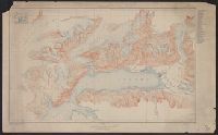
- Beinecke Rare Book and Manuscript Library > Administrative map of Yosemite National Park, California / topography by R.E. Marshall and A.H. Sylvester ; surveyed in 1893-94, 1896, 1898-99 and 1905.
- Creator:
- Geological Survey (U.S.)
- Published / Created:
- [1910]
- Call Number:
- 844fcm Y83 1910
- Container / Volume:
- BRBL_00615
- Image Count:
- 1
- Resource Type:
- Maps, Atlases & Globes
- Found in:
- Beinecke Rare Book and Manuscript Library > Administrative map of Yosemite National Park, California / topography by R.E. Marshall and A.H. Sylvester ; surveyed in 1893-94, 1896, 1898-99 and 1905.
- Creator:
- Geological Survey (U.S.)
- Published / Created:
- 1898
- Call Number:
- 848 C793 1898
- Container / Volume:
- BRBL_00632
- Image Count:
- 1
- Resource Type:
- Maps, Atlases & Globes
- Found in:
- Beinecke Rare Book and Manuscript Library > Alaska military expedition : in charge of Captain W.R. Abercrombie, U.S.A. Copper River and adjacent territory / topography by P.G. Lowe, F.C. Schrader, and Emil Mahlo.
- Creator:
- Geological Survey (U.S.)
- Published / Created:
- 1909
- Call Number:
- 848 C26 1909
- Container / Volume:
- BRBL_00632
- Image Count:
- 1
- Resource Type:
- Maps, Atlases & Globes
- Found in:
- Beinecke Rare Book and Manuscript Library > Alaska, Casadepaga quadrangle / U.S. Geological Survey.
- Creator:
- Geological Survey (U.S.)
- Published / Created:
- [1908]
- Call Number:
- 848 F15 1908
- Container / Volume:
- BRBL_00632
- Image Count:
- 1
- Resource Type:
- Maps, Atlases & Globes
- Found in:
- Beinecke Rare Book and Manuscript Library > Alaska, Fairbanks special map / U.S. Geological Survey.
- Creator:
- Geological Survey (U.S.)
- Published / Created:
- [1915]
- Call Number:
- 848 V23 1915
- Container / Volume:
- BRBL_00634
- Image Count:
- 1
- Resource Type:
- Maps, Atlases & Globes
- Found in:
- Beinecke Rare Book and Manuscript Library > Alaska, Prince William Sound region, Port Valdez District [cartographic material] / U.S. Geological Survey, Alfred H. Brooks, Geologist in charge of division ; topography by J.W. Bagley and C.E. Giffin.
- Creator:
- Geological Survey (U.S.)
- Published / Created:
- 1906
- Call Number:
- 771cbf Al13 1906
- Image Count:
- 1
- Resource Type:
- Maps, Atlases & Globes
- Found in:
- Beinecke Rare Book and Manuscript Library > Albany and vicinity, New York.
- Creator:
- Geological Survey (U.S.)
- Published / Created:
- [1893]
- Call Number:
- 831ca 1893
- Container / Volume:
- BRBL_00581
- Image Count:
- 1
- Resource Type:
- Maps, Atlases & Globes
- Found in:
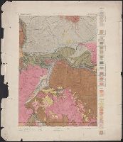
- Beinecke Rare Book and Manuscript Library > Areal geology, Montana, Livingston sheet / U.S. Geological Survey, J.W. Powell, Director ; Henry Gannett, Chief Topographer ; A.H. Thompson, Geographer in charge ; triangulation by E.M. Douglas and J.H. Renshawe ; topography by Northern Transcontinental S
- Creator:
- Geological Survey (U.S.)
- Published / Created:
- 1917?]
- Call Number:
- 38hc L337 1917
- Container / Volume:
- BRBL_00173
- Image Count:
- 1
- Resource Type:
- Maps, Atlases & Globes
- Found in:
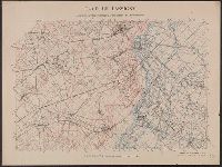
- Beinecke Rare Book and Manuscript Library > Camp de Lassigny, Anciennes Organisations Francaises et Allemandes [cartographic material] / Engraved and printed by the U.S. Geological Survey.
- Creator:
- Geological Survey (U.S.)
- Published / Created:
- 1916?]
- Call Number:
- 38hc L337 1916
- Container / Volume:
- BRBL_00173
- Image Count:
- 1
- Resource Type:
- Maps, Atlases & Globes
- Found in:
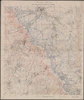
- Beinecke Rare Book and Manuscript Library > Camp de Lassigny, Anciennes Organisations Francaises et Allemandes [cartographic material].