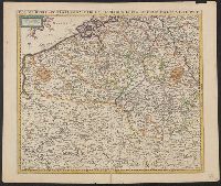
Imperfect: torn along folds and chipped at edges, with no loss of text. Sheet measures 54.0 x 61.9 cm., Prime meridian: Ferro., Relief shown pictorially., and Variant of Koeman, C. Atlantes Neerlandici, III, p. 215, map 99 (without privilege statement
Publisher:
Frederik de Wit?,
Subject (Geographic):
Pomerania (Poland and Germany)--Maps--Early works to 1800
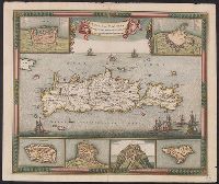
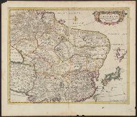
"23" in upper right corner., Appears in various editions of Wit's Atlas., Bar scale given in "milliaria Germanica"., Includes six insets: Canea; Candia; Spinalonga; Retimo; Thine; Suda., Relief shown pictorially., Watermark., and Without a watermark. Sheet measures
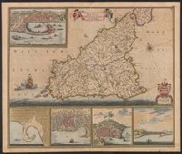
Appears in various editions of Wit's Atlas., Dedication: Amplissimo Doctissimoque Viro Domino Do. Joanni Uytenbogaert Jcto. nomine Illustrium et praepotent. DD. ordinum Hollandiae et Westvrisiae Aerary Publici Amstelodamensis Tribuno., and Includes col. ill., v
Publisher:
Gedruckt tot Amsterdam by Frederik de Wit inde Kalverstraet by den Dam inde Witte Paskaert,
Subject (Geographic):
Sicily (Italy)--Maps--Early works to 1800
Subject (Name):
Rodriguez, José M.--Bookplate, Uytenbogaart, J. W. H. (Johannes Wilhelmus Huybert), and Wit, Frederik de. Atlas
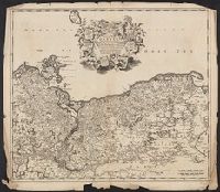
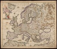
"Gemeene Duytsche mylen van 15 in een graedt.", Appears in various editions of Wit's Atlas., Relief shown pictorially., and Sheet measures 51.8 x 60.5 cm. Ms. no. on verso: 70.
Publisher:
By Frederick de Wit in de Kalversbraet in de Witte Pascaert,
Subject (Geographic):
Middle East--Maps--Early works to 1800
Subject (Name):
Rodriguez, José M.--Bookplate and Wit, Frederik de. Atlas
"Amstelodami cum privilegio D.D. ordin. Hollandiae Westfrisiaeq[ue].", Backed with paper., Illustrated hand colored title cartouche; sea decorated with ships., Prime meridian: Ferro., and Relief shown pictorially.
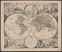
Allegorical vignettes of the four seasons., Cf. Shirley, R. Mapping of the world, no. 545., Cross Collection no. 25., and Double hemisphere, with smaller polar insets.
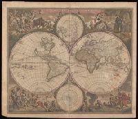
Allegorical vignettes of the four seasons., Double hemisphere, with smaller polar insets., Imperfect: chipped and mutilated along edges and fold, with some loss of text. Backed with paper., Relief shown pictorially., Shows California as an island., and State 2, in which cherubs were placed in the cusps and a border added; see Rodney Shirley, Mapping of the world, entry 451.