Skip to search
Skip to main content
Skip to first result
Search
You Searched For
%22North America--Maps%22
Access
Public
New Search
Search Results
Creator:
Published / Created:
2d. July 1772.
Call Number:
71 1763
Container / Volume:
BRBL_00364
Image Count:
4
Resource Type:
Maps , Atlases & Globes
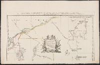
Alternative Title:
Particular map of Baffin and Hudson's
Description:
map of Baffin and Hudson's Bay" and "The
Subject (Geographic):
North America --Maps --Early works to
Subject (Topic):
British--America --Maps --Early works to
Found in:
Beinecke Rare Book and Manuscript Library > An accurate map of North America [cartographic material] : Describing and distinguishing the British and Spanish dominions on this great continent; according to the definitive treaty concluded at Paris 10th Feby. 1763. Also all the West India Islands belo
Creator:
Published / Created:
1759
Call Number:
774 1759
Container / Volume:
BRBL_00497
Image Count:
3
Resource Type:
Maps , Atlases & Globes
Alternative Title:
Map of the improved part of the
Subject (Geographic):
political divisions--Maps --Early works to 1800
Found in:
Beinecke Rare Book and Manuscript Library > To the honourable Thomas Penn and Richard Penn...this map of the improved part of the province of Pennsylvania is humbly dedicated / by Nicholas Scull ; engraved by Ja. Turner.
Creator:
Published / Created:
1792-1800, bulk 1792-1794.
Call Number:
WA MSS S-2405 (Oversize)
Image Count:
130
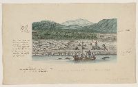
Abstract:
America , Pacific Islands, China, and South
Description:
, India, the Cape, and the Americas .
Subject (Geographic):
South America
Subject (Topic):
Indians of North America
Found in:
Beinecke Rare Book and Manuscript Library > Drawings and sketches made during a voyage around the world, 1791-1795
Creator:
Published / Created:
[1730?]
Call Number:
755 1730
Container / Volume:
BRBL_00426
Image Count:
1
Resource Type:
Maps , Atlases & Globes
Subject (Geographic):
Louisiana--Maps --Early works to 1800
Found in:
Beinecke Rare Book and Manuscript Library > Carte de la Louisiane et du cours du Mississipi / dressée sur un grand nombre de memoires entr'autres sur ceux de Mr. le Maire, par Guillme. de L'Isle de l'Academie Rle. des Sciences.
Creator:
Published / Created:
1761
Call Number:
762 1761
Container / Volume:
BRBL_00450
Image Count:
2
Resource Type:
Maps , Atlases & Globes
Description:
topography of North America . 1768. no. 22 , plates
Found in:
Beinecke Rare Book and Manuscript Library > An accurate map of His Majesty's Province of New-Hampshire in New England, taken from actual surveys of all the inhabited part, and from the best information of what is uninhabited, together with the adjacent countries, which exhibits the theatre of this
Creator:
Published / Created:
1733
Call Number:
89 1720
Container / Volume:
BRBL_00697
Image Count:
1
Resource Type:
Maps , Atlases & Globes
Alternative Title:
America Septentrionalis.
Description:
. Popple's Map of America . 25 cm.
Subject (Geographic):
Great Britain--Colonies--America --Maps
Found in:
Beinecke Rare Book and Manuscript Library > A map of the British Empire in America, with the French and Spanish settlements adjacent thereto / by Henry Popple.
Creator:
Published / Created:
1755
Call Number:
2003 Folio 85
Image Count:
1
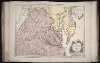
Description:
BEIN 2003 Folio 85: No. 22 of 45 maps
Subject (Geographic):
Maryland -- Maps -- 1755
Found in:
Beinecke Rare Book and Manuscript Library > Carte de la Virginie et du Maryland
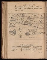
Creator:
Published / Created:
MDCXIII [1613]. Avec privilege dv Roy.
Call Number:
Taylor 257
Image Count:
1
Resource Type:
Books, Journals & Pamphlets
Description:
22 x 26 cm.) bound in after p. 22 (first
Subject (Geographic):
New France--Maps .
Subject (Topic):
Indians of North America --Canada.
Found in:
Beinecke Rare Book and Manuscript Library > Les voyages dv sievr de Champlain Xaintongeois, capitaine ordinaire pour le Roy, en la marine : divisez en devx livres, ou, iovrnal tres-fidele des observations faites es descouuertures de la Nouuelle France : tant en la descriptiõ des terres, costes, riuieres, ports, haures, leurs hauteurs, & plusieurs declinaisons de la guide-aymant : qu'en la crẽace des peuples, leur superstition, façon de viure & de guerroyer : enrichi de quantité de figures : Ensemble deux cartes geografiques : la premiere seruant à la nauigation, dressée selon les compas qui nordestent, sur lesquels les mariniers nauigent : l'autre en son vray Meridien, auec ses longitudes & latitudes : à laquelle est adiousté le voyage du destroict qu'ont trouué les Anglois, au dessus de Labrador, depuis le 53e. degré de latitude, iusques au 63e. en l'an 1612, cerchans vn chemin par le Nord, pour aller à la Chine.
Branch:v1.60.98 ,Deployed:2024-04-24T10:14:32-04:00