Search
You Searched For
Search Results
- Published / Created:
- [1610]
- Call Number:
- Taylor 251
- Collection Title:
- Certaine errors in nauigation / detected and corrected by Edw. Wright ; with many additions that
- Image Count:
- 1
- Found in:
- Beinecke Rare Book and Manuscript Library > A particular sea chart for the islands Azores
- Call Number:
- Ik P810 +Z745
- Collection Title:
- A plan of Mr. Pope’s garden : as it was left at his death, with a plan and perspective view of the
- Image Count:
- 1
- Resource Type:
- Books, Journals & Pamphlets
- Found in:
- Beinecke Rare Book and Manuscript Library > A plan of Mr. Pope's garden as it was left at his death
- Call Number:
- CF352 I54 1793
- Collection Title:
- A topographical description of the Western territory of North America; containing a succinct
- Image Count:
- 1
- Found in:
- Beinecke Rare Book and Manuscript Library > A plan of the rapids of the Ohio
- Call Number:
- Egf 778Hb
- Collection Title:
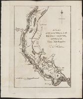
- A topographical description of Virginia, Pennsylvania, Maryland and North Carolina : comprehending
- Image Count:
- 1
- Found in:
- Beinecke Rare Book and Manuscript Library > A plan of the several villages in the Illinois country, with part of the river Mississippi &c. by Thos. Hutchins
- Creator:
- Tachard, Guy, 1651-1712
- Published / Created:
- 1688
- Call Number:
- 1977 1538
- Image Count:
- 195
- Found in:
- Beinecke Rare Book and Manuscript Library > A relation of the voyage to Siam. Performed by six Jesuits, sent by the French king, to the Indies and China, in the year, 1685 : With their astrological observations, and their remarks of natural philosophy, geography, hydrography, and history ... / Publ
- Call Number:
- CF2041 +L54
- Collection Title:
- A true & exact history of the island of Barbados. Illustrated with a mapp of the island, as also
- Image Count:
- 1
- Resource Type:
- Maps, Atlases & Globes
- Found in:
- Beinecke Rare Book and Manuscript Library > A topographicall description and admeasurement of the yland of Barbados in the West Indyaes with the m.rs names of the seuerall plantacons
- Published / Created:
- Undated
- Call Number:
- 1973 Folio 10
- Image Count:
- 1
- Resource Type:
- Maps, Atlases & Globes
- Found in:
- Beinecke Rare Book and Manuscript Library > A view of Prince Charles's passage over ye Rhine being a new and correct plan of that river from ye city of Maintz to Fort Louis
- Call Number:
- 1976 1233
- Collection Title:
- Forty-two new maps of Asia, Africa, and America ... : all engrav’d, according to the latest
- Image Count:
- 1
- Found in:
- Beinecke Rare Book and Manuscript Library > Abissina and Anian &c
- Creator:
- Lotter, Tobias Conrad, 1717-1777
Seutter, Matthaeus, 1678-1756
- Published / Created:
- ca. 1750
- Call Number:
- 1973 Folio 30
- Collection Title:
- [Atlas factice of 32 maps and 1 distance table, produced by the Homann Erben firm]
- Image Count:
- 2
- Found in:
- Beinecke Rare Book and Manuscript Library > Accuratissima delineatio geographica dioecesis ac praefecturae Dresdensis [cartographic material] : cujus urbes, oppida et pagi, loca item contermina, et quae in singulis notatu digniora videntur exactiori methodo geometrice designata sistuntur / per Matt
- Creator:
- Smith, John, 1580-1631
- Published / Created:
- 1631
- Call Number:
- Taylor 316
- Image Count:
- 2
- Found in:
- Beinecke Rare Book and Manuscript Library > Advertisements for the unexperienced planters of New-England, or anywhere, or, The path-way to experience to erect a plantation : With the yearely proceedings of this country in fishing and planting, since the yeare 1614. to the yeare 1630. and their present estate. Also how to prevent the greatest inconveniences, by their proceedings in Virginia, and other plantations, by approved examples. With the countries armes, a description of the coast, harbours, habitations, land-markes, latitude and longitude: with the map, allowed by our royall King Charles. By Captaine Iohn Smith, sometimes governour of Virginia, and admirall of Nevv-England.