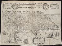
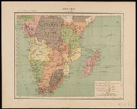
John Huighen van Linschoten, his Discours of Voyages into ye Easte & West Indies
Image Count:
1
Description:
[Scale ca. 1:14,000,000]., Bound in following p. 214., Map folded irregularly., and Map has small tear at bottom fold in center outside frame of map.
Subject (Geographic):
Africa, East --Maps, Egypt --Maps --Early works to 1800, Ethiopia --Maps --Early works to 1800, Mediterranean Sea --Maps --Early works to 1800, Nile River --Maps --Early works to 1800, and Tigris River Valley
Subject (Topic):
Voyages and travels --Early works to 1800
Collection Created:
[London] : Printed at London by [John Windet for] Iohn Wolfe, printer to ye Honorable Cittie of London, [1598]
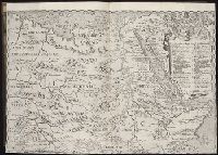
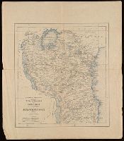
John Huighen van Linschoten, his Discours of Voyages into ye Easte & West Indies
Image Count:
1
Description:
Bound in following p. 52., Map has numerous repairs on verso with tape., Map has some small tears along fold lines, most notably in the center., and Scale not given.
Subject (Geographic):
Goa (India : State) --Maps and Velha Goa (India)
Subject (Topic):
Voyages and travels --Early works to 1800
Collection Created:
[London] : Printed at London by [John Windet for] Iohn Wolfe, printer to ye Honorable Cittie of London, [1598]
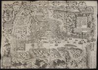
"Atlas de geographia universal" in upper left corner., "Carta 29a" in upper right corner., From Julio Gaspar Ferreira da Costa's Atlas de geographia universal., and Relief shown by hachures.
Publisher:
[Empresa Editora do Atlas de Geographia Universal],
Subject (Geographic):
Africa, Southern--Maps
Subject (Name):
Costa, Julio Gaspar Ferreira da. Atlas de geographia universal.
Portugal. Ministério do Ultramar. Inspecção-geral do fomento
Published / Created:
[1954]
Call Number:
BrSides Double Folio 2019 8
Image Count:
2
Resource Type:
Maps, Atlases & Globes
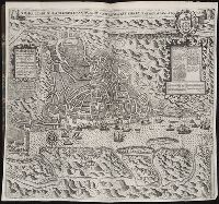
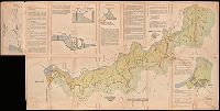
Description:
Includes three diagrams and two inset maps on recto and seven panels of photographs on verso. and Label pasted to verso with manuscript note "CDU626 (673) No. 1375."
Publisher:
[Ministério do Ultramar?]
Subject (Geographic):
Cunene River (Angola and Namibia)--Maps.
Subject (Topic):
Navigation--Cunene River (Angola and Namibia)--Maps.
Germany. Heer. Abteilung für Kriegskarten- und Vermessungswesen
Published / Created:
[1942]
Call Number:
212 1942A
Container / Volume:
BRBL_00014
Image Count:
1
Resource Type:
Maps, Atlases & Globes
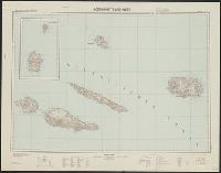
Description:
-- Azoren-Ost., "Azoren-Mitte und -West" includes inset of Corvo and Flores Islands., "XII. 1942 (D.57).", Azoren-Mitte und -West, German, with Portuguese place names., Includes location map and glossary of Portuguese terms., Librar, and Title supplied by cataloger.
Portugal. Comissão de Cartografia das Colónias, author
Call Number:
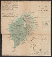
6514 1885
Container / Volume:
BRBL_00342
Image Count:
1
Resource Type:
Maps, Atlases & Globes
Description:
Imperfect: trimmed in lower left corner, with some loss of graticule., Inset: Planta da Bahia de Anna de Chaves., and Relief shown by hachures and spot heights.
Subject (Geographic):
São Tomé Island (Sao Tome and Principe)--Maps
Subject (Name):
Oliveira, A. A. de and Vasconcellos, Ernesto J. de C. e (Ernesto Julio de Carvalho), 1852-1930