Skip to search
Skip to main content
Skip to first result
Search
You Searched For
Genre
Topographic maps
Resource Type
Maps, Atlases & Globes
Creator
Geological Survey (U.S.)
New Search
Search Results
Creator:
Published / Created:
1898
Call Number:
848 C793 1898
Container / Volume:
BRBL_00632
Image Count:
1
Resource Type:
Maps, Atlases & Globes
Alternative Title:
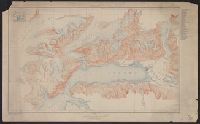
Copper River and adjacent territory, Geological Survey (U.S.). Report, Public resolution ; no. 25, 55th Congress, 3d session., and Its Report, Public resolution ; no. 25, 55th Congress, 3d session
Description:
Contour interval approximately 250 feet., Imperfect: Upper portion of map wanting. Dimensions 35 x 50 cm., and Relief shown by form lines, hachures, and spot heights.
Publisher:
The Survey,
Subject (Geographic):
Alaska--Maps, Chugach Mountains (Alaska)--Maps, and Copper River Region (Alaska)--Maps
Subject (Name):
Abercrombie, W. R.--(William Ralph),--b. 1857, Lowe, P. G, Mahlo, Emil, and Schrader, Frank C. (Frank Charles), 1860-1944
Found in:
Beinecke Rare Book and Manuscript Library > Alaska military expedition : in charge of Captain W.R. Abercrombie, U.S.A. Copper River and adjacent territory / topography by P.G. Lowe, F.C. Schrader, and Emil Mahlo.
Creator:
Published / Created:
1909
Call Number:
848 C26 1909
Container / Volume:
BRBL_00632
Image Count:
1
Resource Type:
Maps, Atlases & Globes
Alternative Title:
Casadepaga quadrangle and Topographic map of Casadepaga quadrangle, Alaska
Description:
Relief shown by contours and spot heights.
Publisher:
The Survey,
Subject (Geographic):
Casadepaga River (Alaska)--Maps
Found in:
Beinecke Rare Book and Manuscript Library > Alaska, Casadepaga quadrangle / U.S. Geological Survey.
Creator:
Published / Created:
[1908]
Call Number:
848 F15 1908
Container / Volume:
BRBL_00632
Image Count:
1
Resource Type:
Maps, Atlases & Globes
Alternative Title:
Alaska ; sheet no. 642 A and Fairbanks special map
Description:
"Surveyed in 1907.", Oriented with north to the upper right corner., and Relief shown by contours and spot heights.
Publisher:
The Survey,
Subject (Geographic):
Fairbanks Region (Alaska)--Maps
Found in:
Beinecke Rare Book and Manuscript Library > Alaska, Fairbanks special map / U.S. Geological Survey.
Creator:
Published / Created:
[1915]
Call Number:
848 V23 1915
Container / Volume:
BRBL_00634
Image Count:
1
Resource Type:
Maps, Atlases & Globes
Alternative Title:
Port Valdez District, Prince William Sound region, Port Valdez District, and Topography, Alaska, Prince William Sound region, Port Valdez District
Description:
"Alaska Sheet no. 602 B.", "Control by Coast and Geodetic Survey. Surveyed in 1911 and 1912.", "Entire area within Chugach National Forest.", Includes index to the mines and prospects in the area and location map., Relief shown by contours and spot heights., and Title, upper center margin: Topography.
Publisher:
The Survey,
Subject (Geographic):
Port Valdez Region (Alaska)--Maps and Prince William Sound Region (Alaska)--Maps
Subject (Name):
Bagley, James Warren, 1881-1947 and Giffin, C. E
Found in:
Beinecke Rare Book and Manuscript Library > Alaska, Prince William Sound region, Port Valdez District [cartographic material] / U.S. Geological Survey, Alfred H. Brooks, Geologist in charge of division ; topography by J.W. Bagley and C.E. Giffin.
Creator:
Published / Created:
1906
Call Number:
BrSides Folio 2019 61
Image Count:
1
Resource Type:
Maps, Atlases & Globes
Alternative Title:
Central City special map
Description:
"Surveyed in 1904.", Relief shown by contours and hachures., and Shows mining activity.
Publisher:
The Survey,
Subject (Geographic):
Central City (Colo.)--Maps. and Colorado--Central City
Subject (Name):
Chapman, Pearson, Douglas, E. M. (Edward Morehouse), 1855-1932, Moor, D. F., and Tweedy, Frank, 1854-1937
Subject (Topic):
Gold mines and mining--Colorado--Central City--Maps. and Mines and mineral resources--Colorado--Central City--Maps.
Found in:
Beinecke Rare Book and Manuscript Library > Colorado, Central City special map [cartographic material] / U.S. Geological Survey ; E.M. Douglas, geographer ; Frank Tweedy, in charge of section ; topography by Pearson Chapman and D.F. Moor ; triangulation by Frank Tweedy.
Creator:
Published / Created:
1912
Call Number:
848 G95 1912
Container / Volume:
BRBL_00632
Image Count:
1
Resource Type:
Maps, Atlases & Globes
Alternative Title:
Geological Survey bulletin. 498. and Headwater region of Gulkana and Susitna Rivers, Alaska
Description:
"Bulletin 498, Plate I.", Relief shown by contours and spot heights., and Surveyed in 1896, 1909, 1910.
Publisher:
Geological Survey,
Subject (Geographic):
Gulkana River Region (Alaska)--Maps and Susitna River Region (Alaska)--Maps
Subject (Name):
Bagley, James Warren, 1881-1947, Brooks, Alfred H. (Alfred Hulse), 1871-1924, Giffin, C. E, and Witherspoon, D. C
Subject (Topic):
Geology--Alaska--Gullkana River Region--Maps and Geology--Alaska--Sustina River Region--Maps
Found in:
Beinecke Rare Book and Manuscript Library > Geologic reconnaissance map of headwater region of Gulkana and Susitna Rivers, Alaska / U.S. Geological Survey. Alfred H. Brooks, geologist in charge of division, topography and triangulation by D.C. Witherspoon, C.E. Giffin and J.W. Bagley.
Creator:
Published / Created:
[1918]
Call Number:
848 J953 1918
Container / Volume:
BRBL_00633
Image Count:
1
Resource Type:
Maps, Atlases & Globes
Description:
"1918.", "Surveyed in 1914-1916.", Includes notes., and Relief shown by contours and spot heights.
Publisher:
U.S. Geological Survey,
Subject (Geographic):
Juneau Region (Alaska)--Maps
Subject (Name):
Brooks, Alfred H. (Alfred Hulse), 1871-1924 and Witherspoon, D. C
Found in:
Beinecke Rare Book and Manuscript Library > Juneau and vicinity, Alaska / Alfred H. Brooks, geologist in charge of division ; topography by D.C. Witherspoon.
Creator:
Published / Created:
1913
Call Number:
BrSides Double Folio 2019 127
Image Count:
1
Resource Type:
Maps, Atlases & Globes
Alternative Title:
Colorado (Lake County), Leadville mining district
Description:
"Surveyed in 1911.", Includes "Index to shafts" listed alphabetically and by number on map., Map showing responsibility for topography in lower margin., and Relief shown by contours and spot heights.
Publisher:
The Survey,
Subject (Geographic):
Leadville (Colo.)--Maps
Subject (Name):
Davis, E. P., Marshall, R. B. (Robert Bradford), 1867-1949., Robertson, R. B., Semper, C. H., Tatum, Sledge., and Taylor, S. E.
Subject (Topic):
Mines and mineral resources--Colorado--Leadville--Maps.
Found in:
Beinecke Rare Book and Manuscript Library > Leadville mining district [cartographic material] / U.S. Geological Survey ; R.B. Marshall, chief geographer ; Sledge Tatum, geographer in charge ; topography by E.P. Davis and S.E. Taylor ; control by R.B. Robertson, C.H. Semper, and S.E. Taylor.
Branch:v1.61.6 ,Deployed:2024-06-12T09:55:33-04:00