Search
You Searched For
Search Results
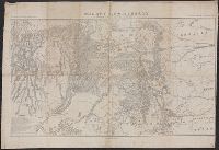
- Creator:
- De Werthern, H
- Published / Created:
- 1869]
- Call Number:
- 836 1869
- Container / Volume:
- BRBL_00592
- Image Count:
- 1
- Resource Type:
- Maps, Atlases & Globes
- Found in:
- Beinecke Rare Book and Manuscript Library > Map of Utah and Colorado / prepared by order of Lieut. Genl. W.T. Sherman ; drawn by H. De Werthern.
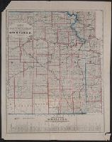
- Published / Created:
- 187-?]
- Call Number:
- 825gme 1870
- Container / Volume:
- BRBL_00576
- Image Count:
- 1
- Resource Type:
- Maps, Atlases & Globes
- Found in:
- Beinecke Rare Book and Manuscript Library > Map of eastern Kansas : showing the lines of the Mo.R.F.S. & G.R.R. and connections.
- Published / Created:
- 1917]
- Call Number:
- 11hcf 1919B-27
- Container / Volume:
- BRBL_00010Q
- Image Count:
- 1
- Resource Type:
- Maps, Atlases & Globes
- Found in:
- Beinecke Rare Book and Manuscript Library > Map of the Russian Empire.
- Published / Created:
- 1882]
- Call Number:
- 834 C719 1882
- Container / Volume:
- BRBL_00589
- Image Count:
- 1
- Resource Type:
- Maps, Atlases & Globes
- Found in:
- Beinecke Rare Book and Manuscript Library > Map of the city of Colorado Springs, Colorado / W.P. Jewett, civil engineer, May 1882.
- Creator:
- Peters, W. G., draughtsman
- Published / Created:
- 188-?]
- Call Number:
- 847 T119 188X
- Container / Volume:
- BRBL_00627
- Image Count:
- 1
- Resource Type:
- Maps, Atlases & Globes
- Found in:
- Beinecke Rare Book and Manuscript Library > Map of the city of Tacoma, W.T. and vicinity : Pacific Terminus N.P.R.R. / compiled and drawn by W.G. Peters, draughtsman ; A. Anderson & Co., map engravers.
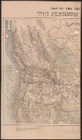
- Creator:
- Knight, E. H. (Edward H.)
- Published / Created:
- 1871]
- Call Number:
- 80gme 1871A
- Container / Volume:
- BRBL_00538
- Image Count:
- 2
- Resource Type:
- Maps, Atlases & Globes
- Found in:
- Beinecke Rare Book and Manuscript Library > Map of the country tributary to the Northern Pacific Railroad / compiled from English, Canadian, and American official sources and original surveys by Edward H. Knight, Jan. 1st 1871.
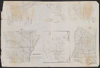
- Published / Created:
- 1845?]
- Call Number:
- 818fb 1845
- Container / Volume:
- BRBL_00565
- Image Count:
- 1
- Resource Type:
- Maps, Atlases & Globes
- Found in:
- Beinecke Rare Book and Manuscript Library > Map of the south western district, Louisiana ; South eastern district, Louisiana ; Map of the district north of Red River and part of N.W. District, LA. / Surveyor Generals Office, Donaldson, Oct. 29th 1845, P.T. Landry, Sur. Genl. La. Arkansas / Wm. Pel
- Published / Created:
- 1880?]
- Call Number:
- 796gme 1880
- Container / Volume:
- BRBL_00531
- Image Count:
- 1
- Resource Type:
- Maps, Atlases & Globes
- Found in:
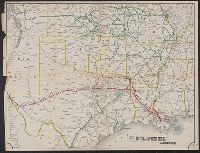
- Beinecke Rare Book and Manuscript Library > Map of the the Texas & Pacific Railway and connections.
- Creator:
- Walling, Henry Francis, 1825-1888
- Published / Created:
- 1856
- Call Number:
- 764 D255 1856
- Container / Volume:
- BRBL_00457
- Image Count:
- 1
- Resource Type:
- Maps, Atlases & Globes
- Found in:
- Beinecke Rare Book and Manuscript Library > Map of the town of Dartmouth, Bristol County Mass. : made by order of the town / under the direction of H.F. Walling, sup. of the state map.
- Creator:
- Cornwall, Pierre Barlow, 1821-1904
- Published / Created:
- 1883
- Call Number:
- 847 B45 1883
- Container / Volume:
- BRBL_00626
- Image Count:
- 1
- Resource Type:
- Maps, Atlases & Globes
- Found in:
- Beinecke Rare Book and Manuscript Library > Map of the town of New Whatcom, Whatcom Co. Wash. Terr./ E.C. Prather engr. ; I.A. Lefevre del.