Search
You Searched For
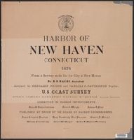
Search Results
- Published / Created:
- 1876
- Call Number:
- 766cea N46 1876
- Container / Volume:
- BRBL_00474
- Image Count:
- 15
- Resource Type:
- Maps, Atlases & Globes
- Found in:
- Beinecke Rare Book and Manuscript Library > Harbor of New Haven, Connecticut.
- Creator:
- International Boundary Commission
- Published / Created:
- 1952]
- Call Number:
- 848fab 1951
- Container / Volume:
- BRBL_00635
- Image Count:
- 15
- Resource Type:
- Maps, Atlases & Globes
- Found in:
- Beinecke Rare Book and Manuscript Library > Joint maps of the international boundary between United States and Canada from Cape Muzon to Mount St. Elias.
- Creator:
- Sanborn Map Company
- Published / Created:
- June, 1919.
- Call Number:
- 776 D75 1919
- Container / Volume:
- BRBL_00502
- Image Count:
- 15
- Resource Type:
- Maps, Atlases & Globes
- Found in:
- Beinecke Rare Book and Manuscript Library > Dover, Kent County, Delaware.
- Creator:
- Chishitsu Chōsajo (Japan)
- Published / Created:
- 1899
- Call Number:
- 57 1899A
- Container / Volume:
- BRBL_00302
- Image Count:
- 15
- Resource Type:
- Maps, Atlases & Globes
- Found in:
- Beinecke Rare Book and Manuscript Library > Topographical map of the Japanese Empire, 1899 / Imperial Geological Survey of Japan ; drawn by T. Togawa and K. Suzuki ; engraved by N. Matsudaira.
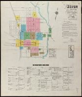
- Call Number:
- 766 N46 1917
- Container / Volume:
- BRBL_00473A
- Image Count:
- 15
- Resource Type:
- Maps, Atlases & Globes
- Found in:
- Beinecke Rare Book and Manuscript Library > [City of New Haven] 1913-1917.
- Creator:
- Sanborn Map Company
- Published / Created:
- Nov. 1919.
- Call Number:
- 776 M59 1919
- Container / Volume:
- BRBL_00502
- Image Count:
- 15
- Resource Type:
- Maps, Atlases & Globes
- Found in:
- Beinecke Rare Book and Manuscript Library > Milford, Kent and Sussex Co., Delaware.
- Published / Created:
- 1878
- Call Number:
- 32 L84 1741A
- Container / Volume:
- BRBL_00048
- Image Count:
- 16
- Resource Type:
- Maps, Atlases & Globes
- Found in:
- Beinecke Rare Book and Manuscript Library > Environs of London By John Rocque 1741-1745. London, 1746-63.
- Creator:
- United States. Congress. House. Committee on the Public Lands
- Published / Created:
- [1878?].
- Call Number:
- 75 1878
- Container / Volume:
- BRBL_00406
- Image Count:
- 16
- Resource Type:
- Maps, Atlases & Globes
- Found in:
- Beinecke Rare Book and Manuscript Library > 1876 Centennial map of the United States and territories : showing the extent of public surveys, indian and military reservations, land grant R.R. rail roads, canals, cities, towns & other details / compiled from the official surveys of the General Land O
- Creator:
- Allied Forces
Great Britain. War Office. General Staff. Geographical Section
- Published / Created:
- 1943-
- Call Number:
- 11hd 1942D-44
- Image Count:
- 14
- Resource Type:
- Maps, Atlases & Globes
- Found in:
- Beinecke Rare Book and Manuscript Library > Central Europe 1:100,000.
- Creator:
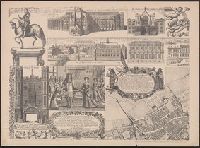
- Rocque, John, -1762.
- Published / Created:
- 1746
- Call Number:
- 2002 Folio 94
- Image Count:
- 16
- Resource Type:
- Maps, Atlases & Globes
- Found in:
- Beinecke Rare Book and Manuscript Library > An exact survey of the city's of London and Westminster, ye borough of Southwark and the country near ten miles round : begun in 1741, finished in 1745, and published in 1746, according to act of Parliament / by John Rocque ; engrav'd by Richard Parr and printed by W. Pratt ... = Urbium maxime insignium Londini et Westmonasterii nec non municipii Sudovercencis, regionumque ad decem quasi milliaria circumjacentium : delineatio ichnographica anno 1741 incohata 1745 absoluta / a Johanne Rocque ... = Carte topographique des villes de Londres, Westminster, et bourg de Southwark et de leurs environs : levée très exactement sur les lieux, en 1741, achevée en 1745, et publieé selon un acte de Parlement en 1746 / par Jean Rocque.
- Published / Created:
- 1882
- Call Number:
- 812 1882
- Container / Volume:
- BRBL_00555
- Image Count:
- 16
- Resource Type:
- Maps, Atlases & Globes
- Found in:
- Beinecke Rare Book and Manuscript Library > Atlas of the geological survey of Wisconsin / T.C. Chamberlin, chief geologist ; R.D. Irving, Moses Strong, assistant geologists ; W.I.L. Nicodemus, topographical assistant ; T.B. Brooks ... [et al.], contributors.
- Published / Created:
- [1750?]
- Call Number:
- 38cea 1750
- Container / Volume:
- BRBL_00169
- Image Count:
- 17
- Resource Type:
- Maps, Atlases & Globes
- Found in:
- Beinecke Rare Book and Manuscript Library > [North and East Coast of France].
- Creator:
- Hollar, Wenceslaus, 1607-1677.
- Call Number:
- 1980 458
- Image Count:
- 18
- Resource Type:
- Maps, Atlases & Globes
- Found in:
- Beinecke Rare Book and Manuscript Library > The kingdome of England & principality of Wales : exactly described whith euery sheere & the small townes in euery one of them, in six mappes, portable for euery mans pocket ... : vsefull for all gentlemen and travellors and all sorts of persons, that would be informed of the distance of places neuer so commodiously drawne before this, 1676, described by one that trauailed throughout the whole kingdome, for its purpose / W. Hollar, fecit.
- Published / Created:
- [1738]
- Call Number:
- BrSides Folio 2017 4
- Image Count:
- 12
- Resource Type:
- Maps, Atlases & Globes
- Found in:
- Beinecke Rare Book and Manuscript Library > The first [-twelfth] sheet of Chinese Tartary ...
- Creator:
- Morgan, William, -1690
- Published / Created:
- 1682] and 1904.
- Call Number:
- 32 L84 1682/1904
- Container / Volume:
- BRBL_00737
- Image Count:
- 12
- Resource Type:
- Maps, Atlases & Globes
- Found in:
- Beinecke Rare Book and Manuscript Library > London &c. actually surveyed, by Wm. Morgan, his ma[jes]ties cosmogr., 1681/2.
- Creator:
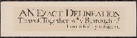
- Newcourt, Richard, d. 1679
- Published / Created:
- 1658. and 1905.
- Call Number:
- 32 L84 1658/1905
- Container / Volume:
- BRBL_00737
- Image Count:
- 12
- Resource Type:
- Maps, Atlases & Globes
- Found in:
- Beinecke Rare Book and Manuscript Library > An exact delineation of the cities of London and Westminster and the suburbs thereof, together wth. ye burrough of Sovthwark and all ye through-fares, highwaies, streetes, lanes & common allies wthin. ye same. Composed by a scale, and ichnographically described by Richard Newcovrt of Somerton in the countie of Somersett, gentleman. Willm. Faithorne, sculpsit.
- Creator:
- Kip, Johannes, 1653-1722
- Published / Created:
- 1903
- Call Number:
- 32 L84 1720/1903
- Container / Volume:
- BRBL_00736
- Image Count:
- 12
- Resource Type:
- Maps, Atlases & Globes
- Found in:
- Beinecke Rare Book and Manuscript Library > A prospect of the city of London, Westminster and St. James Park = veue et perspective de la ville de Londre, Westminster et Parc St. Jacques / John Kip delineavit et sculpsit.
- Creator:
- Great Britain. Ordnance Survey
- Published / Created:
- 1920-21.
- Call Number:
- 32 1920B
- Container / Volume:
- BRBL_00745
- Image Count:
- 11
- Resource Type:
- Maps, Atlases & Globes
- Found in:
- Beinecke Rare Book and Manuscript Library > Ordnance Survey of Great Britain 1/4 inch to one mile.
- Creator:
- Jones, Lewis A
- Published / Created:
- 1915
- Call Number:
- 794gcf B48 1914
- Container / Volume:
- BRBL_00521
- Image Count:
- 11
- Resource Type:
- Maps, Atlases & Globes
- Found in:
- Beinecke Rare Book and Manuscript Library > A report on the methods and cost of reclaiming the overflowed lands along the Big Black River, Mississippi / by Lewis A. Jones ; assisted by W.J. Schlick and C.E. Ramser.
- Published / Created:
- 1769
- Call Number:
- 32 1769
- Container / Volume:
- BRBL_00043
- Image Count:
- 11
- Resource Type:
- Maps, Atlases & Globes
- Found in:
- Beinecke Rare Book and Manuscript Library > England and Wales ... Engraved by Thos. Kitchin.