Skip to search
Skip to main content
Skip to first result
Search
You Searched For
Date
Unknown
Extent of Digitization
Partially digitized
Format
cartographic
Date Created
[Missing]
New Search
Search Results
Creator:
Call Number:
C6 033c
Collection Title:
The natural and civil history of the French dominions in North and South America : with an
Image Count:
1
Resource Type:
Maps, Atlases & Globes
Description:
Plate between p. 68-9.
Subject (Geographic):
Atlantic Ocean--Charts, maps, etc., Atlantic Ocean--Maps--Early works to 1800, and Santo Domingo (Dominican Republic)
Collection Created:
London, Printed for T. Jeffreys, 1761
Found in:
Beinecke Rare Book and Manuscript Library > An authentic plan of the town and harbour of Cap Francois in the isle of St. Domingo. By Thomas Jefferys geographer to his Royal Highness the Prince of Wales
Call Number:
1973 Folio 114
Collection Title:
The English pilot: describing the West-India navigation, from Hudson's-Bay to the river Amazones
Image Count:
1
Resource Type:
Maps, Atlases & Globes
Subject (Geographic):
Atlantic Ocean --Maps --Early works to 1800, Central America --Maps --Early works to 1800, and Panama --Maps --Early works to 1800
Subject (Topic):
Navigation --Early works to 1800, Pilot guides --Atlantic Coast (U.S.) --Early works to 1800, and Pilot guides --Caribbean Area --Early works to 1800
Collection Created:
London : Printed for W. and J. Mount, T. Page and son, on Tower-Hill, MDCCLIX [1759]
Found in:
Beinecke Rare Book and Manuscript Library > An exact draught of the Gulf of Darien & the coast to Porto Bello with Panama in the South Sea & the Scotch settlement in Calledonia
Call Number:
1978 +73
Collection Title:
The ecclesiastical history of New-England from its first planting in the year 1620 unto the year of
Image Count:
1
Resource Type:
Books, Journals & Pamphlets
Description:
Verso blank.
Subject (Geographic):
New England --Biography, New England --Church history, and New England --History --Colonial period, ca. 1600-1775
Collection Created:
London, Printed for Thomas Parkhurst, at the Bible and Three Crowns in Cheapside, 1702
Found in:
Beinecke Rare Book and Manuscript Library > An exact mapp of New England and New York
Call Number:
1973 Folio 114
Collection Title:
The English pilot: describing the West-India navigation, from Hudson's-Bay to the river Amazones
Image Count:
1
Resource Type:
Maps, Atlases & Globes
Subject (Geographic):
Atlantic Ocean --Maps --Early works to 1800 and Barbados --Maps --Early works to 1800
Subject (Topic):
Navigation --Early works to 1800, Pilot guides --Atlantic Coast (U.S.) --Early works to 1800, and Pilot guides --Caribbean Area --Early works to 1800
Collection Created:
London : Printed for W. and J. Mount, T. Page and son, on Tower-Hill, MDCCLIX [1759]
Found in:
Beinecke Rare Book and Manuscript Library > Barbados
Call Number:
1973 Folio 114
Collection Title:
The English pilot: describing the West-India navigation, from Hudson's-Bay to the river Amazones
Image Count:
1
Resource Type:
Maps, Atlases & Globes
Subject (Geographic):
Atlantic Ocean --Maps --Early works to 1800 and Newfoundland and Labrador --Maps --Early works to 1800
Subject (Topic):
Navigation --Early works to 1800, Pilot guides --Atlantic Coast (U.S.) --Early works to 1800, and Pilot guides --Caribbean Area --Early works to 1800
Collection Created:
London : Printed for W. and J. Mount, T. Page and son, on Tower-Hill, MDCCLIX [1759]
Found in:
Beinecke Rare Book and Manuscript Library > Bay Bulls, part of Newfoundland
Call Number:
1977 +392
Collection Title:
A survey of the cities of London and Westminster : containing the original, antiquity, increase
Image Count:
1
Resource Type:
Maps, Atlases & Globes
Description:
Plate between p. 90-91.
Subject (Geographic):
London (England)--History
Collection Created:
London : Printed for A. Churchill, J. Knapton, R. Knaplock, J. Walthoe [and 6 others], 1720
Found in:
Beinecke Rare Book and Manuscript Library > Bishop Gate Street Ward taken from the last survey and corrected
Published / Created:
Undated
Call Number:
1983 Folio 19
Collection Title:
[Atlas factice of 96 maps by Blaeu, Visscher, Jansson, Hondius and others]
Image Count:
2
Publisher:
Apud Ioannem Ianssonium
Subject (Geographic):
Austria --Maps --Early works to 1800, Czechoslovakia --Maps, Germany --Maps --Early works to 1800, and Poland --Maps --Early works to 1800
Subject (Topic):
Atlases --Early works to 1800
Collection Created:
[1556-1680]
Found in:
Beinecke Rare Book and Manuscript Library > Bohemia
Published / Created:
Undated
Call Number:
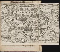
Taylor 229
Collection Title:
Neuwe Schiffart / warhafftige vnd eygentliche Beschreibung der langwirigen / soerglichen vnd
Image Count:
1
Description:
Bound in after p. 92., Map folded irregularly., Map has multiple small brown stains on both the recto and verso., Place names in multiple languages including Italian, Latin, Portuguese, and Spanish., and Scale [ca. 1:6,500,000].
Subject (Geographic):
Borneo --Maps --Early works to 1800
Collection Created:
Gedruckt zu Franckfurt / Durch Matthaeum Becker, 1602
Found in:
Beinecke Rare Book and Manuscript Library > Borneo Insula
Creator:
Call Number:
1977 Folio 114
Collection Title:
L’atlas curieux ou Le monde represente dans des cartes generales et particulieres du ciel et de la
Image Count:
1
Resource Type:
Maps, Atlases & Globes
Description:
Verso blank.
Subject (Geographic):
Fontainebleau (France)
Subject (Topic):
Atlases, French
Collection Created:
A Paris, Chez l’auteur dans l’Isle du Palais sur le quay de l’Orloge a la Sphere Royale, 1700[-03]
Found in:
Beinecke Rare Book and Manuscript Library > Bourg, chateau, et iardins de Fontaine-bleau
Call Number:
1977 +392
Collection Title:
A survey of the cities of London and Westminster : containing the original, antiquity, increase
Image Count:
1
Resource Type:
Maps, Atlases & Globes
Description:
Plate between p. 14-15.
Subject (Geographic):
London (England)--History
Collection Created:
London : Printed for A. Churchill, J. Knapton, R. Knaplock, J. Walthoe [and 6 others], 1720
Found in:
Beinecke Rare Book and Manuscript Library > Bread Street Ward and Cordwainer Ward with it's division into parishes taken from the last survey
Branch:v1.61.6 ,Deployed:2024-06-12T09:55:36-04:00