Search
You Searched For
Search Results
- Creator:
- Királyi Magyar Térképészeti Intézet
- Published / Created:
- [1918?-1943?]
- Call Number:
- 304 1886A
- Container / Volume:
- BRBL_00740
- Image Count:
- 9
- Resource Type:
- Maps, Atlases & Globes
- Found in:
- Beinecke Rare Book and Manuscript Library > [Kelet-Európa térképe] [cartographic material].
- Creator:
- Great Britain. Ordnance Survey
- Published / Created:
- Novr. 9th, 1843 [i.e. ca. 1853-1874?]
- Call Number:
- 32 1873
- Container / Volume:
- BRBL_00744
- Image Count:
- 8
- Resource Type:
- Maps, Atlases & Globes
- Found in:
- Beinecke Rare Book and Manuscript Library > [Old series Ordnance Survey maps of England and Wales] / engraved at the Ordnance Map Office, Southampton ...
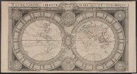
- Creator:
- Jaugeon, N
- Published / Created:
- 173-?]
- Call Number:
- 11 1670
- Container / Volume:
- BRBL_00680
- Image Count:
- 1
- Resource Type:
- Maps, Atlases & Globes
- Found in:
- Beinecke Rare Book and Manuscript Library > Mappe-monde celeste, terrestre et historique [cartographic material].
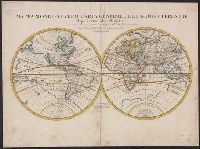
- Creator:
- Rossi, Giovanni Giacomo de, 17th cent
- Published / Created:
- 1674
- Call Number:
- 11 1674
- Container / Volume:
- BRBL_00680
- Image Count:
- 1
- Resource Type:
- Maps, Atlases & Globes
- Found in:
- Beinecke Rare Book and Manuscript Library > Mappa mondo o vero carta generale del globo terrestre [cartographic material] : rapresentato in due planisferi ... / da N. Sanson de Abbeville Giografo di sua Maesta Cristma ; intagliata da Gio. Lhuilier.
- Creator:
- Homann, Johann Baptist, 1663-1724
- Published / Created:
- 1716?]
- Call Number:
- 11 1716
- Container / Volume:
- BRBL_00680
- Image Count:
- 1
- Resource Type:
- Maps, Atlases & Globes
- Found in:
- Beinecke Rare Book and Manuscript Library > Planiglobii terrestris cum utroq hemisphaerio caelesti generalis repraesentatio [cartographic material] : quam ex novissimis probatissimisque recentium geographorum scriptis concinnatam, multisq[ue] phaenomenis illustratam / publice proponit Io. Bapt. Hom
- Published / Created:
- 1737
- Call Number:
- 11 1737
- Container / Volume:
- BRBL_00681
- Image Count:
- 1
- Resource Type:
- Maps, Atlases & Globes
- Found in:
- Beinecke Rare Book and Manuscript Library > A new and correct map of ye world [cartographic material] : laid down according to ye latest and best observations : to which is added several curious discourses on the tides, trade winds & monsoons ...
- Creator:
- Senex, John, d. 1740
- Published / Created:
- 1720]
- Call Number:
- 11 1720B
- Container / Volume:
- BRBL_00680
- Image Count:
- 1
- Resource Type:
- Maps, Atlases & Globes
- Found in:
- Beinecke Rare Book and Manuscript Library > A new map of the world [cartographic material] : from the latest observations / revised by I. Senex.
- Creator:
- Moll, Herman, d. 1732
- Published / Created:
- [after 1754]
- Call Number:
- 11 1728
- Container / Volume:
- BRBL_00680
- Image Count:
- 1
- Resource Type:
- Maps, Atlases & Globes
- Found in:
- Beinecke Rare Book and Manuscript Library > A new and correct map of the world laid down according to the newest discoveries and from the most exact observations / [cartographic material] / by Herman Moll, geographer.
- Creator:
- Cóvens et Mortier
- Published / Created:
- ca. 1730-ca. 1800]
- Call Number:
- 1973 Folio 71
- Image Count:
- 1
- Resource Type:
- Maps, Atlases & Globes
- Found in:
- Beinecke Rare Book and Manuscript Library > [Atlas nouveau contenant toutes les parties du monde ou sont exactement marqués les empires, monarchies, royaumes, états, republiques &c. Le tout recueilli par les meilleurs geógraphes.]
- Creator:
- Evans, Lewis, 1700?-1756
- Published / Created:
- 1771
- Call Number:
- 755 1771C
- Container / Volume:
- BRBL_00429
- Image Count:
- 1
- Resource Type:
- Maps, Atlases & Globes
- Found in:
- Beinecke Rare Book and Manuscript Library > A general map of the middle British colonies in America : viz. Virginia, Maryland, Delaware, Pensilvania, New-Jersey, New York, Connecticut & Rhode-Island : of Aquanishuonigy the country of the confederate Indians comprehending Aquanishuonigy proper, thei
- Creator:
- Moll, Herman, d. 1732
- Published / Created:
- [178-?]
- Call Number:
- 1973 Folio 113
- Image Count:
- 2
- Resource Type:
- Maps, Atlases & Globes
- Found in:
- Beinecke Rare Book and Manuscript Library > Atlas minor: or A new and curious set of sixty two maps, in which are shewn all the empires, kingdoms, countries, states in all the known parts of the earth ... by Herman Moll ...
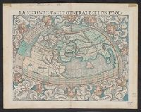
- Creator:
- Münster, Sebastian, 1489-1552
Münster, Sebastian, 1489-1552. Cosmographei
Ptolemy, fl. 2nd cent
- Published / Created:
- 1552?]
- Call Number:
- 13 1552
- Container / Volume:
- BRBL_00011
- Image Count:
- 2
- Resource Type:
- Maps, Atlases & Globes
- Found in:
- Beinecke Rare Book and Manuscript Library > La seconde table generale selon Ptol[omée].
- Creator:
- Chauveau, François, 1613-1676
Jaillot, Alexis Hubert, 1632?-1712. Atlas nouveau
Sanson, Guillaume
- Published / Created:
- 1673
- Call Number:
- 1973 Folio 57
- Collection Title:
- Composite atlas of 41 maps from Alexis Hubert Jaillot's Atlas nouveau.
- Image Count:
- 1
- Found in:
- Beinecke Rare Book and Manuscript Library > Provinces-Unies des Pays-Bas : auec leurs acquisitions dans La Flandre, Le Brabant, Le Limbourg, et Le Lyege, et les places queílles possedoient sur le Rhein, dans le Ducheí de Cleves, et dans l'Archevescheí et Eslectorat de Cologne / par le Sr. Sanson
- Creator:
- Moll, Herman, d. 1732
- Published / Created:
- 17--]
- Call Number:
- 1978 47
- Collection Title:
- Atlas minor.
- Image Count:
- 1
- Found in:
- Beinecke Rare Book and Manuscript Library > The Island of St. Christophers By Her. Moll Geographer
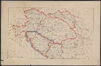
- Creator:
- Wyld, James, 1812-1887, cartographer
- Call Number:
- 13 1873A
- Container / Volume:
- BRBL_00011
- Image Count:
- 1
- Resource Type:
- Maps, Atlases & Globes
- Found in:
- Beinecke Rare Book and Manuscript Library > Map of the countries between England & India : designed to shew the over-land and sea-routes to the east, and the relative position of Russia to England & Hindostan / by James Wyld.
- Published / Created:
- 1919?]
- Call Number:
- 11hcf 1919C-3-4
- Container / Volume:
- BRBL_00010U
- Image Count:
- 1
- Resource Type:
- Maps, Atlases & Globes
- Found in:
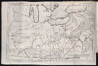
- Beinecke Rare Book and Manuscript Library > [Map of Balkan Peninsula and Eastern Europe].
- Published / Created:
- 1919?]
- Call Number:
- 11hcf 1919C-3-5
- Container / Volume:
- BRBL_00010U
- Image Count:
- 1
- Resource Type:
- Maps, Atlases & Globes
- Found in:
- Beinecke Rare Book and Manuscript Library > [Map of Balkan Peninsula and Eastern Europe].
- Published / Created:
- 1919?]
- Call Number:
- 11hcf 1919C-3-8
- Container / Volume:
- BRBL_00010U
- Image Count:
- 1
- Resource Type:
- Maps, Atlases & Globes
- Found in:
- Beinecke Rare Book and Manuscript Library > Austria-Hungary.
- Published / Created:
- 1919?]
- Call Number:
- 11hcf 1919C-3-6
- Container / Volume:
- BRBL_00010U
- Image Count:
- 1
- Resource Type:
- Maps, Atlases & Globes
- Found in:
- Beinecke Rare Book and Manuscript Library > [Map of Balkan Peninsula and Eastern Europe].
- Published / Created:
- 1919?]
- Call Number:
- 11hcf 1919C-3-9
- Container / Volume:
- BRBL_00010U
- Image Count:
- 1
- Resource Type:
- Maps, Atlases & Globes
- Found in:
- Beinecke Rare Book and Manuscript Library > [Map of Eastern Europe and the Balkan Peninsula].
- Published / Created:
- undated
- Call Number:
- WA Photos 524
- Collection Title:
- Peter E. Palmquist Papers: correspondence, research files, mss., photographs, audio visual material
- Container / Volume:
- Box 130
- Image Count:
- 1
- Found in:
- Beinecke Rare Book and Manuscript Library > Map showing land on Blue Creek, Humboldt Co., Cal.
- Published / Created:
- [Late Chosŏn i.e. 18th century]
- Call Number:
- YAJ K4.1
- Image Count:
- 22
- Found in:
- Beinecke Rare Book and Manuscript Library > Chidoch'ŏp, [Late Chosŏn i.e. 18th century].
- Creator:
- Des Barres, Joseph F. W. (Joseph Frederick Wallet), 1722-1824
- Published / Created:
- 1775?-1781?]
- Call Number:
- 1983 Folio 25
- Image Count:
- 3
- Resource Type:
- Maps, Atlases & Globes
- Found in:
- Beinecke Rare Book and Manuscript Library > [The Atlantic Neptune : published for the use of the Royal Navy Great Britain / by Joseph F.W. Des Barres, esq.].
- Creator:
- Cooke & LeCount
- Published / Created:
- 1852
- Call Number:
- Zc72 852co
- Image Count:
- 3
- Resource Type:
- Maps, Atlases & Globes
- Found in:
- Beinecke Rare Book and Manuscript Library > A complete map of San Francisco : compiled from the original map from the latest surveys, containing all the latest extensions and improvements, new streets, alleys, places, wharfs, etc
- Call Number:
- 2003 310
- Collection Title:
- The journal of Major George Washington, : sent by the Hon. Robert Dinwiddie, Esq; His Majesty’s
- Image Count:
- 1
- Resource Type:
- Books, Journals & Pamphlets
- Found in:
- Beinecke Rare Book and Manuscript Library > Map of the western parts of the colony of Virginia, as far as the Mississipi [sic]
- Published / Created:
- 1850
- Call Number:
- 1976 Folio 96
- Collection Title:
- A new universal atlas containing maps of the various empires, kingdoms, states and republics of the
- Image Count:
- 1
- Resource Type:
- Maps, Atlases & Globes
- Found in:
- Beinecke Rare Book and Manuscript Library > 10. Map of Connecticut
- Creator:
- Friesen, F
- Published / Created:
- 1808
- Call Number:
- Folio Q115 H84 1B
- Collection Title:
- Atlas geographique et physique des regions equinoxiales du nouveau continent, fonde sur des
- Image Count:
- 1
- Resource Type:
- Maps, Atlases & Globes
- Found in:
- Beinecke Rare Book and Manuscript Library > Limite inferieure des Neiges perpetuelles a differentes Latitudes
- Published / Created:
- 1817
- Call Number:
- Folio Q115 H84 1B
- Collection Title:
- Atlas geographique et physique des regions equinoxiales du nouveau continent, fonde sur des
- Image Count:
- 1
- Resource Type:
- Maps, Atlases & Globes
- Found in:
- Beinecke Rare Book and Manuscript Library > Tableau physique des Ils Canaries. Geographie des plantes du Pic de Teneriffe
- Published / Created:
- 1820
- Call Number:
- Folio Q115 H84 1B
- Collection Title:
- Atlas geographique et physique des regions equinoxiales du nouveau continent, fonde sur des
- Image Count:
- 1
- Resource Type:
- Maps, Atlases & Globes
- Found in:
- Beinecke Rare Book and Manuscript Library > Profit du Chemin de Carthagene des Indes au Plateau de Santa Fe de Bogata. pl. 6
- Published / Created:
- 1807-08
- Call Number:
- Folio Q115 H84 3A
- Collection Title:
- Atlas geographique et physique du royaume de la Nouvelle-Espagne, fonde sur des observations
- Image Count:
- 1
- Resource Type:
- Maps, Atlases & Globes
- Found in:
- Beinecke Rare Book and Manuscript Library > Tableau physique de la pente Orientale du Plateau de la Nouvelle Espagne (Chemin de Mexico a Veracruz par Puebla et Xalapa.) Dresse d'apres des mesures barometriques et trigonometriques, prises en 1804 par Mr. de Humboldt. pl. 12
- Published / Created:
- 1805-07
- Call Number:
- Folio Q115 H84 3A
- Collection Title:
- Atlas geographique et physique du royaume de la Nouvelle-Espagne, fonde sur des observations
- Image Count:
- 1
- Resource Type:
- Maps, Atlases & Globes
- Found in:
- Beinecke Rare Book and Manuscript Library > Tableau du Plateau central des Montagnes du Mexique, entre les 19 et 21 [degree] de Latitude boreale, (Chemin de Mexico a Guanaxuato) Dresse d'apres le Nivellement Barometrique de Mr. de Humboldt. pl. 14
- Published / Created:
- 1808
- Call Number:
- Folio Q115 H84 3A
- Collection Title:
- Atlas geographique et physique du royaume de la Nouvelle-Espagne, fonde sur des observations
- Image Count:
- 1
- Resource Type:
- Maps, Atlases & Globes
- Found in:
- Beinecke Rare Book and Manuscript Library > Profit du Canal de Huehuetoca (Desague Real.) Creuse pour preserver la Ville de Mexico du danger des Inondations. pl. 15
- Published / Created:
- [ca. 1675]
- Call Number:
- GEN MSS VOL 4
- Collection Title:
- Atlas of the world
- Image Count:
- 1
- Resource Type:
- Maps, Atlases & Globes
- Found in:
- Beinecke Rare Book and Manuscript Library > Die gantse welt
- Published / Created:
- [1542]
- Call Number:
- Taylor 86
- Collection Title:
- Rvdimenta cosmographica
- Image Count:
- 1
- Found in:
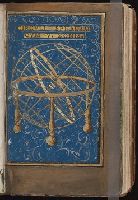
- Beinecke Rare Book and Manuscript Library > Circvlia sphaerae
- Published / Created:
- [1542]
- Call Number:
- Taylor 86
- Collection Title:
- Rvdimenta cosmographica
- Image Count:
- 1
- Found in:
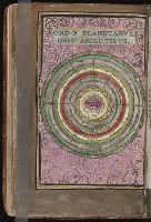
- Beinecke Rare Book and Manuscript Library > Ordo planetarvm cvm aspectibvs
- Published / Created:
- [1542]
- Call Number:
- Taylor 86
- Collection Title:
- Rvdimenta cosmographica
- Image Count:
- 1
- Found in:
- Beinecke Rare Book and Manuscript Library > Regiones et nomina ventorvm
- Published / Created:
- [1542]
- Call Number:
- Taylor 86
- Collection Title:
- Rvdimenta cosmographica
- Image Count:
- 1
- Found in:
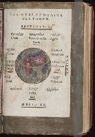
- Beinecke Rare Book and Manuscript Library > Vniversalis cosmographia
- Published / Created:
- [1542]
- Call Number:
- Taylor 86
- Collection Title:
- Rvdimenta cosmographica
- Image Count:
- 1
- Found in:
- Beinecke Rare Book and Manuscript Library > Hispania
- Published / Created:
- [1542]
- Call Number:
- Taylor 86
- Collection Title:
- Rvdimenta cosmographica
- Image Count:
- 1
- Found in:
- Beinecke Rare Book and Manuscript Library > Gallia
- Published / Created:
- [1542]
- Call Number:
- Taylor 86
- Collection Title:
- Rvdimenta cosmographica
- Image Count:
- 1
- Found in:
- Beinecke Rare Book and Manuscript Library > Germania
- Published / Created:
- [1542]
- Call Number:
- Taylor 86
- Collection Title:
- Rvdimenta cosmographica
- Image Count:
- 1
- Found in:
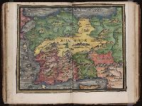
- Beinecke Rare Book and Manuscript Library > Sarmatia
- Published / Created:
- [1542]
- Call Number:
- Taylor 86
- Collection Title:
- Rvdimenta cosmographica
- Image Count:
- 1
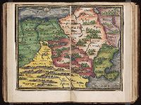
- Found in:
- Beinecke Rare Book and Manuscript Library > [Map of the Balkan Peninsula including Macedonia, Blugaria, Moldova]
- Published / Created:
- [1542]
- Call Number:
- Taylor 86
- Collection Title:
- Rvdimenta cosmographica
- Image Count:
- 1
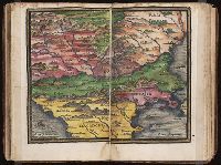
- Found in:
- Beinecke Rare Book and Manuscript Library > [Map of the Balkan Peninsula including Macedonia and Greece]
- Published / Created:
- [1542]
- Call Number:
- Taylor 86
- Collection Title:
- Rvdimenta cosmographica
- Image Count:
- 1
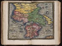
- Found in:
- Beinecke Rare Book and Manuscript Library > Italia
- Published / Created:
- [1542]
- Call Number:
- Taylor 86
- Collection Title:
- Rvdimenta cosmographica
- Image Count:
- 1
- Found in:
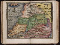
- Beinecke Rare Book and Manuscript Library > Syria
- Published / Created:
- [1542]
- Call Number:
- Taylor 86
- Collection Title:
- Rvdimenta cosmographica
- Image Count:
- 1
- Found in:
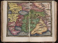
- Beinecke Rare Book and Manuscript Library > Asia Minor
- Published / Created:
- [1542]
- Call Number:
- Taylor 86
- Collection Title:
- Rvdimenta cosmographica
- Image Count:
- 1
- Found in:
- Beinecke Rare Book and Manuscript Library > Asia
- Published / Created:
- [1542]
- Call Number:
- Taylor 86
- Collection Title:
- Rvdimenta cosmographica
- Image Count:
- 1
- Found in:
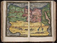
- Beinecke Rare Book and Manuscript Library > Africa
- Published / Created:
- [1542]
- Call Number:
- Taylor 86
- Collection Title:
- Rvdimenta cosmographica
- Image Count:
- 1
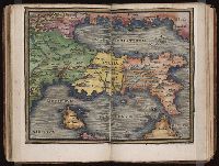
- Found in:
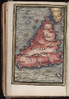
- Beinecke Rare Book and Manuscript Library > Sicilia
- Creator:
- Houbloup, L
- Published / Created:
- 1836
- Call Number:
- 1997 876
- Collection Title:
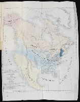
- De la democracia en la America del Norte / por Alejo de Tocqueville, abogado de la real audiencia
- Image Count:
- 1
- Resource Type:
- Books, Journals & Pamphlets
- Found in:
- Beinecke Rare Book and Manuscript Library > Mapa para la obra intitulada De la Democracia en America por A. de Tocqueville